
Long-track tornado touches down near Montezuma Creek, San Juan County, Utah
A long-track tornado was confirmed northeast of Montezuma Creek in San Juan County, Utah, between 12:30 and 13:05 MDT on September 13, 2025, about 10–13 km (6–8 miles) northeast of Montezuma Creek and 35 km (22 miles) southeast of Blanding. The National Weather Service issued a tornado warning for southeastern Utah and western Colorado.
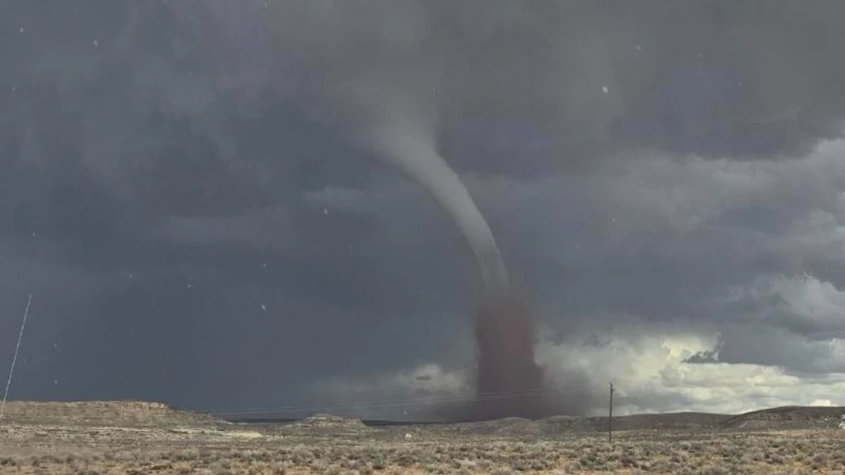
Long-track tornado near Montezuma Creek, Utah on September 13, 2025. Credit: Navajo Police Department
The Storm Prediction Center logged reports between 12:30 and 13:05 MDT (18:30–19:05 UTC), placing the tornado about 10–13 km (6–8 miles) northeast of Montezuma Creek and approximately 35 km (22 miles) southeast of Blanding. The twister moved northeast at about 16 km/h (10 mph).
The first tornado warning was issued just before 12:47 MDT (18:47 UTC), and later extended to cover parts of east-central San Juan County, Utah, and western Montezuma County, Colorado. The warning included the possibility of damaging winds, hail up to 2.5 cm (1 inch) in diameter, and flying debris.
Eyewitness videos showed a well-defined funnel cloud, described in some reports as large for Utah standards. However, the NWS has not released an official Enhanced Fujita (EF) rating, and no damage survey has yet been completed.
The tornado occurred in a remote, sparsely populated area. However, preliminary reports by Navajo Police Department mention three homes were affected.
“Residences have been informed by the Navajo Police Department to seek shelter, stay off the roads and do not drive in the area,” the department said.
KSL5TV meteorologist Matthew Johnson described it as long-track tornado that has been touching down multiple times.
Tornadoes are relatively rare in Utah, though they occur occasionally during late summer when atmospheric instability develops over the Colorado Plateau.
Updates
09:59 UTC, September 14
Preliminary ground reports from San Juan County indicate more extensive impacts than first noted. Three homes were described as “completely damaged,” along with three trailers and a hay barn destroyed. Several power poles were knocked down, causing localized outages around Montezuma Creek.
Livestock and pets were also reported missing, though the numbers remain unconfirmed. No human injuries have been reported so far.
The American Red Cross and Navajo Nation authorities are providing temporary shelter for displaced residents.
The National Weather Service has not yet completed a damage survey.

Teo Blašković founded The Watchers in 2011 and edited it until 2026, covering seismic and volcanic activity, extreme weather, space weather and near-Earth objects. Articles on this page are his archive.
Published in the last 24 hours
- Second nationwide US flight halt since 9/11: how the November 13 FAA ground stop compares with September 2001 and January 2023 Epicenter
- FAA grounds all departing flights across the US after communications outage hits air traffic control centers nationwide
- In September 1859, a solar storm lit up the night sky so brightly that gold miners in the Rocky Mountains woke up after midnight and started cooking breakfast, convinced the aurora glowing over their camp was the sunrise Epicenter
- A patch of warm Pacific water that could become the strongest El Niño in more than 70 years sits thousands of miles from any American town, yet it is already the main reason NOAA expects a wetter winter across the South and a milder one across the North
