
Dirty rain in Grand Rapids, Michigan linked to atmospheric dust from New Mexico
Western Michigan experienced mud rain on Friday, April 18, 2025, as thunderstorms moved into the region from Wisconsin, leaving a thin layer of mud on vehicles and homes.
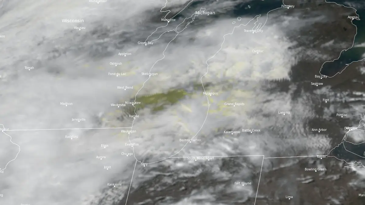
Satellite image showing cloud layer with dust over Wisconsin and Michigan at 19:00 UTC on April 18, 2025. Image credit: NOAA/GOES-East, RAMMB/CIRA, The Watchers
Thunderstorms moving into western Michigan on Friday afternoon, April 18, produced mud rain across the Grand Rapids area, leaving vehicles and other surfaces coated in a thin layer of sediment-laden water.
The dirty rain was caused by dust lifted from surface-level air over New Mexico on Thursday, April 17. Carried northeastward by strong winds ahead of an approaching storm system, the dust was transported at altitudes between 2.4 and 4.6 m (8 000 and 15 000 feet) before reaching Michigan.
As this dust-laden air mass moved over Michigan and encountered rainfall, it mixed with precipitation and deposited a layer of mud on contact surfaces.
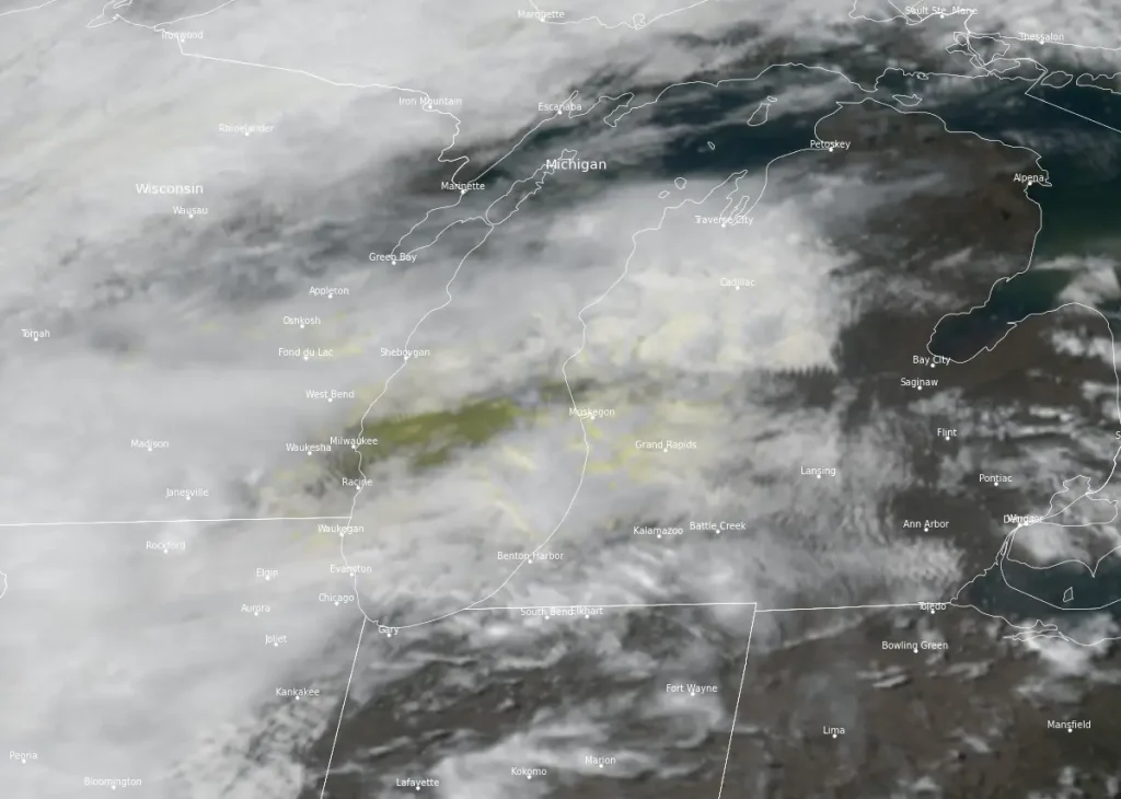
Satellite imagery from NOAA’s GOES-East during the event shows a brownish tint in the cloud cover over parts of Michigan, indicating the presence of elevated dust in the atmosphere.
Similar dirty rain events have occurred in Michigan, often linked to dust from arid regions, such as the Plains or the Southwest.
In mid-March 2025, a significant dust storm originating from Texas and New Mexico carried particulate matter across the Midwest, resulting in “dirty rain” and “dirty snow” in parts of Michigan, including Gaylord. This event also led to reduced air quality and visibility across the region.

Rishav Kothari is Editor-in-Chief of The Watchers, where he runs the newsroom and covers earthquakes, volcanoes, severe weather and space weather.
Published in the last 24 hours
- High Risk of excessive rainfall covers Florida’s Space Coast as St. Johns River near Cocoa reaches 5.67 m
- Four small asteroids will pass close to Earth from November 21 to 23
- Cyclone Akvan weakens after landfall near Gopalpur; more than 300 000 evacuated in Odisha, India
- A broad low over southeastern Florida and the northwestern Bahamas has a 30 percent chance of subtropical or tropical development within 48 hours and a 50 percent chance within 7 days, the National Hurricane Center says
