
Earthquake swarm at Kamaʻehuakanaloa (Lōʻihi) volcano, Hawaii
A period of increased seismic activity started at Kamaʻehuakanaloa volcano (previously known as Lōʻihi) near Hawaii on November 1, 2024, with over 70 recorded earthquakes and two reaching M4.3. Seismicity remains above normal levels today, indicating magma movement beneath the volcano.
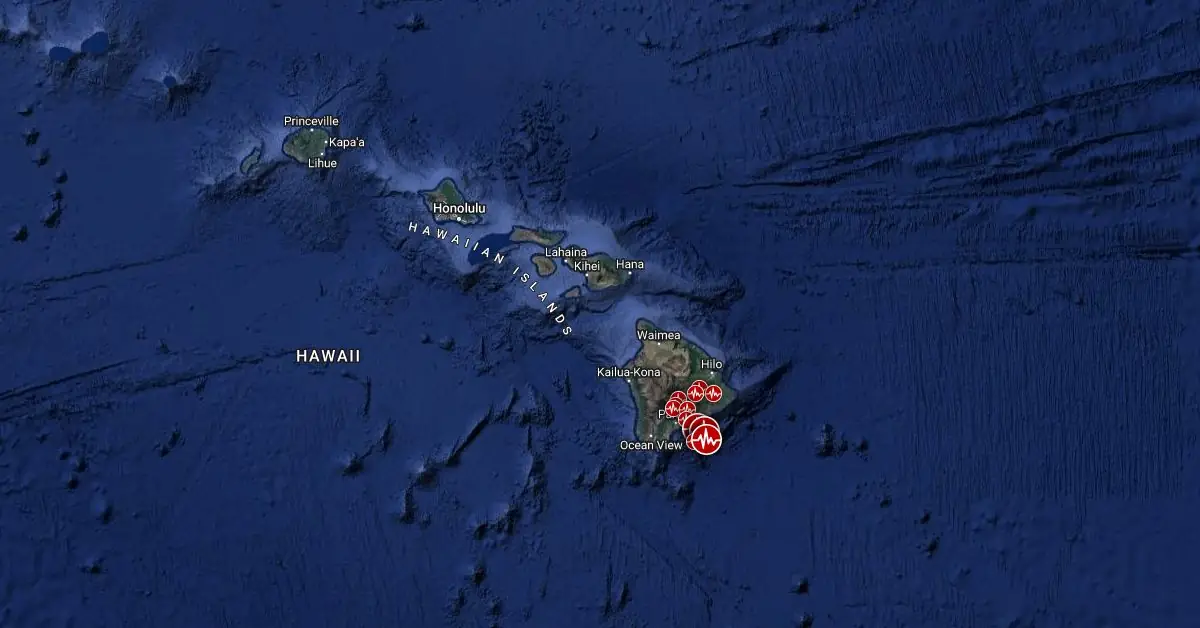
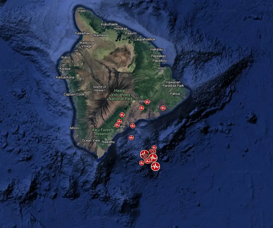
Earthquake swarm near Kamaʻehuakanaloa (Lōʻihi) volcano, Hawaii - November 1 - 3, 2024. Credit: TW/SAM, Google
The Kamaʻehuakanaloa seamount, located about 35 km (22 miles) southeast of Hawaii’s Big Island, entered a period of increased seismic activity at 04:00 UTC (18:00 HST) on November 1.
The swarm included more than 70 earthquakes to 23:23 UTC on November 2, with 32 events exceeding M2 and two surpassing M4. The strongest event, a M4.3 earthquake, occurred at 22:05 UTC on November 1 at a depth of 5.8 km (3.6 miles) below sea level, or about 4.8 km (3 miles) beneath the volcano’s summit. The USGS has so far received only one felt report from the Island of Hawaiʻi for this event.
Although the exact cause of the activity remains uncertain, it may be related to magma movement within the volcano.
The last confirmed eruption at Kamaʻehuakanaloa, formerly known as Lōʻihi, occurred in 1996 (VEI 0). Previous seismic swarms related to probable eruptions at the volcano involved thousands of thousands of earthquakes over days to weeks.
Despite the current heightened seismicity, the HVO reported no anticipated impact on nearby volcanoes or infrastructure on the Island of Hawaiʻi.
The volcano’s location and depth below the ocean surface mean that any eruptive activity would not pose a direct threat to residents on the island.
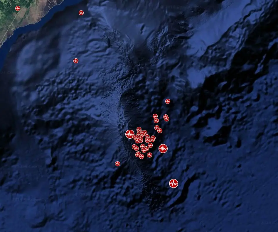
Kamaʻehuakanaloa is the youngest volcano in the Hawaiian island chain. Its summit, located approximately 975 m (3 199 feet) below sea level, has a distinctive structure with two primary rift zones and a 3 x 4 km (1.8 x 2.5 miles) caldera.
Seismicity indicates a magmatic system distinct from that of Kīlauea. During the 1996 eruption, a new pit crater formed at the summit, and lava flows erupted.
Scientists estimate that continued volcanic activity could eventually lead to the formation of a new island, though at this rate the process could take between 10 000 and 100 000 years.
The Volcano Alert Level and Aviation Color Code remain Unassigned.
References:
1 Kama’ehuakanaloa activity summary – USGS/HVO – 23:23 UTC on November 2, 2024
2 Kama’ehuakanaloa geological summary – GVP – Accessed November 3, 2024

Teo Blašković founded The Watchers in 2011 and edited it until 2026, covering seismic and volcanic activity, extreme weather, space weather and near-Earth objects. Articles on this page are his archive.
Published in the last 24 hours
- In 1920, a man out hunting on a farm in Namibia sat down on a strange black rock, scratched it with his knife and saw metal shine underneath. It was Hoba, a 60-ton meteorite, the largest ever found, and there is no crater around it Epicenter
- On December 26, 2004, a 10-year-old British girl on a Phuket beach recognized the frothing sea from a recent geography lesson, and her warning helped clear the beach before the tsunami struck Epicenter
