
Major winter storm targets Central and Southern Rockies, widespread disruptions expected
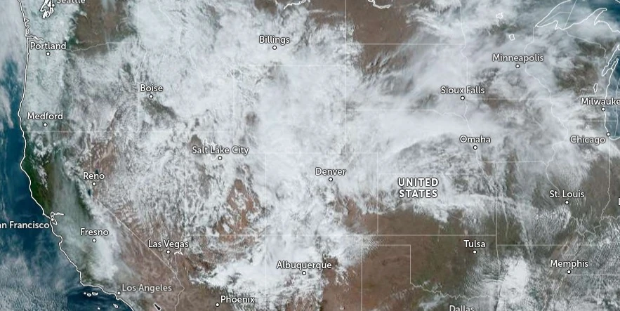
Image credit: NOAA/GOES-East, Zoom Earth, The Watchers. Acquired at 19:40 UTC on March 13, 2024
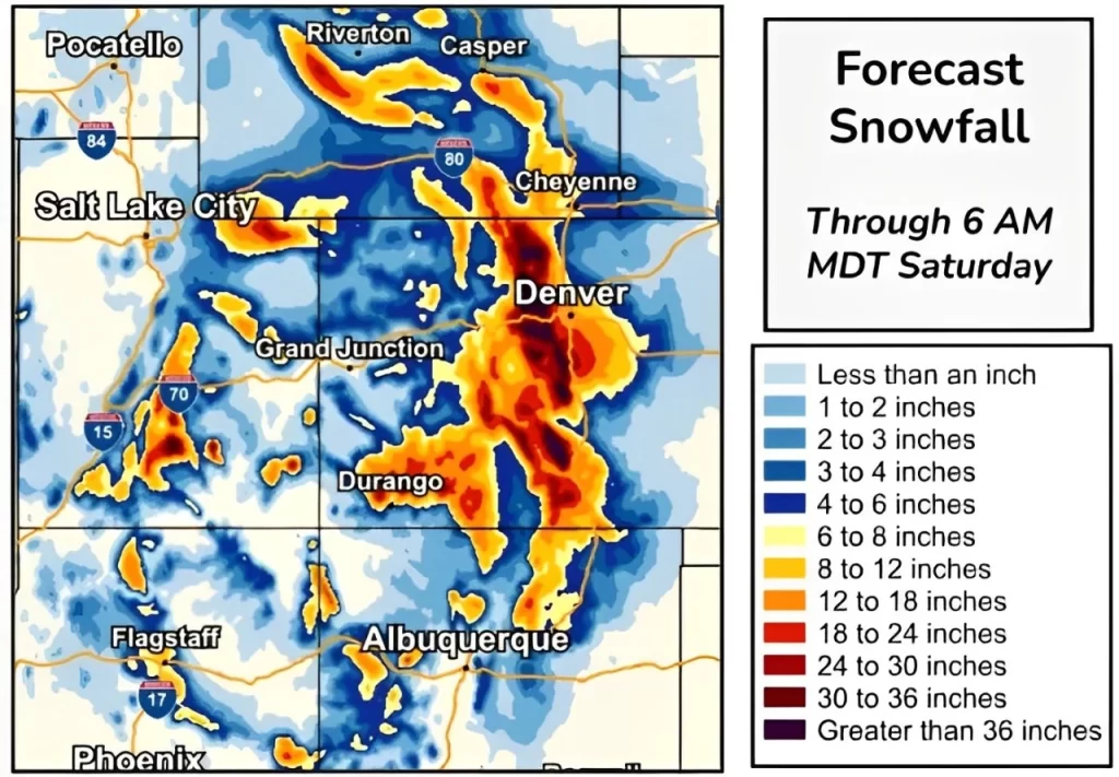
A significant winter storm is set to bring widespread heavy snow to the Central/Southern Rockies and the Four Corners region from tonight through the weekend. Snowfall rates could exceed 5 cm (2 inches) per hour, leading to accumulations of over 30 cm (1 foot) in many areas and causing travel disruptions, including road closures and potentially severe visibility issues due to gusty winds.
A significant and long-duration winter storm is forecasted to impact the Central and Southern Rockies, including the Four Corners region, from tonight through the weekend, with the most intense period expected on March 15, 2024.
This event is characterized by heavy snowfall, with snowfall rates exceeding 5 cm (2 inches) per hour in some locations, notably within the Front Range tonight and Thursday. The probabilities of such heavy snowfall rates are estimated between 40 and 60%, with more than a 90% chance of snow accumulations surpassing 30 cm (1 foot) across a broad area including the Front Range, Foothills, Sangre de Cristos, and San Juans. In some localities, snow accumulations could reach between 30 and 60 cm (2 to 4 feet), with a likelihood of 20 to 30%.
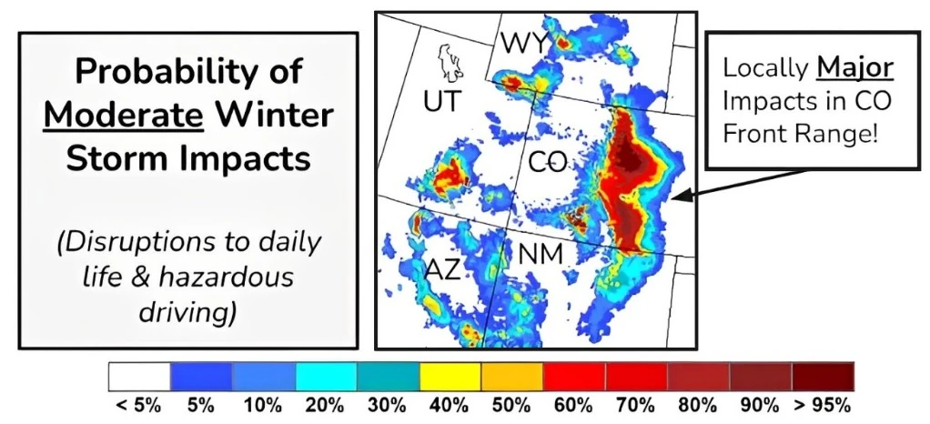
The combination of heavy snow rates and gusty winds exceeding 56 km/h (35 mph) will result in blowing snow and significantly reduced visibility, particularly along the I-25 urban corridor and other mountain roads in the region.
Such conditions are expected to make travel extremely difficult, if not impossible, with road closures likely. The storm also poses a risk of disruptions to infrastructure, including potential power outages.
Starting Thursday night, subsequent waves of heavy snow are forecasted to impact areas north of the Mogollon Rim and extend northeast toward the San Juans and the southern Colorado Rockies. The probability of snow accumulations reaching or exceeding 30 cm (12 inches) remains high, above 70%. In some locations, snowfall may exceed 30 cm (2 feet), with a 30 to 40% probability.
References:
1 Key Messages for March 13 – 16 Winter Storm – NWS Weather Prediction Center – March 13, 2024
I'm a dedicated researcher, journalist, and editor at The Watchers. With over 20 years of experience in the media industry, I specialize in hard science news, focusing on extreme weather, seismic and volcanic activity, space weather, and astronomy, including near-Earth objects and planetary defense strategies. You can reach me at teo /at/ watchers.news.
Commenting rules and guidelines
We value the thoughts and opinions of our readers and welcome healthy discussions on our website. In order to maintain a respectful and positive community, we ask that all commenters follow these rules.