
Very strong and shallow M7.0 earthquake hits northern Molucca Sea, Indonesia
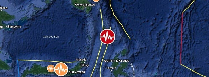
Image credit: TW/SAM, Google
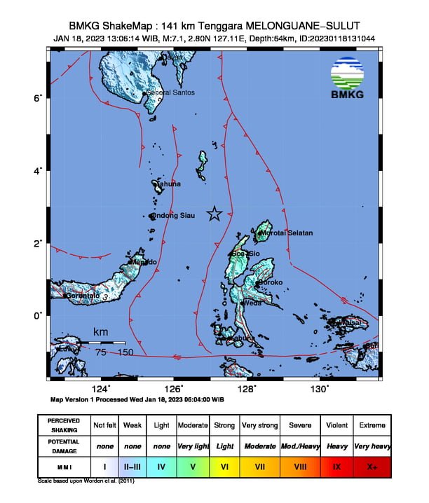
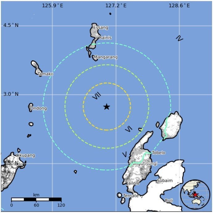
A very strong and shallow earthquake registered by the USGS hit the northern Molucca Sea, Indonesia at 06:06 UTC on January 18, 2023 (15:06 LT). The agency is reporting a depth of 48 km (29.8 miles). BMKG is reporting M7.1 at a depth of 64 km (39.7 miles); EMSC reporting M7.1 at a depth of 60 km (37.3 miles).
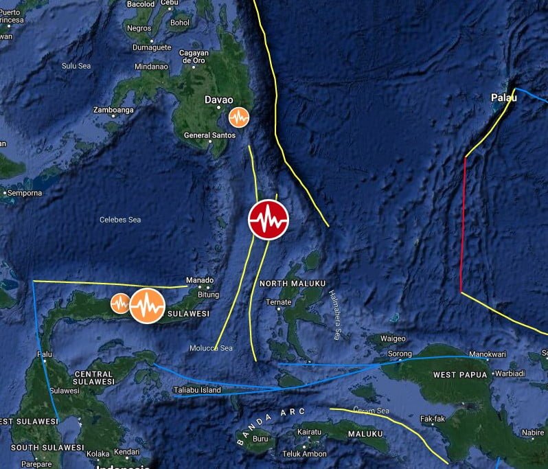
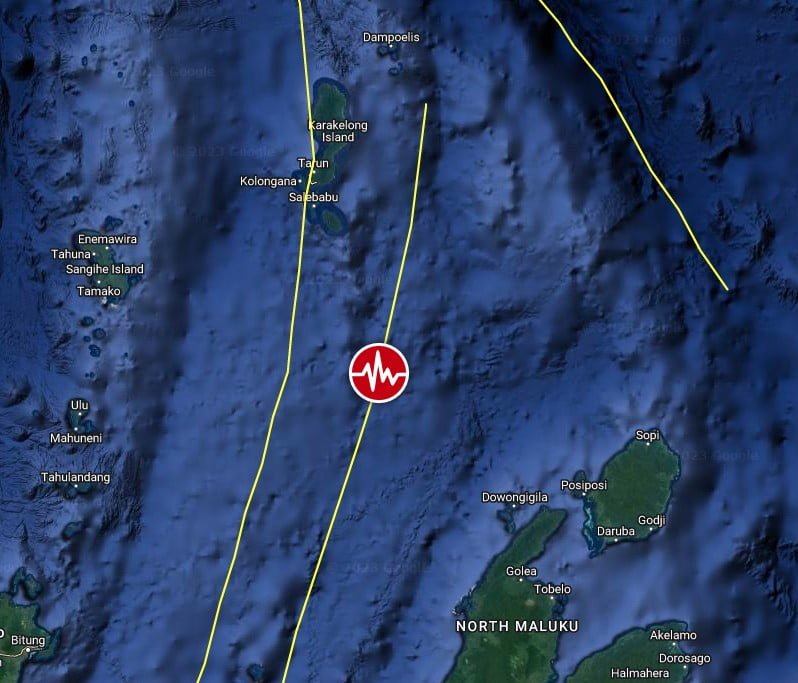
The epicenter was located 155.1 km (96.4 miles) NW of Tobelo and 220.1 km (136.8 miles) N of Ternate, North Maluku, Indonesia.
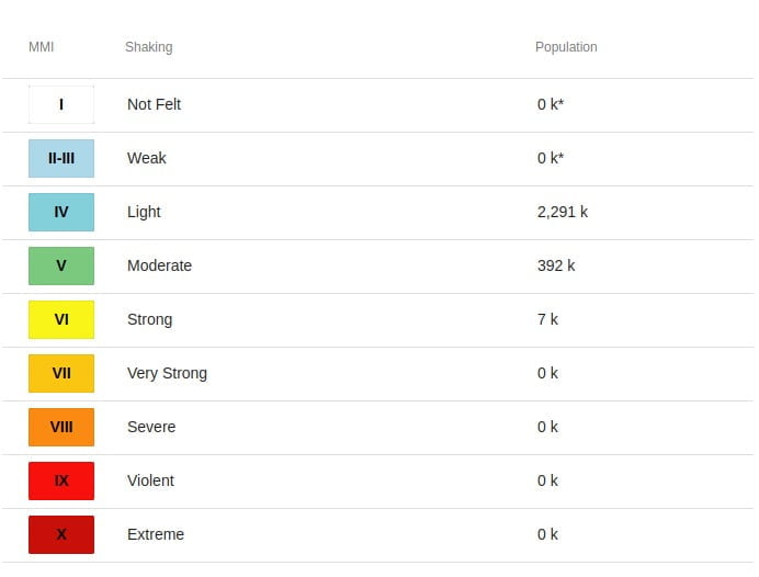
7 000 people are estimated to have felt strong shaking.
This earthquake has no tsunami potential, BMKG said.
The USGS issued a Green alert for shaking-related fatalities and economic losses. There is a low likelihood of casualties and damage.
Overall, the population in this region resides in structures that are a mix of vulnerable and earthquake-resistant construction. The predominant vulnerable building types are unknown/miscellaneous types and heavy wood frame construction.
Recent earthquakes in this area have caused secondary hazards such as tsunamis that might have contributed to losses.
This is the second M6+ earthquake to hit Indonesia since 00:34 UTC on January 18.
Estimated population exposure to earthquake shaking
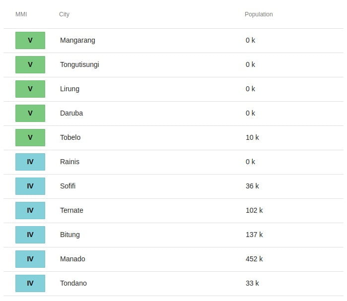
Selected cities exposed
Regional seismicity
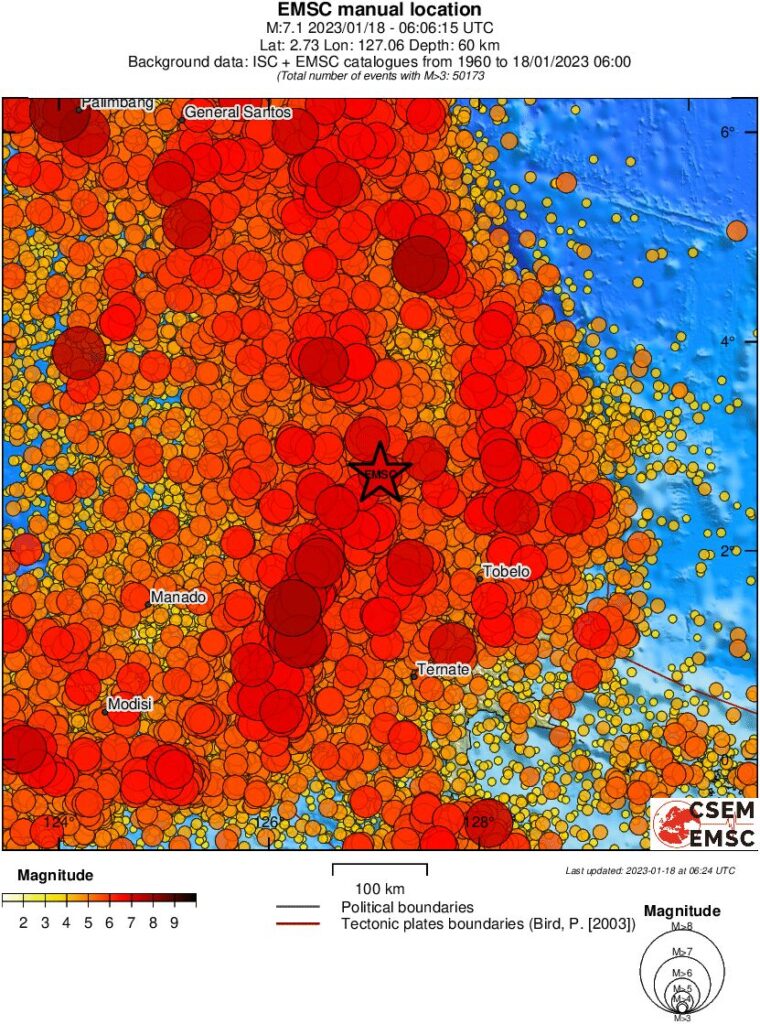
This region has a history of strong and damaging earthquakes, with the strongest being M7.6 on September 11, 2008 (no reported damage), followed by M7.4 on November 2, 2009 (64 injured people, 597 damaged buildings).
I'm a dedicated researcher, journalist, and editor at The Watchers. With over 20 years of experience in the media industry, I specialize in hard science news, focusing on extreme weather, seismic and volcanic activity, space weather, and astronomy, including near-Earth objects and planetary defense strategies. You can reach me at teo /at/ watchers.news.
Commenting rules and guidelines
We value the thoughts and opinions of our readers and welcome healthy discussions on our website. In order to maintain a respectful and positive community, we ask that all commenters follow these rules.