
Ian rapidly strengthens into a hurricane – significant wind and storm surge impacts expected in Cuba
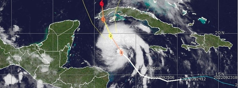
Featured image: Hurricane "Ian" at 08:40 UTC on September 26, 2022. Credit: NOAA/GOES-East, The Watchers
Tropical Storm “Ian” rapidly strengthened into a hurricane by 09:00 UTC on September 26, 2022. Significant wind and storm surge impacts are expected in western Cuba before Ian emerges over the southeastern Gulf of Mexico on September 28 and heads toward Florida.
- Ian is expected to produce heavy rainfall and instances of flash flooding and possible mudslides in areas of higher terrain, particularly over Jamaica and Cuba, the National Weather Service (NHC) warns.
- Considerable flooding impacts are possible later this week in west central Florida. Additional flash and urban flooding, and flooding on rivers across the Florida Peninsula and parts of the Southeast cannot be ruled out for later this week.
- Life-threatening storm surge and hurricane-force winds are expected in portions of western Cuba beginning late today, and Ian is forecast to be at major hurricane strength when it is near western Cuba. Efforts to protect life and property should be rushed to completion.
- Ian is expected to be a major hurricane in the eastern Gulf of Mexico during the middle of this week.
- Regardless of Ian’s exact track and intensity, there is a risk of a life-threatening storm surge, hurricane-force winds, and heavy rainfall along the west coast of Florida and the Florida Panhandle by the middle of this week.
At 09:00 UTC on September 26, the center of Hurricane “Ian” was located about 150 km (90 miles) SW of Grand Cayman and 510 km (315 miles) SE of the western tip of Cuba.1
Ian had maximum sustained winds of 120 km/h (75 mph) and a minimum central pressure of 983 hPa.
It is moving toward the northwest near 14 mph (22 km/h).
A turn toward the north-northwest is expected today followed by a northward motion on Tuesday, September 27, with a slightly slower forward speed.
A turn toward the north-northeast is forecast on Tuesday night or early Wednesday, September 28.
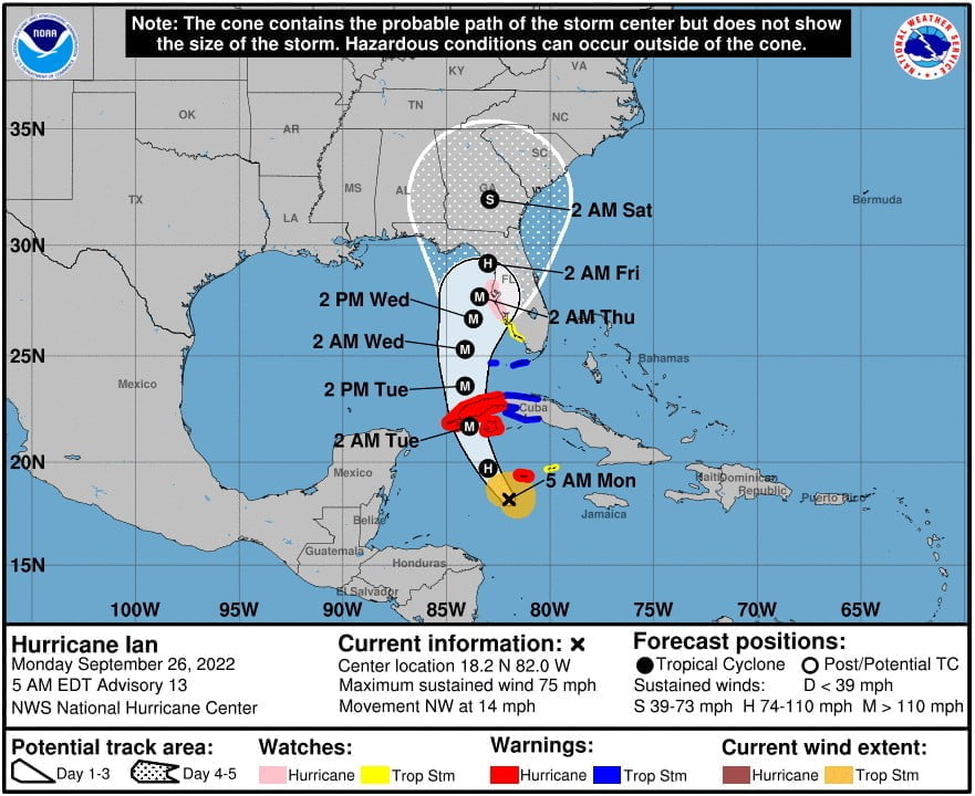
A Tropical Storm Warning is in effect for the Cuban provinces of La Habana, Mayabeque, and Matanzas; Lower Florida Keys from Seven Mile Bridge westward to Key West; Dry Tortugas.
A Storm Surge Watch is in effect for the Florida Keys from the Card Sound Bridge westward to Key West; Dry Tortugas; Florida Bay; Anclote River southward to the Card Sound Bridge; Tampa Bay.
A Hurricane Watch is in effect for Englewood to the Anclote River, including Tampa Bay.
A Tropical Storm Watch is in effect for Little Cayman and Cayman Brac; Englewood southward to Chokoloskee.
On the forecast track, the center of Ian is expected to pass near or west of the Cayman Islands today, and near or over western Cuba tonight and early Tuesday.
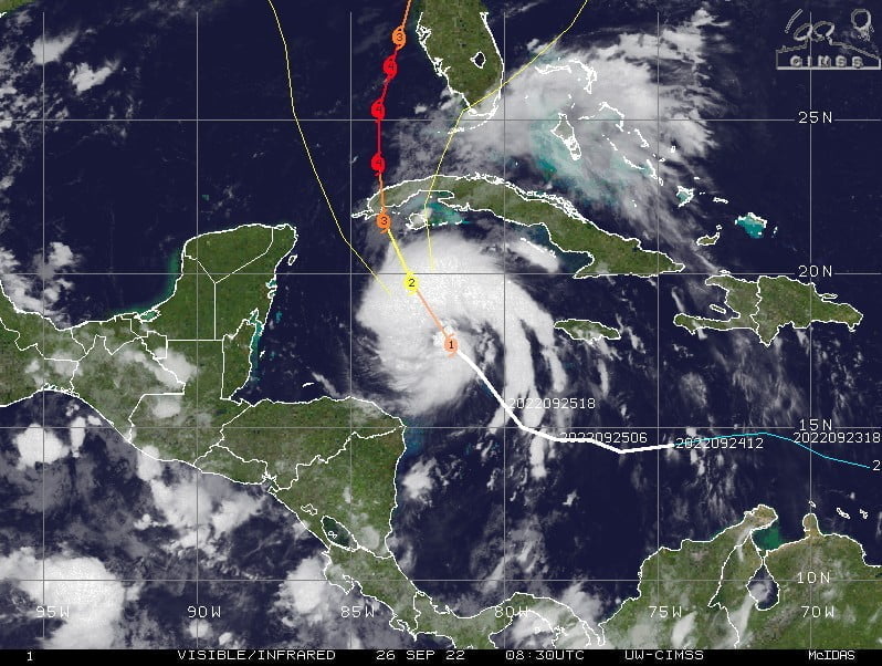
Ian will then emerge over the southeastern Gulf of Mexico on Tuesday, and pass west of the Florida Keys late Tuesday, and approach the west coast of Florida on Wednesday.
Rapid strengthening is expected during the next day or so, and Ian is forecast to become a major hurricane tonight when it is near western Cuba.
References:
1 Hurricane Ian Advisory Number 13 – NWS National Hurricane Center Miami FL – 500 AM EDT Mon Sep 26 2022
I'm a dedicated researcher, journalist, and editor at The Watchers. With over 20 years of experience in the media industry, I specialize in hard science news, focusing on extreme weather, seismic and volcanic activity, space weather, and astronomy, including near-Earth objects and planetary defense strategies. You can reach me at teo /at/ watchers.news.
Commenting rules and guidelines
We value the thoughts and opinions of our readers and welcome healthy discussions on our website. In order to maintain a respectful and positive community, we ask that all commenters follow these rules.