
Powerful phreatic eruption at Bulusan volcano, Philippines
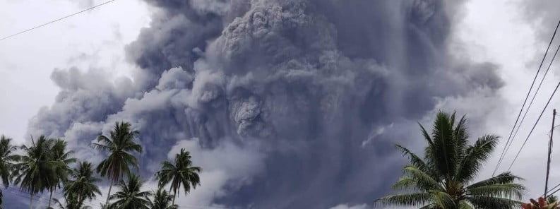
Image credit: Il Mondo dei Terremoti
A powerful phreatic eruption took place at Bulusan volcano, Philippines at 02:37 UTC (10:37 LT) on June 5, 2022. As a result, the Philippine Institute of Volcanology and Seismology raised the Alert Level for the volcano from 0 to 1.
- The last eruption of this volcano was on June 5, 2017 (VEI 1) – exactly 5 years ago.
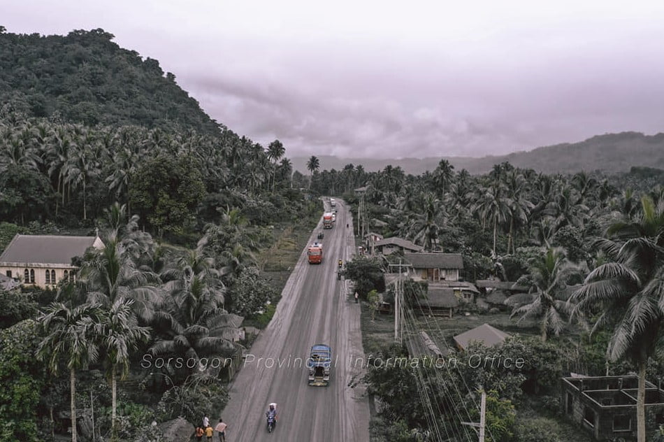
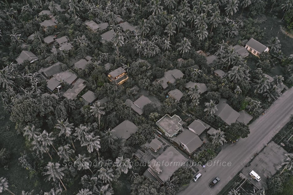
- Ashfall has been reported in Juban and Casiguran, Sorsogon.
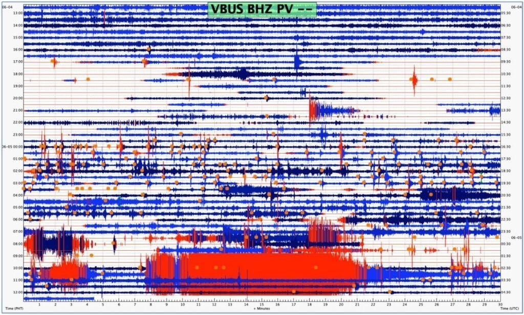
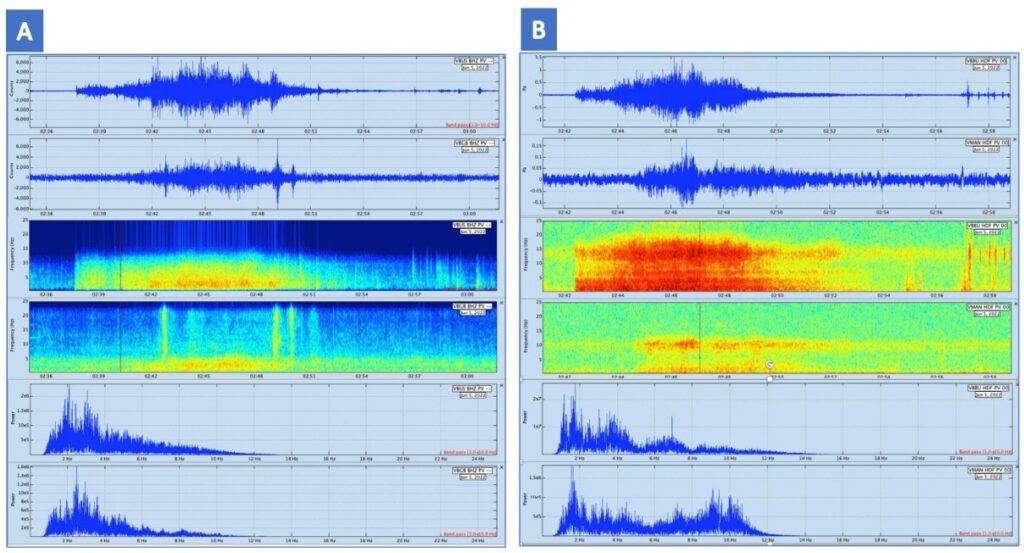
The eruption lasted 17 minutes and was recorded by seismic and infrasound monitoring by the Bulusan Volcano Network (BVN).1
The event was poorly visible through cloud cover over the edifice although a steam-rich grey plume at least 1 km (3 280 feet) tall was observed from Juban, Sorsogon and was subsequently observed to drift west.
According to the Tokyo VAAC, ash cloud top reached an 2.7 km (9 000 feet) above sea level at 03:40 UTC.
Thin fine ashfall fell on the general northwestern sector of the edifice and affected the barangays of Puting Sapa, Añog, Guruyan, Catanusan, Buraburan, Bacolod, and Sangkayon in Juban and Bolos in Irosin, Sorsogon Province.2
Rumbling sounds and sulfurous odor were also observed by residents of Brgys. Añog, Guruyan, and Catanusan.

After the eruption, degassing was observed from the northwest vent on the summit for the first time this year.
A total of 27 weak volcanic earthquakes were recorded through 8:00 UTC today by the Bulusan Volcano Network.
Fine ashfall can cause irritation and breathing problems, especially among the vulnerable population – the elderly, children, expecting mothers and those with respiratory disorders – and can be particularly dangerous when inhaled in copious amounts. In addition, ashfall even when thin but having high amounts of sulfur can also cause irritation.
Affected populations are advised to protect their mouths and noses using N95 grade facemasks or wet cloth or towel. Motorists are advised to drive with extreme caution as ash can cause poor visibility and, when wet, can make roads slippery.
Prior to the eruption, the BVN recorded 77 volcanic earthquakes in the past 24-hour observation period.
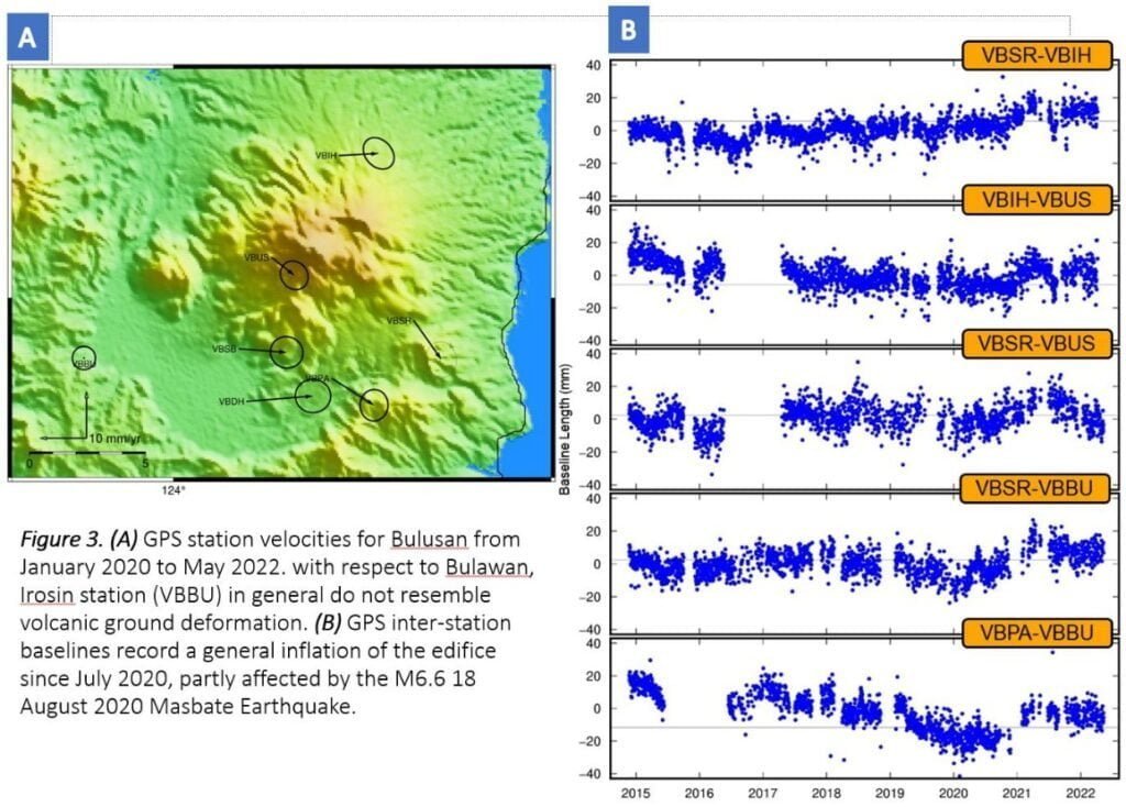
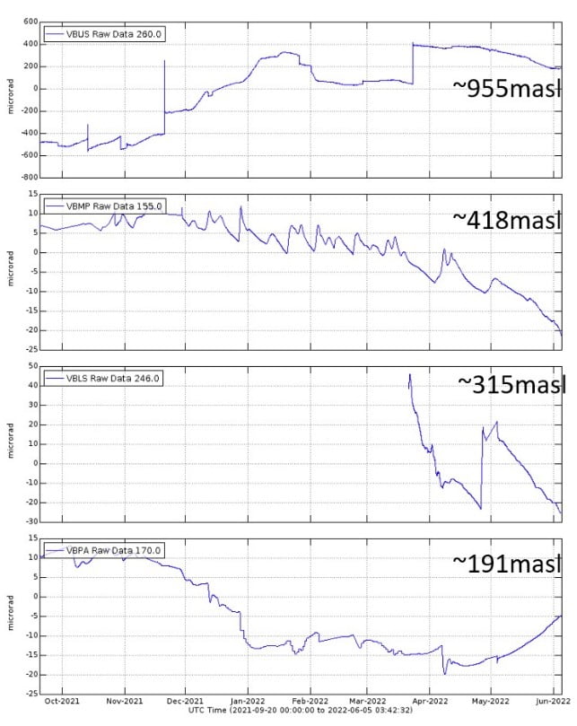
Ground deformation data from continuous GPS monitoring indicate that the Bulusan edifice has been generally inflated since July 2020, while electronic tilt monitoring recorded a sudden but isolated inflation of the southeast lower slopes only since April 2022.
These parameters indicate that volcanic processes are underway beneath the edifice that are likely caused by shallow hydrothermal activity.
Alert Level 1 status remains in effect over Bulusan Volcano, which means that it is currently in an abnormal condition.
Local government units and the public are reminded that entry into the 4 km (2.5 miles) radius Permanent Danger Zone (PDZ) must be strictly prohibited and that vigilance in the 2 km (1.2 miles) Extended Danger Zone (EDZ) on the southeast sector must be exercised due to the increased possibilities of sudden and hazardous phreatic eruptions that can occur without warning, PHIVOLCS said.
“Civil aviation authorities must also advise pilots to avoid flying close to the volcano’s summit as ash from any sudden phreatic eruption can be hazardous to aircraft.
“Furthermore, people living within valleys and along river/stream channels especially on the southeast, southwest and northwest sector of the edifice should be vigilant against sediment-laden stream flows and lahars in the event of heavy and prolonged rainfall should phreatic eruption occur.”
Geological summary
Luzon’s southernmost volcano, Bulusan, was constructed along the rim of the 11-km-diameter (6.8 miles) dacitic-to-rhyolitic Irosin caldera, which was formed about 36 000 years ago. Bulusan lies at the SE end of the Bicol volcanic arc occupying the peninsula of the same name that forms the elongated SE tip of Luzon. A broad, flat moat is located below the topographically prominent SW rim of Irosin caldera; the NE rim is buried by the andesitic Bulusan complex.
Bulusan is flanked by several other large intracaldera lava domes and cones, including the prominent Mount Jormajan lava dome on the SW flank and Sharp Peak to the NE. The summit of 1 565-m-high (5 134 feet) Bulusan volcano is unvegetated and contains a 300-m-wide (984 feet), 50-m-deep (164 feet) crater. Three small craters are located on the SE flank. Many moderate explosive eruptions have been recorded at Bulusan since the mid-19th century.3
References:
1 BULUSAN VOLCANO UPDATE – PHIVOLCS – 05 June 2022 11:40 P.M. (LT)
2 BULUSAN VOLCANO UPDATE – PHIVOLCS – 05 June 2022 08:00 P.M. (LT)
3 Bulusan – Geological summary – GVP
I'm a dedicated researcher, journalist, and editor at The Watchers. With over 20 years of experience in the media industry, I specialize in hard science news, focusing on extreme weather, seismic and volcanic activity, space weather, and astronomy, including near-Earth objects and planetary defense strategies. You can reach me at teo /at/ watchers.news.
Commenting rules and guidelines
We value the thoughts and opinions of our readers and welcome healthy discussions on our website. In order to maintain a respectful and positive community, we ask that all commenters follow these rules.