
Tropical Storm “Dolores” forecast to be near hurricane strength as it hits Mexico
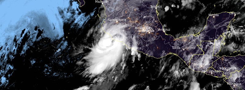
Featured image: Tropical Storm "Dolores" at 11:40 UTC on June 19, 2021. Credit: NOAA/GOES-East, RAMMB/CIRA, TW
Tropical Storm "Dolores" continues intensifying on its way toward Mexico. Landfall is expected today, June 19, or early June 20, 2021, along the southwest coast of Mexico. Dolores formed at 15:00 UTC on June 18 as the 4th named storm of the 2021 Pacific hurricane season. At the time, its center was located about 370 km (230 miles) S of Lazaro Cardenas and 515 km (320 miles) SSW of Manzanillo, Mexico.
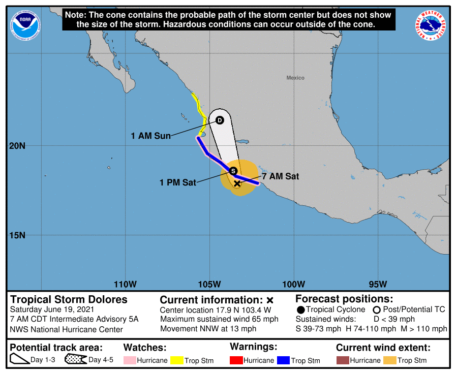
- Dolores is expected to continue strengthening today up until landfall, and it could be near hurricane strength when it reaches the coast of west-central Mexico by this afternoon (LT).
- A tropical storm warning and a hurricane watch are in effect for portions of the southwestern and west-central coasts of Mexico.
- Heavy rains are forecast over coastal sections of the Mexican states of Oaxaca, Guerrero, Michoacan, Colima, Jalisco, and Nayarit during the next few days, which could result in life-threatening flash flooding and mudslides.
A Tropical Storm Warning and a Hurricane Watch are in effect for Lazaro Cardenas to Cabo Corrientes, Mexico, and a Tropical Storm Watch is in effect for areas north of Cabo Corrientes to Escuinapa, Mexico.
At 09:00 UTC on June 19, the center of Tropical Storm "Dolores" was located about 145 km (90 miles) SW of Lazaro Cardenas and 225 km (160 miles) SSE of Manzanillo.
Its maximum sustained winds were 95 km/h (60 mph) and minimum central pressure 995 hPa.
The storm is moving NNW at 17 km/h (10 mph) and this motion is expected to continue with a gradual acceleration prior to landfall.
Dolores is expected to make landfall along the southwest coast of Mexico later today (LT), NHC forecasters said.
Additional intensification is expected prior to landfall, and Dolores is forecast to be near hurricane intensity when it makes landfall.
Rapid weakening is expected after landfall and the system is expected to dissipate by the end of the weekend.
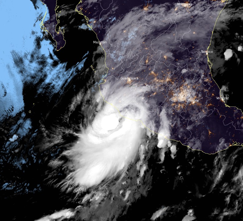
Tropical Storm "Dolores" at 11:40 UTC on June 19, 2021. Credit: NOAA/GOES-East, RAMMB/CIRA, TW
Tropical storm conditions are expected to begin within the warning area this morning, making outside preparations difficult or dangerous. Hurricane conditions are also possible within the hurricane watch area by late this morning and afternoon while the tropical storm conditions will possible within the tropical storm watch area this evening through Sunday morning.
Dolores will produce heavy rainfall of 150 to 250 mm (6 to 10 inches) with isolated maximum amounts of 380 mm (15 inches) across coastal sections of the Mexican states of Guerrero, Michoacan, Colima, Jalisco, and Nayarit through the weekend, according to the NHC.
This will likely produce life-threatening flash flooding and mudslides.
Additionally, 75 to 125 mm (3 to 5 inches) of rainfall with isolated maximum amounts of 200 mm (8 inches) is expected for western Oaxaca, as well as southern Sinaloa. This may produce life-threatening flash flooding.
A storm surge is expected to produce coastal flooding near and to the east of where the center makes landfall. Near the coast, the surge will be accompanied by large and destructive waves.
Swells generated by Dolores will affect portions of the southwestern coast of Mexico through the weekend. These swells are likely to cause life-threatening surf and rip current conditions.
I'm a dedicated researcher, journalist, and editor at The Watchers. With over 20 years of experience in the media industry, I specialize in hard science news, focusing on extreme weather, seismic and volcanic activity, space weather, and astronomy, including near-Earth objects and planetary defense strategies. You can reach me at teo /at/ watchers.news.
Commenting rules and guidelines
We value the thoughts and opinions of our readers and welcome healthy discussions on our website. In order to maintain a respectful and positive community, we ask that all commenters follow these rules.