
Strong and shallow M6.5 earthquake hits Idaho – the largest since 1983
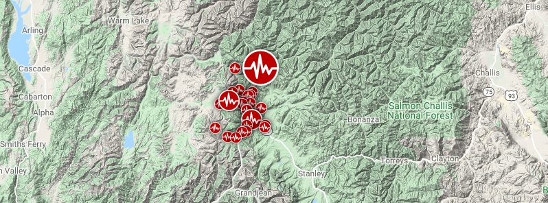
Image credit: Google, TW/SAM
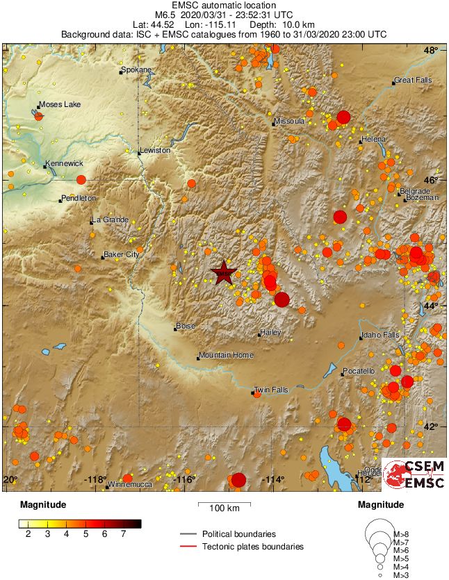
A strong and shallow earthquake registered by the USGS as M6.5 hit southern Idaho at 23:52 UTC (17:52 LT) on March 31, 2020. The agency is reporting a depth of 10 km (6.2 miles). This is the largest earthquake in Idaho since the 1983 Borah Peak earthquake. 25 aftershocks were registered by 05:07 UTC on April 1.
The epicenter was located about 30 km (19 miles) NNW of Stanley (population 68) and 126 km (78 miles) NE of Boise (population 145 987), Idaho.
There are about 16 000 people living within 100 km (62 miles).
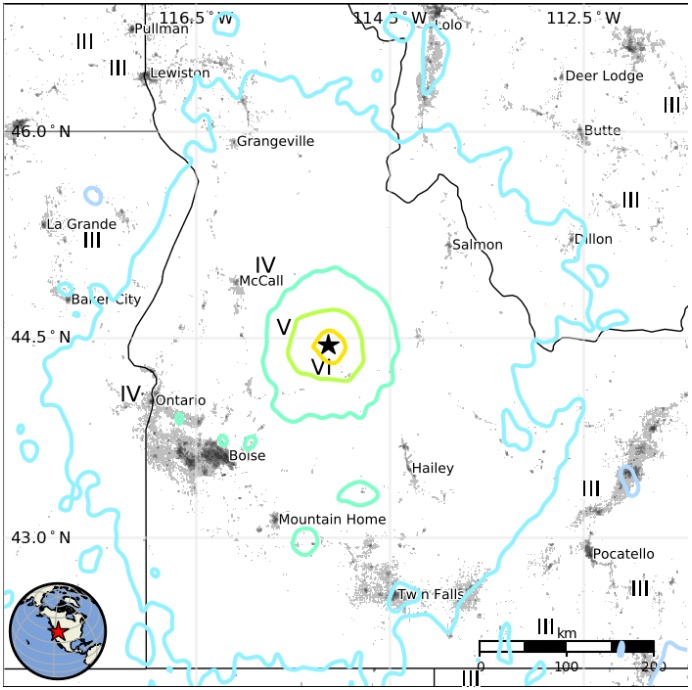
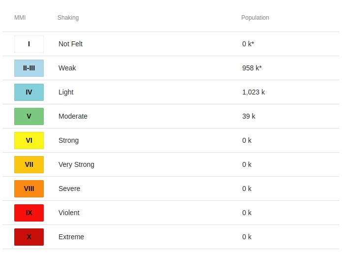
39 000 people are estimated to have felt moderate shaking and 1 023 000 light.
The USGS issued a green alert for shaking-related fatalities and economic losses. There is a low likelihood of casualties and damage.
Overall, the population in this region resides in structures that are resistant to earthquake shaking, though vulnerable structures exist. The predominant vulnerable building types are unreinforced brick masonry and reinforced masonry construction.
Recent earthquakes in this area have caused secondary hazards such as landslides that might have contributed to losses.
Landslides triggered by this earthquake are estimated to be limited in number and (or) spatial extent.
The number of people living near areas that could have produced landslides in this earthquake is low, but landslide damage or fatalities are still possible in highly susceptible areas.
Little or no liquefaction is expected, but some liquefaction could have occurred in highly susceptible areas.
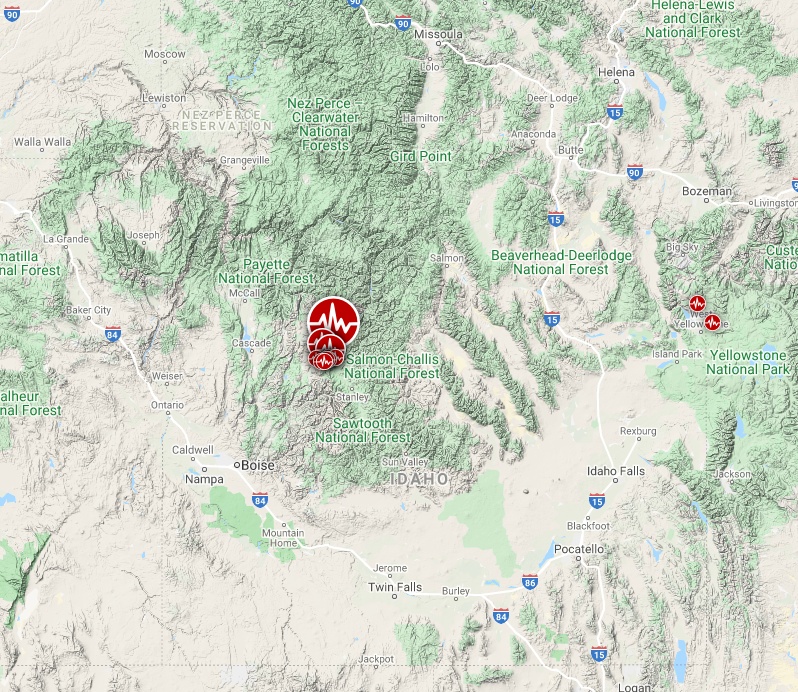
Image credit: Google, TW/SAM
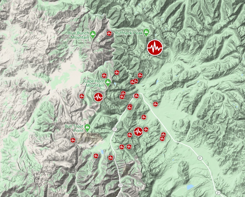
Image credit: Google, TW/SAM
The earthquake occurred as the result of strike-slip faulting within the shallow crust of the North America plate, the USGS said.
It occurred in the western part of the Centennial Tectonic Belt, an area north of the Snake River Plain that is undergoing southwest-northeast extension.
Historic seismicity in the immediate vicinity of the epicenter is sparse; no earthquakes of M5+ have occurred within 50 km (31 miles) of this event over the past 50 years, and the most notable historic seismicity in the region occurred about 100 km (62 miles) to the east on the Lost River fault zone. This was the site of the 1983 M6.9 Borah Peak earthquake (October 28, 1983), which killed 2 in Challis, and resulted in over $12M in damage in the Challis-Mackay area, and which was followed by five other M 5+ events over the following year, and most recently a M5.0 earthquake in January 1950, about 60 km (37 miles) to the east of today’s event.
This is the largest earthquake in Idaho since the 1983 Borah Peak earthquake.
According to the USGS forecast, there is a 1% chance of one or more aftershocks larger than magnitude 6.5 over the next week.
It is likely that there will be smaller earthquakes over the next week, with 7 to 95 magnitude 3 or higher aftershocks.
Magnitude 3 and above are large enough to be felt near the epicenter.
The number of aftershocks will drop off over time, but a large aftershock can increase the numbers again, temporarily.
Estimated population exposure to earthquake shaking
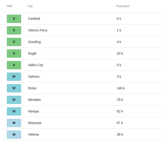
Selected cities exposed
Regional seismicity
I'm a dedicated researcher, journalist, and editor at The Watchers. With over 20 years of experience in the media industry, I specialize in hard science news, focusing on extreme weather, seismic and volcanic activity, space weather, and astronomy, including near-Earth objects and planetary defense strategies. You can reach me at teo /at/ watchers.news.
Impossible! There Was SOMETHING Mysterious About That Quake | * Video During Quake 200 Miles Away* https://www.youtube.com/watch?v=1PHPQ1mWdAM
Ok Jamal, Lets not allow knowledge go to your head. Describing yourself as supreme god” of anything symptom of an over-the-top ‘ego’. Let that go.
Only Jamal Shrair, explained in advance the physical events that are taking place on our planet right now. He is not prophet or astrologer, but rather the supreme god of physics. He knows the true building blocks of matter and the force that unifies the Universe.
Yellowstone Supervolcano M2.9 Earthquake, Uplift across Caldera! 3 31 20 https://www.youtube.com/watch?v=8JeSpQxfGhY