
Record-breaking rainfall soaks Southern California, another storm underway, U.S.
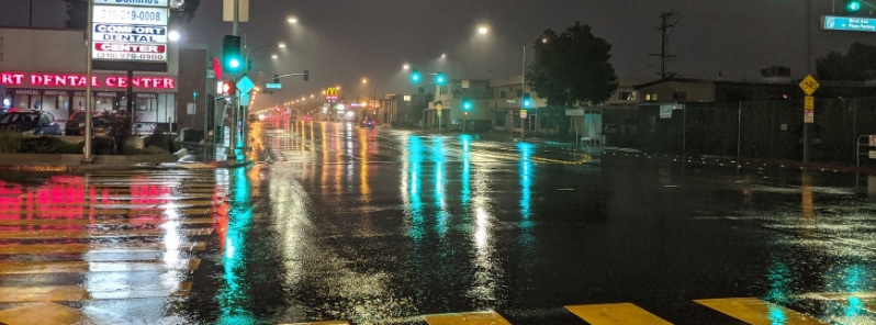
Image credit: @snooze2718/Twitter
Heavy rains drenched parts of Southern California on March 22 and into March 23, 2020. The coastal mountain ranges were also hit by the widespread rain, while some beneficial rain and snow fell in the southern San Joaquin Valley and the Sierra Nevada.
Southern California welcomed the rains following drought in February. The freeways in the Los Angeles area were hit by flooding early Monday; fortunately, people followed warnings to stay indoors amid the COVID-19 outbreak.
Numerous rainfall records were broken on March 22, including at L.A. Airport, DWTLA, Lancaster, and Palmdale, the National Weather Service (NWS) announced.
Scattered showers continue across the region this morning as a low pressure moves over #SoCal. Another cool day on tap today. #LARain #CAwx pic.twitter.com/LtA6Hdee60
— NWS Los Angeles (@NWSLosAngeles) March 23, 2020
Image showing the observed rainfall over the past 24-hours across portions of SW California.
For a tabular listing of rainfall visit this link: https://t.co/o8NMZfGxZi#LARain #CAwx #LAweather #CAwater #CAdrought #SoCal pic.twitter.com/eL4beKTexa
— NWS Los Angeles (@NWSLosAngeles) March 23, 2020
Following a dry Jan. and Feb, March precipitation across San Luis Obispo, Santa Barbara, Ventura, and Los Angeles Counties has been above average so far this month. Still below average for the water year. #LArain #CAwx #LAweather #CAdrought #CAwater #SoCal pic.twitter.com/bUiNyEmEK6
— NWS Los Angeles (@NWSLosAngeles) March 23, 2020
The L.A. International Airport recorded 43.9 mm (1.73 inches) on Sunday, breaking the previous record of 20.8 mm (0.82 inches) set in 2005. Downtown L.A. also broke its 28.19 mm (1.11 inches) rainfall record set in 1975 with 38.35 mm (1.51 inches).
Lancaster registered more than 25.4 mm (1 inch), smashing the previous record for the day of 10.4 mm (0.41 inches) set in 1958. Palmdale Airport broke its previous record of 10.92 mm (0.43 inches) set in 2018, after recording 11.43 mm (0.45 inches) on Sunday.
Neon and rain on a Los Angeles night pic.twitter.com/iCky92Zf4j
— (@snooze2718) March 23, 2020
Sunset Blvd. March 23, 2020 at 2:45 am., Rained all night in Los Angeles gives vibrant colors on the lonely rain soaked road. Peace! pic.twitter.com/9y83IGHcKu
— Paul L. Esbrandt (@PLEPhotography) March 23, 2020
Intense rains caused a mudslide in Sherman Oaks, damaging several homes, but no injuries were reported.
The mudslide occurred sometime before 22:00 LT in the 15000 block of West Hamner Drive. The debris from the slide damaged a backyard and appeared to open up a sinkhole alongside one of the houses, CBS reported.
The downpour continued into Monday morning, becoming one-and-off showers.
The coastal mountain ranges of central and Southern California received beneficial rain and snowfall, particularly in the southern San Joaquin Valley and the southern Sierra Nevada.
Meanwhile, another storm system is affecting the region. "A strong cold front will drop southeastward from the Pacific Northwest this afternoon across the Northern Rockies, Great Basin and as far south as southern California by early Wednesday," NWS said March 23.
This front will cause temperatures to drop below normal through mid-week from the West Coast to the Central Rockies. Most of the West over the next few days can anticipate showery conditions in the lower elevations and snow at higher elevations.
A storm system that brought locally gusty thunderstorms and heavy rain to the Southern California coastline to end the weekend will continue to bring along beneficial moisture early this week: https://t.co/KqCfzIQQPl pic.twitter.com/fNBAJ1GZNh
— AccuWeather (@breakingweather) March 23, 2020
Commenting rules and guidelines
We value the thoughts and opinions of our readers and welcome healthy discussions on our website. In order to maintain a respectful and positive community, we ask that all commenters follow these rules.