
Heavy snow hits Arizona on the first day of spring, U.S.
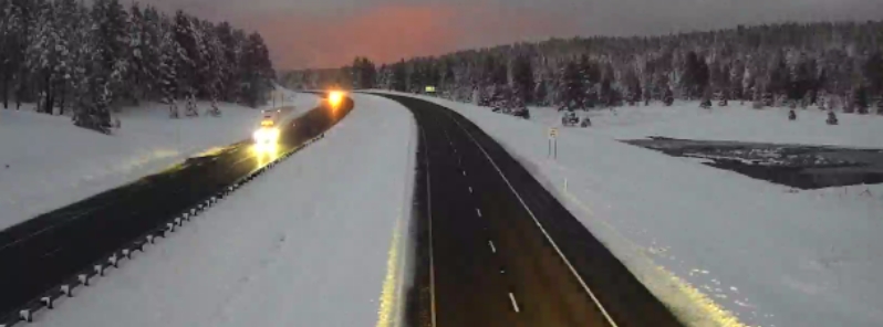
Image credit: ADOT
Parts of northwest Arizona saw heavy snow on the first day of spring on Thursday, March 19, 2020, with up to 30 cm (12 inches) in parts of the country.
The National Weather Service (NWS) said up to 30 cm (12 inches) of snow fell in Flagstaff by 05:00 LT on Thursday, urging drivers to cancel travels as roads were blanketed in snow and ice.
NWS Flagstaff also warned of "poor visibility and accumulating snow on the roads," reiterating that it is best to avoid travel if possible.
Interstate-40 was open in both directions near Williams, around 56 km (35 miles) west of Flagstaff, said ADOT. However, the department added that it would take time to clear miles of a traffic backup.
The weather service said temperatures will gradually warm over the weekend, before returning to normal by March 21. A flood warning for small streams, however, remains in effect until Sunday for Gila county.
6:20pm: Snow intensity has really picked up in the greater Flagstaff area in the past hr. Poor visibility and accumulating snow on the roads. Best to avoid travel if possible. #azwx pic.twitter.com/zmL42ySzxc
— NWS Flagstaff (@NWSFlagstaff) March 19, 2020
It's a #winter wonderland in #Flagstaff on the first day of #spring. Courtesy: Calvin Johnson #SpringEquinox #snow #azwx #12news #12newswx pic.twitter.com/cMQyQkeEqK
— Jamie Kagol (@jamiekagol) March 19, 2020
With “March Basketball Madness” out, March Snow Madness is in at Flagstaff Arizona! Yet it’s spring time here in Seattle!! Screen shot source: Virtual Railfan on YouTube. pic.twitter.com/fKSyyDxUGU
— John (@HawkSuperFan) March 19, 2020
"The low will finally eject northeastward on Saturday afternoon, with precipitation chances ending for the entire area. The warming trend will continue this weekend, as high temperatures will reach near normal values by Sunday," said NWS.
"As we head into next week, a weak disturbance will brush the state to the north on Monday. A few showers are likely to develop as it does so, but no major impacts are anticipated. The most notable weather feature for the first half of the week will be a tightening pressure gradient over northern Arizona."
Lots of snow up north … but on the SIDES of the road. Still, be prepared if you have to go up north tonight! #aztraffic #i40 #i17 #flagstaff pic.twitter.com/n9aTSxVln7
— Arizona DOT (@ArizonaDOT) March 20, 2020
Welcome…to the 1st day of #Spring in #Flagstaff #Arizona! About 7 inches of #snow in University Heights.@NWSFlagstaff #azwx pic.twitter.com/FUgvqay1Xw
— Mitch Strohman (@mitchstrohman) March 19, 2020
All this snow, but skiing’s a no-go…
Coming up at 9:30 on #azfamily I’ll tell you why Arizona Snowbowl is shut down today, even after last night’s snowfall pic.twitter.com/Ib0BYn7lU2
— Max Gorden (@Max_Gorden) March 19, 2020
Good morning Arizona
Looks like about 4”. #AzWx #Snow pic.twitter.com/DJ8TRa3M1C— Strawberry, AZ (@Strawberry_AZ) March 19, 2020
Commenting rules and guidelines
We value the thoughts and opinions of our readers and welcome healthy discussions on our website. In order to maintain a respectful and positive community, we ask that all commenters follow these rules.