
Kuchinoerabujima Volcano Alert Level upgraded from 2 to 3, Japan
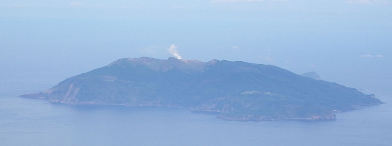
Image credit: As6022014
The Japan Meteorological Agency (JMA) has upgraded Volcano Alert Level for Kuchinoerabujima from 2 to 3 at 15:15 UTC on October 27, 2019 (00:15 JST, October 28). Kuchinoerabujima is a volcano island in Satsunan Islands, Japan, about 120 km (75 miles) SSW of Kagoshima city and about 1 100 km (685 miles) WSW of Tokyo. A series of eruptions with pyroclastic flows were recorded in December 2018 and January 2019.
"There is a possibility that an eruption will occur of a magnitude similar to the one in January when pyroclastic flows reached a point 1.9 km (1.2 miles) from the crater," JMA said.
In 2015, pyroclastic flows reached all the way to the coast, forcing all residents to evacuate.
Significant explosive eruption just now at the restless Kuchinoerabu #volcano in #Japan images via JMA webcam. H/t @wataruen pic.twitter.com/m1nr3bp3VT
— James Reynolds (@EarthUncutTV) January 17, 2019
With Alert Level raised to 3, residents and tourists are warned not to approach the danger zone.
Activity at Kuchinoerabujima is exemplified by interim explosions and periods of high seismicity.
Recent activity has occurred at two composite volcanoes, Shindake and Furudake. Phreatic explosions and Vulcanian eruptions have occurred at Shindake in historical record, that is after 1841, and were frequently accompanied with mudflows. Eruptions with pyroclastic flows occurred at Furudake about 200 years ago.
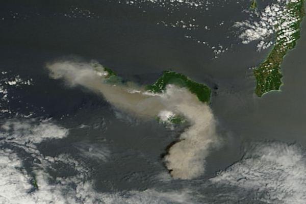
The eruption of Kuchinoerabujima in 2015. Credit: NASA Terra/MODIS
A weak explosion occurred on August 3, 2014, the first since 1980, and was followed by several others from May 29 to June 19, 2015 (VEI 3) and October 21, 2018 to February 3, 2019 (VEI 3); the alert level was lowered from 3 to 2 in June 2019.
Geological summary
A group of young stratovolcanoes forms the eastern end of the irregularly shaped island of Kuchinoerabujima in the northern Ryukyu Islands, 15 km (9.3 miles) west of Yakushima. The Furudake, Shindake, and Noikeyama cones were erupted from south to north, respectively, forming a composite cone with multiple craters.
The youngest cone, centrally-located Shintake, formed after the NW side of Furutake was breached by an explosion. All historical eruptions have occurred from Shintake, although a lava flow from the S flank of Furutake that reached the coast has a very fresh morphology.
Frequent explosive eruptions have taken place from Shintake since 1840; the largest of these was in December 1933. Several villages on the 4 x 12 km (2.5 x 7.5 miles) island are located within a few kilometers of the active crater and have suffered damage from eruptions. (GVP)
I'm a dedicated researcher, journalist, and editor at The Watchers. With over 20 years of experience in the media industry, I specialize in hard science news, focusing on extreme weather, seismic and volcanic activity, space weather, and astronomy, including near-Earth objects and planetary defense strategies. You can reach me at teo /at/ watchers.news.
Commenting rules and guidelines
We value the thoughts and opinions of our readers and welcome healthy discussions on our website. In order to maintain a respectful and positive community, we ask that all commenters follow these rules.