
Bogoslof ejects ash more than 9.5 km (31 000 feet) a.s.l., Alaska
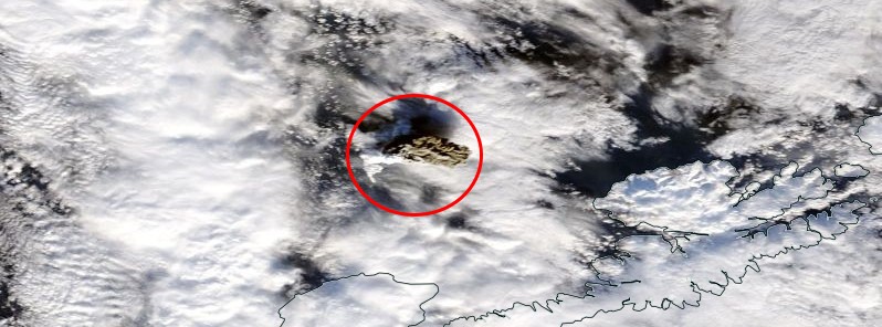
Featured image: Bogoslof erupting on January 18, 2017. Credit: NASA Terra/MODIS. Edit: TW
Alaskan Bogoslof volcano erupted again at about 22:20 UTC on January 18, 2017, following an approximately 20-minute-long increase in seismic activity. The cloud it ejected is presumably more ash-rich than others in current eruptive sequence.
Alaska Volcano Observatory said pilots reported the cloud reached a height greater than 9.5 km (31 000 feet) above sea level, and prevailing winds carried it northeast over the Bering Sea.
The eruption also produced lightning strikes, an infrasound signals detected by sensors in Sand Point and Dillingham.
A satellite image from 22:26 UTC, just after this event, showed a dark ash cloud just northeast of Bogoslof. This cloud was darker in color, and presumably more ash-rich, than others we have seen in the eruptive sequence, which began on December 16, 2016. This image also suggests the presence of very hot material (lava) at the surface immediately surrounding the vent – the first such observation during this eruption sequence.
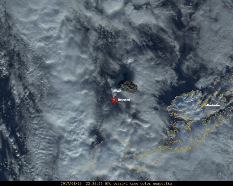
Image by Dave Schneider USGS/AVO
Following the initial explosive eruption, a second, lower-level volcanic cloud is visible in satellite images around 23:00 UTC, likely corresponding with an increase in seismic tremor that occurred from 22:40 – 22:55 UTC. This event was also detected on distant infrasound sensors but did not produce reported lightning. Seismicity remained elevated until 00:45 on January 19, but no additional eruption clouds have been observed.
The Aviation Color Code remains at RED and the Alert Level remains at WARNING.
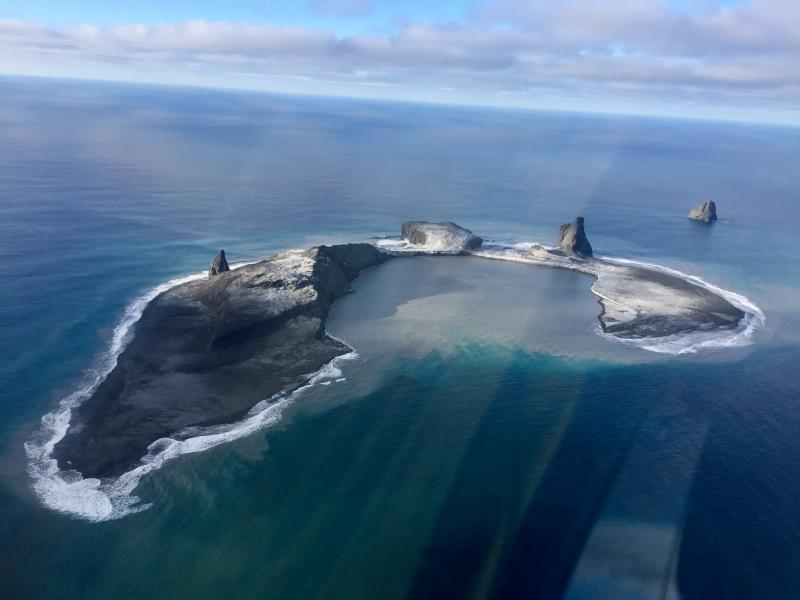
Bogoslof Island on January 10, 2017 – Alaska. Credit: Dan Leary of Maritime Helicopters
Geological summary
Bogoslof is the emergent summit of a submarine volcano that lies 40 km north of the main Aleutian arc. It rises 1500 m above the Bering Sea floor. Repeated construction and destruction of lava domes at different locations during historical time has greatly modified the appearance of this "Jack-in-the-Box" volcano and has introduced a confusing nomenclature applied during frequent visits of exploring expeditions.
The present triangular-shaped, 0.75 x 2 km island consists of remnants of lava domes emplaced from 1796 to 1992. Castle Rock (Old Bogoslof) is a steep-sided pinnacle that is a remnant of a spine from the 1796 eruption. Fire Island (New Bogoslof), a small island located about 600 m NW of Bogoslof Island, is a remnant of a lava dome that was formed in 1883. (GVP)
The Watchers team and our contributors bring the latest on extreme weather, earthquakes, volcanic eruptions, space weather, and all things science. We're all about making sense of the natural world and keeping you informed on what’s happening. Got a tip or a question? Hit us up using the form at newstips!
Commenting rules and guidelines
We value the thoughts and opinions of our readers and welcome healthy discussions on our website. In order to maintain a respectful and positive community, we ask that all commenters follow these rules.