
Fourth explosive eruption at Bogoslov volcano, Alaska
Featured image: Bogoslof volcano eruption on December 26, 2016. Credit: NOAA
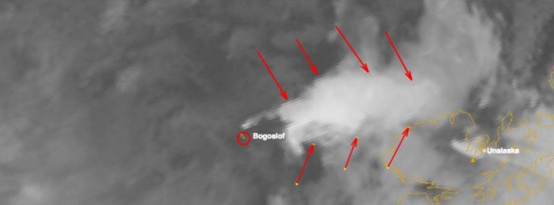
Bogoslof volcano in the Aleutian Islands of Alaska remains in a state of elevated unrest following the fourth explosive eruption since the current eruptive sequence began on December 21, 2016.
Retrospective analysis of seismic, infrasound, and satellite data performed by Alaska Volcano Observatory (AVO) suggest that following the initial increase in seismicity around 23:05 UTC on December 26, a fourth explosive ash emission started at about 23:30 UTC and lasted for approximately one hour. Windy conditions on Umnak Island appear to be obscuring Bogoslof's volcanic signal on seismic instruments there since about 00:20 UTC on December 27, limiting seismic detection capabilities.
AVO said satellite images showed the plume from yesterday's event rose to about 9.1 km (30 000 feet) above sea level and was carried to the northeast by prevailing winds.
Although explosive activity has subsided at present, based on the unpredictability of the situation the status of the volcano remains at Aviation Color Code Red and Alert Status Warning.
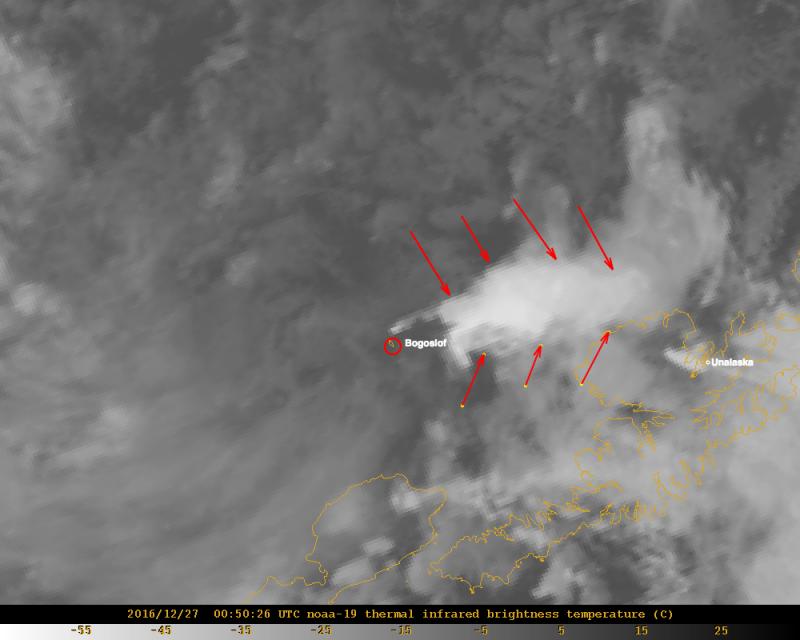
Bogoslof volcano eruption on December 26, 2016. Credit: NOAA
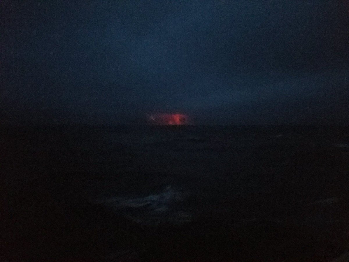
Bogoslof volcano eruption on December 23, 2016. Credit: CGC/Alex Haley
AVO has no ground-based volcano monitoring equipment on Bogoslof volcano.
"We continue to monitor satellite images, data from distant seismic and infrasound instruments, and information from the Worldwide Lightning Location Network for indications of significant activity," the observatory said.
Geological summary
Bogoslof is the emergent summit of a submarine volcano that lies 40 km north of the main Aleutian arc. It rises 1500 m above the Bering Sea floor. Repeated construction and destruction of lava domes at different locations during historical time has greatly modified the appearance of this "Jack-in-the-Box" volcano and has introduced a confusing nomenclature applied during frequent visits of exploring expeditions.
The present triangular-shaped, 0.75 x 2 km island consists of remnants of lava domes emplaced from 1796 to 1992. Castle Rock (Old Bogoslof) is a steep-sided pinnacle that is a remnant of a spine from the 1796 eruption. Fire Island (New Bogoslof), a small island located about 600 m NW of Bogoslof Island, is a remnant of a lava dome that was formed in 1883. (GVP)
The Watchers team and our contributors bring the latest on extreme weather, earthquakes, volcanic eruptions, space weather, and all things science. We're all about making sense of the natural world and keeping you informed on what’s happening. Got a tip or a question? Hit us up using the form at newstips!
It would certainly be good if in addition to Universal Time, the exact timing of such an even to be were given in Alaska Standard Time. Could you add that in parentheses?
Much appreciated. -MEC