
Robust steam plume, new explosive eruption at Bogoslov volcano, Alaska
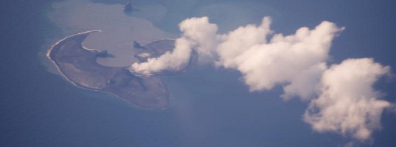
Featured image: Bogoslof seen from Alaska Airlines flight from Adak to Anchorage on June 22, 2017. Credit: Cyrus Read
A new explosive eruption took place at Bogoslof volcano, Alaska at 00:29 UTC on August 27, 2017 and lasted about 4 minutes.
The cloud produced during today's event was observed in satellite images to drift southeast from Bogoslof and pass over southern Unalaska Island. Cloud-top temperatures seen in satellite data show that it rose to as high as 7.4 km (24 000 feet) above sea level.
Seismicity, as detected on neighboring islands, has been quiet since, no lightning has been detected, and satellite images show no additional emission from the volcano.
At 19:59 UTC on August 26, the Alaska Volcano Observatory reported a robust steam plume extending about 70 km (43 miles) SE of the volcano and elevated surface temperatures at Bogoslof Island were observed over the past 24 hours.
"These observations are consistent with the existence of the newly emplaced lava dome within the crater lake, first observed on August 18, and the interaction of hot lava (dome) and sea water," the observatory noted.
Many past eruptions of Bogoslof have ended with the development of a subaerial lava dome. However, during some eruptive periods, lava effusion has been followed by additional explosive activity and dome destruction.
If explosive eruptive activity resumes and the vent remains subaerial, it is possible that the resulting volcanic cloud could be more ash-rich than many of the volcanic clouds observed this far.
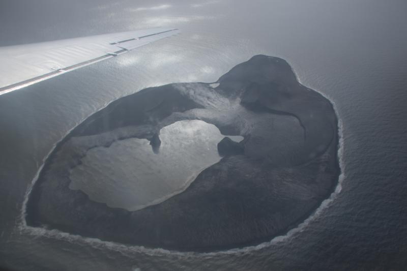
Bogoslof volcano overflight on August 15, 2017. Credit: Janet Schaefer
Geological summary
Bogoslof is the emergent summit of a submarine volcano that lies 40 km (24.8 miles) north of the main Aleutian arc. It rises 1 500 m (4 920 feet) above the Bering Sea floor. Repeated construction and destruction of lava domes at different locations during historical time has greatly modified the appearance of this "Jack-in-the-Box" volcano and has introduced a confusing nomenclature applied during frequent visits of exploring expeditions.
The present triangular-shaped, 0.75 x 2 km (0.46 x 1.2 miles) island consists of remnants of lava domes emplaced from 1796 to 1992. Castle Rock (Old Bogoslof) is a steep-sided pinnacle that is a remnant of a spine from the 1796 eruption. Fire Island (New Bogoslof), a small island located about 600 m (1 970 feet) NW of Bogoslof Island, is a remnant of a lava dome that was formed in 1883. (GVP)
I'm a dedicated researcher, journalist, and editor at The Watchers. With over 20 years of experience in the media industry, I specialize in hard science news, focusing on extreme weather, seismic and volcanic activity, space weather, and astronomy, including near-Earth objects and planetary defense strategies. You can reach me at teo /at/ watchers.news.
Commenting rules and guidelines
We value the thoughts and opinions of our readers and welcome healthy discussions on our website. In order to maintain a respectful and positive community, we ask that all commenters follow these rules.