
Tropical Cyclone “Yvette” forms near Australia
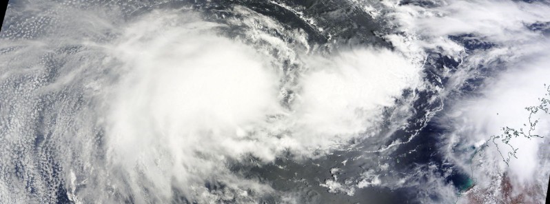
Featured image: Tropical Cyclone "Yvette" on December 21, 2016. Image credit: NASA Terra/MODIS
Two tropical systems are currently eyeing Australia, one of which has developed into the Tropical Cyclone "Yvette", and the other is a tropical low. Yvette won't affect Western Australia over the next two days, although landfall is possible after that.
Bureau of Meteorology reports that the monsoon trough is currently active over northern Australia with a tropical low and Tropical Cyclone "Yvette" embedded in the trough. An enhanced area of shower and thunderstorm activity is taking place over the Top End, Kimberley region, and in the vicinity of Yvette.
The tropical cloud mass is producing middle-level clouds with embedded thunderstorms across the Pilbara through central Australia and into southern Queensland.
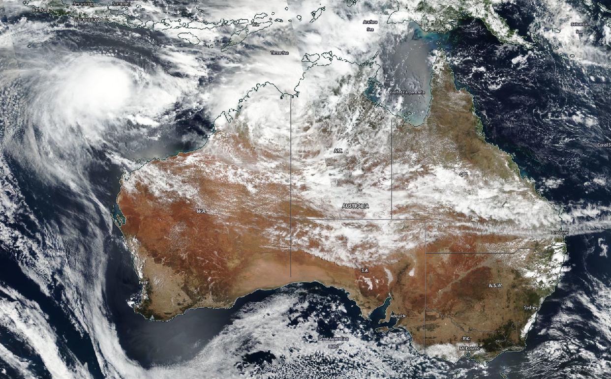
Tropical Cyclone "Yvette" and tropical low approaching the coast of Australia, December 21, 2016. Image credit: NASA/NOAA/DoD Suomi NPP/VIIRS
Video credit: BOM
On December 19, the GPM core satellite found Tropical Cyclone 02S, soon to become Yvette, was dropping rain at a rate of over 127 mm (5 inches) per hour in this area of intense convective showers where cloud tops reached altitudes above 17 km (10.5 miles).
Credit: NASA/JAXA, Hal Pierce
Yvette was located approximately 900 km (559 miles) north of Learmonth, Australia, and moving northward at 1.8 km/h (1.1 mph) on December 21 at 09:00 UTC, according to the Joint Typhoon Warning Center (JTWC).
The system was packing maximum sustained winds of 74 km/h (46 mph) with gusts up to 92.6 km/h (57.5 mph) while its minimum central pressure was estimated at 996 hPa.
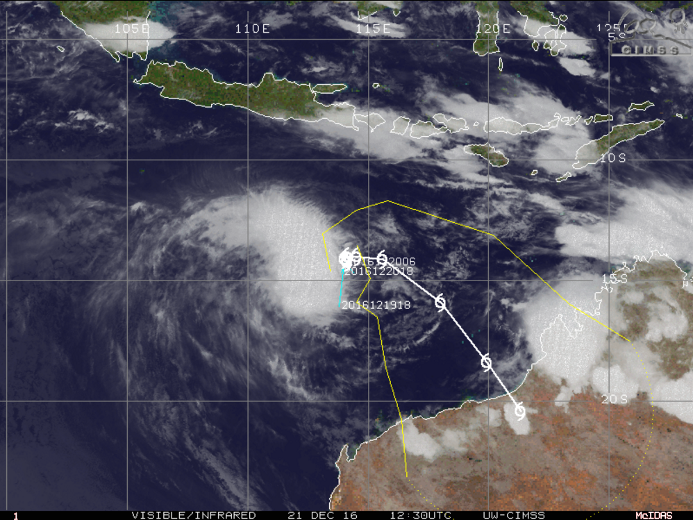
Tropical Cyclone "Yvette", December 21, 2016, at 12:30 UTC. Image credit: UW-CIMSS
Yvette is currently moving in a quasi-stationary fashion and slight intensification is expected over the next 24 hours. The maximum sustained winds will climb to 92.6 km/h (57.5 mph) while gusts are expected to reach 120.4 km/h (74.8 mph). The winds will retain their speed over the next 48 hours while the system will accelerate in a southward course.
According to BOM, Yvette is not expected to affect the Western Australia mainland over the next two days and will continue tracking southeastwards toward the Pilbara/west Kimberley coast during December 23 (AWST). Tropical cyclone should approach the coast over the coming Christmas weekend.
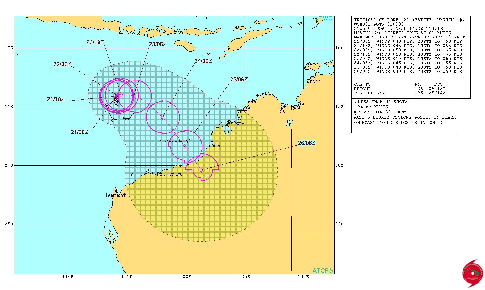
Tropical Cyclone "Yvette" 5-day forecast track. Image credit: JTWC
According to the JTWC forecast, Yvette may make landfall over Western Australia over the next five days. However, the dynamic model guidance shows significant spread and a degree of uncertainty of the exact track which implies current low confidence in the forecast track.
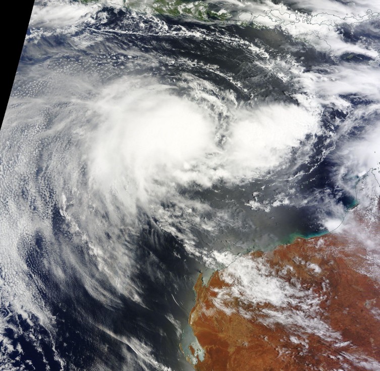
Tropical Cyclone "Yvette" on December 21, 2016. Credit: NASA Terra/MODIS
Yvette is the first named storm of the 2016/17 Australian region cyclone season which officially runs from November 1 to April 30.
Commenting rules and guidelines
We value the thoughts and opinions of our readers and welcome healthy discussions on our website. In order to maintain a respectful and positive community, we ask that all commenters follow these rules.