
Karen (Sarika): Strong typhoon threatens the Philippines
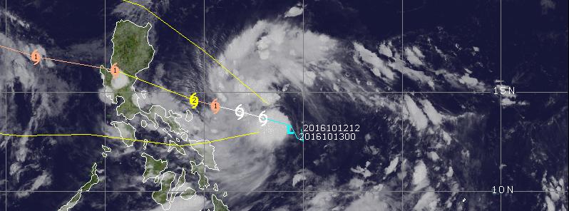
Featured image: Tropical depression 24W approaching the Philippines, October 13, 2016, 09:30 UTC. Image credit: UW-CIMSS
A tropical depression which developed east of Manila, Philippines, on October 13, 2016, is expected to rapidly intensify and become a strong typhoon over the next 48 hours. The system will threaten the Philippines with strong winds and heavy rainfall, and residents are encouraged to closely follow the development, as the storm might turn out to be surprisingly strong.
Tropical depression 24W was located approximately 916.7 km (569.6 miles) east of Manila, Philippines, and moving northwestward at 11.1 km/h (6.9 mph) on October 13, at 09:00 UTC, according to the Joint Typhoon Warning Center (JTWC). The system was packing maximum sustained winds of 55.6 km/h (34.5 mph) with gusts up to 74 km/h (45.9 mph) while its minimum central pressure was estimated at 1 001 hPa.
Read latest on Typhoon Karen (international name Sarika): Typhoon "Sarika" making landfall over the Visayas, Philippines
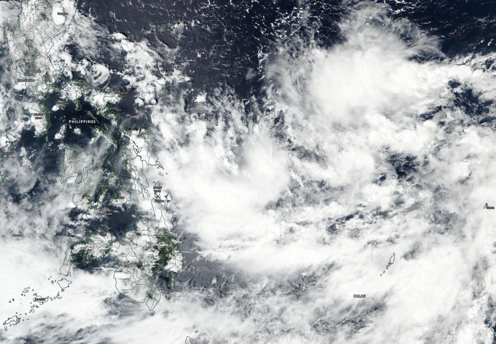
Tropical depression 24W, October 13, 2016. Image credit: NASA/Suomi NPP/VIIRS

Tropical depression 24W approaching the Philippines, October 13, 2016, 09:30 UTC. Image credit: UW-CIMSS
24W is expected to transition into a tropical storm, named Karen (Sarika in the Philippines) over the next 12 hours. Over the next 48 hours, the system's maximum sustained winds will reach 157.4 km/h (97.8 mph) with gusts up to 194.5 km/h (120.8 mph), and Karen will rapidly intensify into a strong typhoon, equivalent to a Category 2 hurricane, as it approache the Philippines.
Video credit: Westpacwx
According to Westpacwx meteorologists, Luzon and part of the northern Visayas can expect typhoon conditions later during the week, and residents should remain on alert and follow the development as the storm may turn to be more surprising than usual.
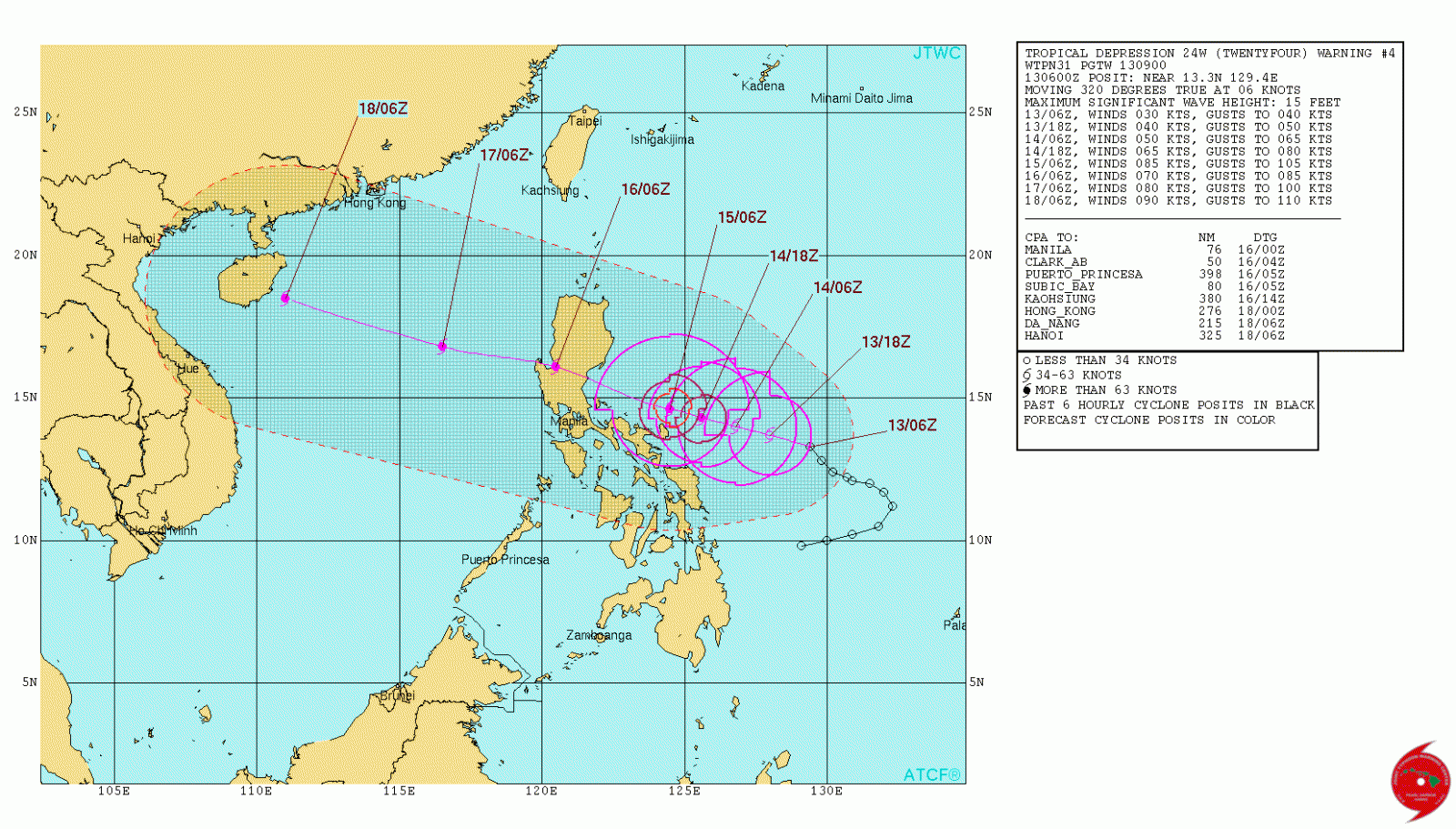
Tropical depression 24W 5-day forecast track. Image credit: JTWC
A major concern for the storm is the wind threat. However, the east coast of Central Luzon which seems to be on the system's course is used to similar storms, and can sustain the winds. A potentially bigger threat could be urban flooding around the northern areas NCR. The good news is that, at the moment, it looks like the downtown Manilla will avoid the worst of the storm.
Read latest on Typhoon Karen (international name Sarika): Typhoon "Sarika" making landfall over the Visayas, Philippines
Dont understand, why the PI calls this typhoon Karen? Also posing no threat to mid Luzon { Manila & Baguio city} ? And here , its a Threat to Baguio City