
Darby becomes the third hurricane of the 2016 eastern Pacific hurricane season
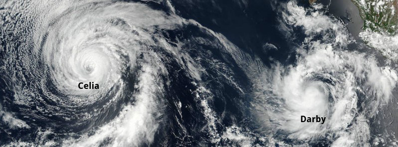
Featured image: Tropical Storm "Darby" and Hurricane "Celia" on July 12, 2016. Credit: NASA/NOAA/DoD Suomi NPP / VIIRS
Tropical Depression 05E formed on July 11, 2016, off the coast of western Mexico and strengthened into a tropical storm named Darby on July 12. By 21:00 UTC on July 13, Darby became the third hurricane of the 2016 eastern Pacific hurricane season. Additional strengthening is forecast during the next 48 hours.
At the time, the center of Hurricane "Darby" was located about 920 km (570 miles) SSW of the southern tip of Baja California, Mexico. Its maximum sustained winds were 120 km/h (75 mph), making Darby a Category 1 hurricane on the Saffir-Simpson Hurricane Wind Scale. The system was moving west at 19 km/h (12 mph), and this general motion is expected to continue during the next few days. Its minimum central pressure was 992 hPa.
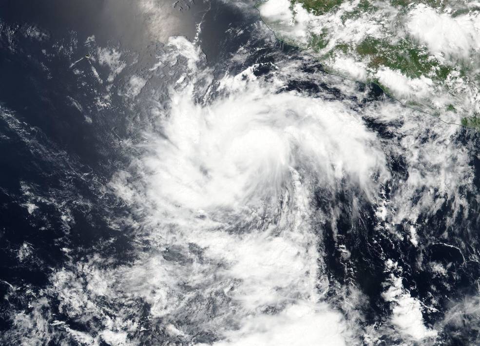
On July 11, the Suomi NPP satellite showed thunderstorms around Tropical Depression 4's center of circulation, and bands of thunderstorms wrapping into the low level center from the western and eastern quadrants. Credit: NASA/NOAA/DdD Suomi NPP / VIIRS

On July 12 at 21:45 UTC the VIIRS instrument aboard NASA-NOAA-DOD's Suomi NPP satellite captured this visible light image of Hurricane "Celia (04E)" and Tropical Storm "Darby" (05E) in the eastern Pacific Ocean. Credits: NASA/NOAA/DoD Suomi NPP / VIIRS
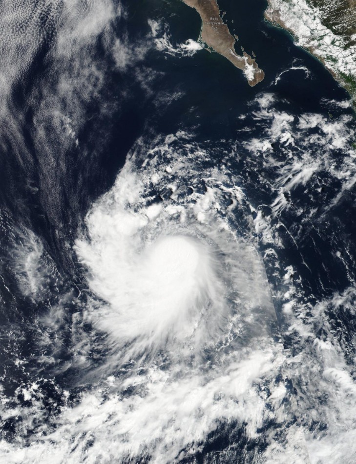
Tropical Storm "Darby" on July 13, 2016. Credit: NASA/NOAA/DoD Suomi NPP / VIIRS
At 03:00 UTC on July 14, Darby's center was located about 950 km (590 miles) SSW of the southern tip of Baja California. Its maximum sustained winds have increased to near 130 km/h (80 mph). The system is still moving west at 20 km/h, with minimum central pressure of 989 hPa.
Hurricane-force winds extend outward up to 35 km (25 miles) from the center and tropical-storm-force winds extend outward up to 150 km (90 miles).
There are no coastal watches or warnings in effect.
At the same time, the center of Tropical Storm "Celia" (04E) was located about 2 130 km (1 325 miles) east of Hilo, Hawaii. Celia, the second hurricane of the 2016 eastern Pacific hurricane season, was moving toward the west-northwest near 20 km/h (13 mph), with maximum sustained winds near 85 km/h (50 mph).
Additional weakening is forecast, and Celia should degenerate into a remnant low during the next couple of days. Its estimated minimum central pressure was 1 000 hPa. Celia officially lost its hurricane status at 09:00 UTC on July 13.
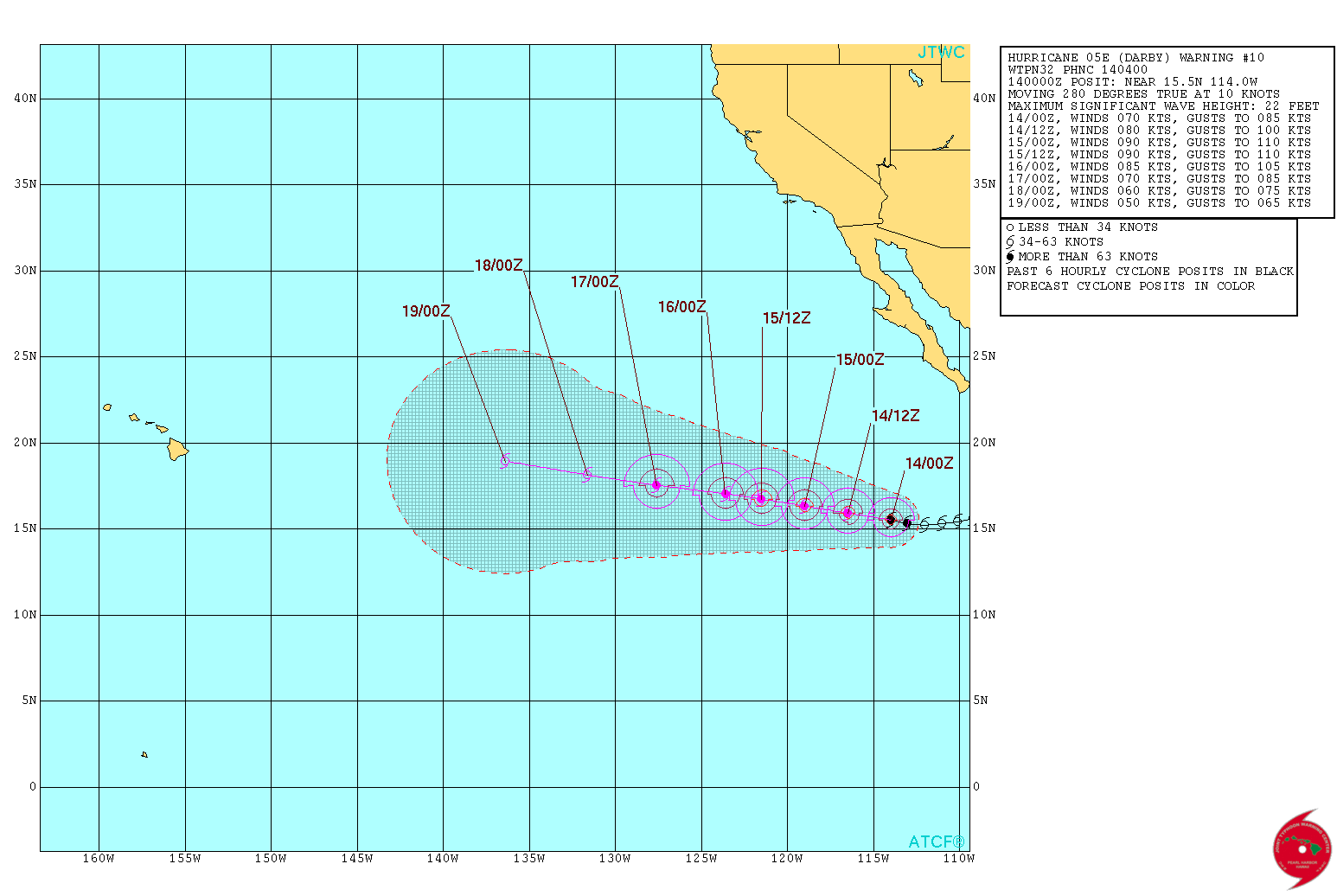
Hurricane "Darby" – JTWC forecast track at 04:00 UTC on July 14, 2016
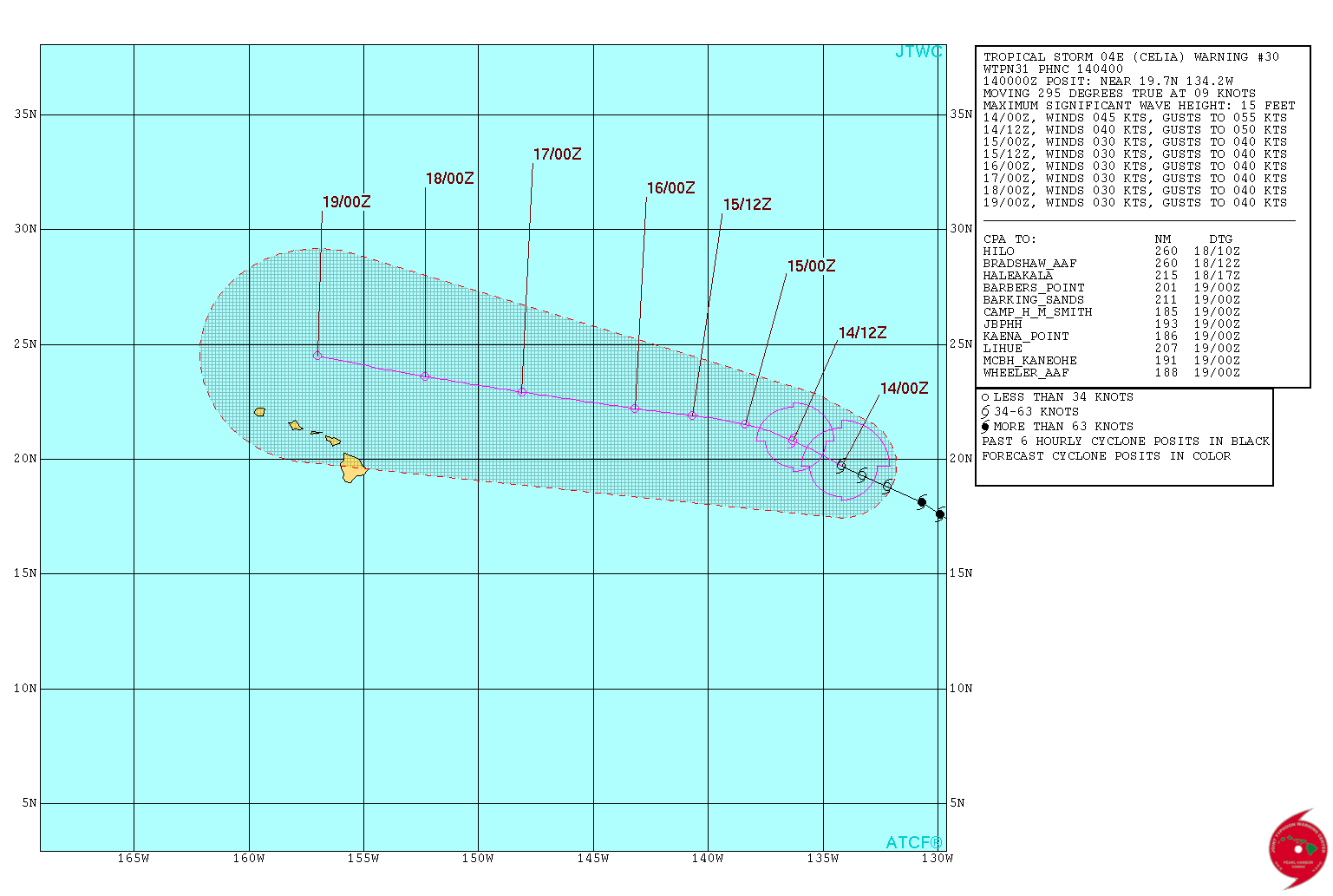
Tropical Storm "Celia" – JTWC forecast track at 04:00 UTC on July 14, 2016
The Watchers team and our contributors bring the latest on extreme weather, earthquakes, volcanic eruptions, space weather, and all things science. We're all about making sense of the natural world and keeping you informed on what’s happening. Got a tip or a question? Hit us up using the form at newstips!
Commenting rules and guidelines
We value the thoughts and opinions of our readers and welcome healthy discussions on our website. In order to maintain a respectful and positive community, we ask that all commenters follow these rules.