
Strong winds and heavy rainfall threaten Baja California as Tropical Storm “Javier” eyes Mexico
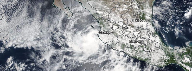
Featured image: Tropical Storm "Javier", August 7, 2016. Image credit: NASA/NOAA/DoD Suomi NPP / VIIRS
After Earl lashed parts of Mexico with abundant rainfall and triggered numerous deadly landslides, another tropical storm is aiming the region. Newly formed Tropical Storm "Javier" is nearing the southern tip of Baja California Sur, and another spell of heavy rainfall and hurricane winds are expected to begin soon. Appropriate hurricane and tropical warnings and watches have been put in effect for regions of the Baja California peninsula.
Tropical Depression "11E" formed in the early morning hours on August 7, 2016 (UTC), near the southwest coast of Mexico and intensified into a tropical storm by late evening.
Tropical Storm "Javier" was located about 160 km (100 miles) southeast of Cabo San Lucas, Mexico and moving northwestward at 20 km/h (13 mph) on August 8, 12:00 UTC, according to the National Hurricane Center (NHC). The system's maximum sustained winds were at 85 km/h (50 mph) with gusts up to 101.9 km/h (63.3 mph) while its minimum central pressure was estimated at 999 hPa. The winds of tropical force extend up to 95 km (60 miles) from the center of the storm.
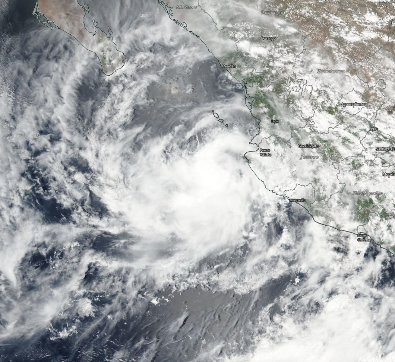
Tropical Storm "Javier", August 7, 2016. Image credit: NASA/NOAA/DoD Suomi NPP / VIIRS
Javier is expected to continue on its path with a decrease in forward speed through August 9. Its center will pass near or over the southern tip of the Baja California later in the afternoon or evening, and move near the west coast of Baja California Sur during August 8 and 9.
The storm will strengthen over the next 24 hours and its maximum sustained winds are expected to reach 111.1 km/h (69 mph) with gusts up to 138.9 km/h (86.3 mph). According to the NHC, Javier could become a hurricane as it passes near the southern portion of Baja California.
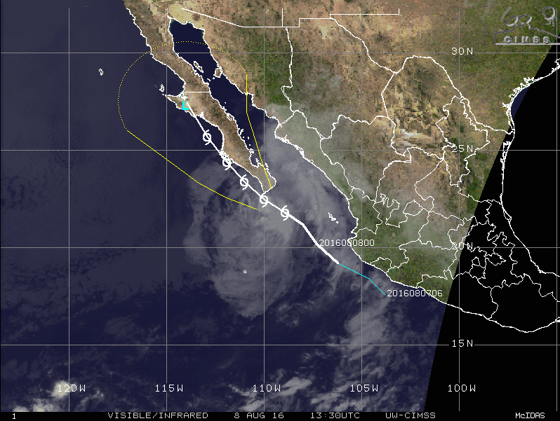
Tropical Storm "Javier", August 8, 13:30 UTC. Image credit: UW-CIMSS
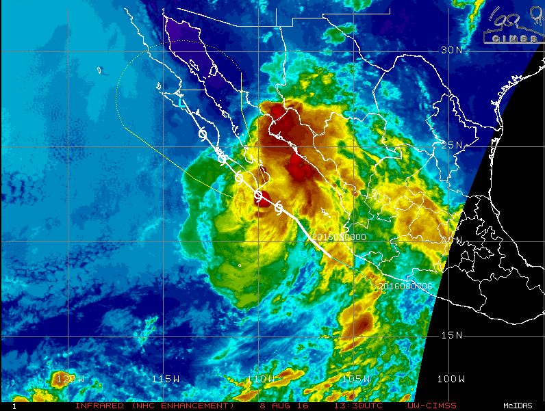
Tropical Storm "Javier", Infrared (NHC enhancement) August 8, 13:30 UTC. Image credit: UW-CIMSS
Tropical Storm "Javier" is expected to produce a total rainfall accumulation between 76.2 and 152.4 mm (3 and 6 inches) over the coastal portions of Sinaloa and southern Sonora into Baja California Sur. Isolated maximum amounts of 254 mm (10 inches) are also possible through the morning of August 10.
Hurricane winds are forecast over the extreme southern portion of the Baja California peninsula by the evening of August 8. Tropical storm conditions are expected over the rest of the peninsula by the late afternoon. Tropical storm conditions are also possible over the southern portion of Baja California on August 9.
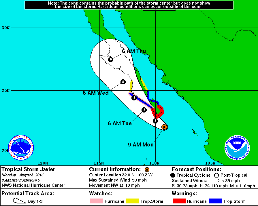
Tropical Storm "Javier" 4-day forecast track. Image credit: NHC/NOAA
A Hurricane Warning is in effect for Los Barriles to Todos Santos and a Hurricane Watch is in place for the region of Todos Santos to Cabo San Lazaro. A Tropical Storm Warning is in effect for the areas from Los Barriles to San Evaristo and Todos Santos to Cabo San Lazaro while a Tropical Storm Watch spans the regions from San Evaristo to Loreto and Cabo San Lazaro to Puerto San Andresito.
Commenting rules and guidelines
We value the thoughts and opinions of our readers and welcome healthy discussions on our website. In order to maintain a respectful and positive community, we ask that all commenters follow these rules.