
Slow-moving low floods the US Gulf Coast, Javier to enhance monsoon in Desert Southwest
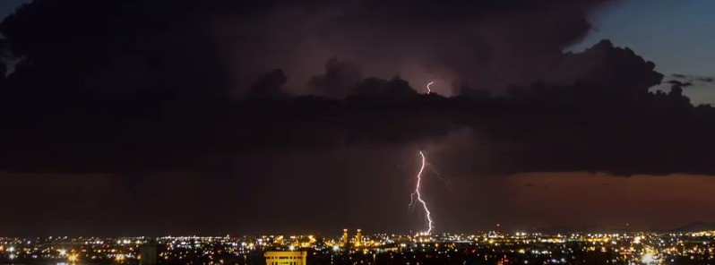
Featured image: Lightning show from the Tropical Storm "Javier" cloud over Phoenix. Image credit: Lennis Wayne Photographic Art
An intense low pressure in the upper levels of the atmosphere in combination with abundant amounts of tropical moisture have brought heavy rainstorms to portions of the US Gulf Coast, from Florida to southeast Louisiana over the last couple of days. Ex-tropical storm Javier already triggered abundant precipitation in parts of Arizona and New Mexico, and will continue enhancing the monsoon in the Desert Southwest and lashing rain by the end of the week. Flash floods, rock and mudslides are expected across the affected portions. Residents have been advised to exercise caution.
Over 152.4 mm (6 inches) of rain was recorded in parts of west-central and northwest Florida since the weekend of August 6, 2016, with at least one location measuring more than 0.3 m (1 foot) of precipitation.
Video credit: Reed Timmer via AccuWeather
Several areas in Perry, Florida, reported 114.3 mm (4.5 inches) of rainfall in only two hours on the morning of August 8 (local time), prompting road closures and causing traffic disruptions. In the period between August 7 and 8, up to 355.6 mm (14 inches) of rainfall was reported near Hatch Bend, Florida. On the evening of August 9, torrential downpours flooded roads across the Panama City.
Video credit: Weather Bug Video
Video credit: ABC Action News
Flood and flash flood watches have been issued for the affected areas, accordingly.
Credit TRMM
The slow-moving storm system will continue spreading westward, along the central Gulf of Mexico by the end of the week. Several inches of rainfall are expected across Tallahassee, Florida, Mobile, Alabam, Biloxi, Mississippi, and New Orleans:
"A general 76.2-152.4 mm (3-6 inches) of rain will fall from the Florida Panhandle to southeastern Louisiana with local amounts potentially topping (203.2 mm) 8 inches," said Alex Avalos, an AccuWeather Storm Warning Meteorologist.
Video credit: Lennis Wayne Photographic Art
Video credit: 24×7 News
A plume of moisture from remnants of the Tropical Storm "Javier" may cause strong and life-threatening flooding across the Southwestern US by the end of the week.
Already increased rainfalls have spread over Arizona and New Mexico on August 9, and a massive dust storm, the so-called haboob was reported in the Phoenix region. About 2 000 people reported power loss in Phoenix.
By August 11, total rainfall accumulation up to 127 mm (5 inches) is expected in central and southern Arizona to the southwestern New Mexico. The rainfall rate may be over 25.4 mm (1 inch) per hour over the Four Corners states.
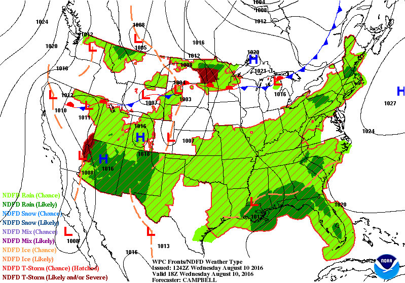
Image credit: NOAA/NWS/WPC
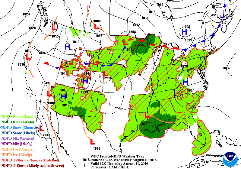 Image credit: NOAA/NWS/WPC
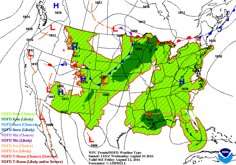 Image credit: NOAA/NWS/WPC
According to the National Weather Service (NWS), showers and thunderstorms will affect the Gulf Coast and the Southeast throughout the week. The remnants of Javier will enhance the monsoon in the Desert Southwest, causing heavy rainfall. Flash floods are expected throughout the affected areas.
Meteorologists warn the rainfall could severely reduce the visibility along the interstates 8, 10, 17, 25, and 40, and localized mud and rockslides can be expected, as well. Drivers have been warned to exercise extreme caution and refrain from driving through the flooded roadways.
Torrential downpours and flash floods will move towards western Texas, eastern New Mexico, and Oklahoma during the coming weekend.
Commenting rules and guidelines
We value the thoughts and opinions of our readers and welcome healthy discussions on our website. In order to maintain a respectful and positive community, we ask that all commenters follow these rules.