
Severe thunderstorms continue to target central US, more tornadoes possible
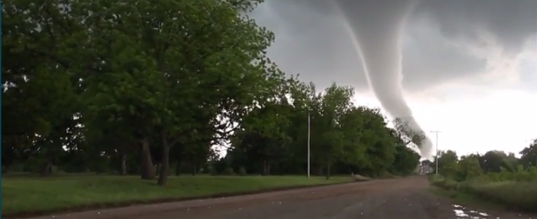
Image credit: Weather Nation
A strong low pressure system over the central US will continue to produce intense thunderstorms, accompanied by tornadoes until the end of May 11, 2016, according to the National Weather Service (NWS). Large hail and strong winds are possible while tornado risk will be the highest in the areas of northern Missouri and western Illinois. On May 12, lately affected regions can look forward to quieter weather conditions.
Severe storms have already wreaked havoc across Oklahoma, Nebraska, Iowa and Illinois on May 9. Two fatalities were reported in Oklahoma. NWS received 22 tornado reports and over 100 hail reports, as of May 10. Strong to severe thunderstorms are still possible across the Southern and Central Great Plains, while heavy rainfall is expected over lower and mid-Mississippi Valle throughout the day.
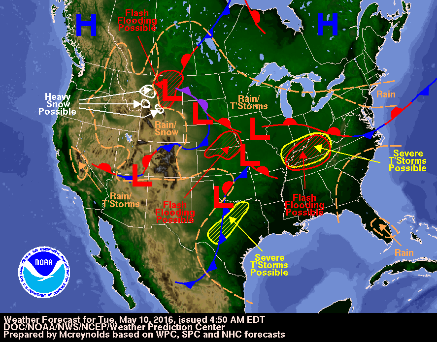
Image credit: DOC/NOAA/NWS/NCEP/Weather Prediction Center
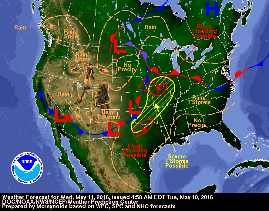
Image credit: DOC/NOAA/NWS/NCEP/Weather Prediction Center
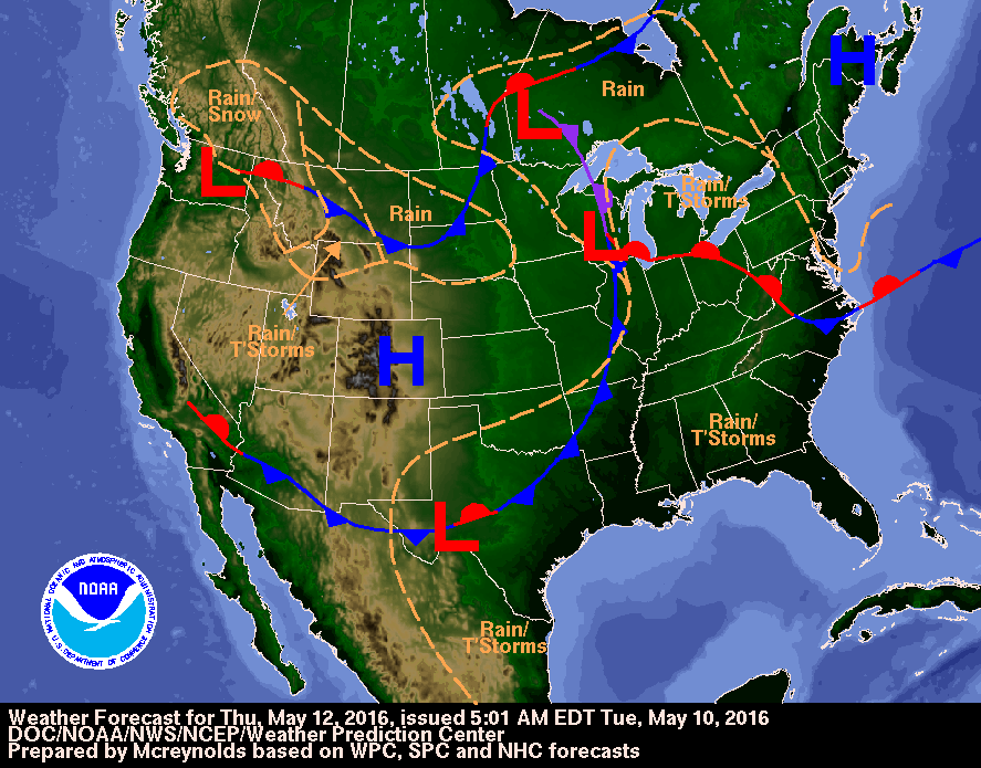
Image credit: DOC/NOAA/NWS/NCEP/Weather Prediction Center
The morning of May 11 will begin quietly. However, strong showers and thunderstorms are expected to develop across parts of Nebraska and Kansas, and then continue affecting the region from Illinois to Missouri into Oklahoma and Texas.
The NWS has forecast an occluded surface low over the Dakotas will bring moderate to heavy rainfall across the northern Plains and snow to the mountains in Wyoming and Montana. Another surface low along the trailing cold front in the south will produce widespread showers and thunderstorms from Texas to Ohio Valley. Some storms may be locally severe and capable of producing flash flooding.
Video credit: Weather Nation
Video credit: Basehunters Chasing
"We expect several tornadoes, flash flooding, large hail and damaging winds across the region," said Eddie Walker, the AccuWeather Enterprise Solutions Lead Meteorologist.
The cities at risk include St. Louis, Kansas City and Springfield, Missouri, Peoria, Illinois, and Fayetteville, Arkansas. Severe thunderstorms will continue to threaten the region on May 11, but a tornado risk should exist only within a smaller area.
"The tornado threat looks to be greatest across northern Missouri and far-western Illinois. This higher threat area should be north of St. Louis," Walker added.
However, on May 11, a new storm will move from the Rockies and could produce intense thunderstorms as it combines with the warm and moist air mass over the region. The risk of strong thunderstorms will spread into northern Texas. At the same time, strong winds and local hailstorms will batter southern areas.
After wild wx rolled through the #Plains, another 14mil ppl are under the risk of #severewx today. Details on @AMHQ. pic.twitter.com/uVmTPGB3G9
— AMHQ (@AMHQ) May 10, 2016
The local population and travelers are warned to remain alert and follow the severe weather updates. Severe conditions are expected to persist until the night of May 11 and ease afterward. The thunderstorms are forecast to travel into the Ohio, Tennesse, and the Gulf Coast during the following day, involving locally isolated threats while recently affected areas of the Plains and Midwest can finally look forward to a drier forecast.
Commenting rules and guidelines
We value the thoughts and opinions of our readers and welcome healthy discussions on our website. In order to maintain a respectful and positive community, we ask that all commenters follow these rules.