
Tropical Cyclone “Yalo” lashes French Polynesia and Austral Islands with strong rainstorms

Featured image: On February 24 at 0005 UTC (Feb. 23 at 7:07 p.m. EST) the AIRS instrument aboard NASA's Aqua satellite captured this near-visible image of newborn storm Yalo near French Polynesia in the Southern Pacific Ocean. Image credit: NASA JPL/Ed Olsen
The fourteenth tropical cyclone is active in the Southern Pacific Ocean. Tropical Cyclone "Yalo" formed on February 25, 2016, at 03:00 UTC, about 600 km (373 miles) west-southwest of Papeete, Tahiti. The system brought heavy rainfall and strong winds to the French Polynesia and Austral Islands. Disrupted rainy passages should cease by the afternoon of February 26, according to Meteo France.
Tropical Cyclone "Yalo" was located approximately 605.6 km (376.3 miles) southwest of Papeete, Tahiti, and moving southeastward at 18.5 km/h (11.5 mph) on February 26 at 03:00 UTC, according to the Joint Typhoon Warning Center (JTWC).
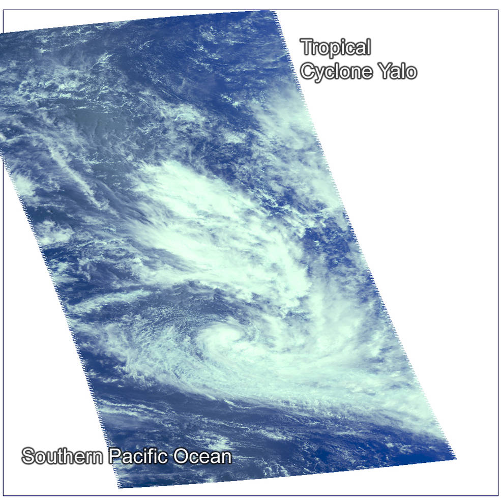
On February 24 at 0005 UTC (Feb. 23 at 7:07 p.m. EST) the AIRS instrument aboard NASA's Aqua satellite captured this near-visible image of newborn storm Yalo near French Polynesia in the Southern Pacific Ocean. Image credit: NASA JPL/Ed Olsen
MJO/Nino contributing to TC Yalo in far eastern S Pacific. Meanwhile, suppressed conv. major issue N Australia. pic.twitter.com/49xumPnm3R
— Anthony Sagliani (@anthonywx) February 25, 2016
The system was packing maximum sustained winds of 74 km/h (46 mph) and gusts of 92.6 km/h (57.5 mph) at the time while its minimum central pressure was estimated at 993 hPa.
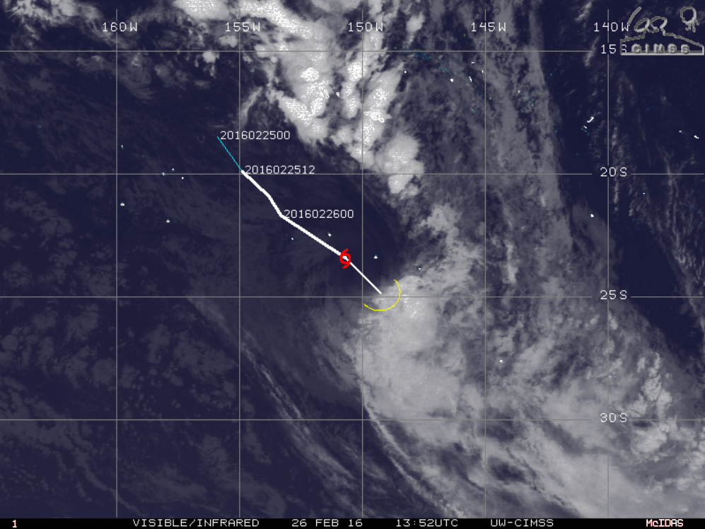
Tropical Cyclone "Yalo", February 26, 2016, 13:52 UTC. Image credit: UW-CIMSS
According to JTWC, Yalo is forecast to track southeastward as it rides along the western boundary of a subtropical ridge positioned to the east. It will move over increasingly cooler sea surface temperatures into an area of very high vertical wind shears, with speeds between 92.6 and 111.1 km/h (57.5 and 69 mph). Rapidly deteriorating conditions will cause the cyclone to dissipate within 24 hours. By then, maximum sustained winds are expected to drop to 55.5 km/h (34.5 mph) and wind gusts will lower to 74 km/h (46 mph).
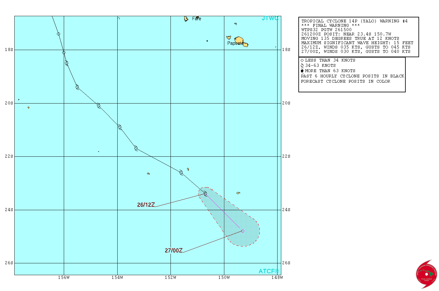
Tropical Cyclone "Yalo" 24h forecast track. Image credit: JTWC
The storm threatens French Polynesia and Austral Islands, and Meteo France issued warnings and watches accordingly. Iles du Vent can expect occasionally brief and intense periods of rainfall until at least midday on February 26 (local time). Local wind gusts can exceed 80 km/h (49.7 mph). Heavy rainfalls and strong winds have been observed on Mopelia and Iles of the Iles Sous Le Vent, and more intense passages are expected until midday on February 26 (local time).
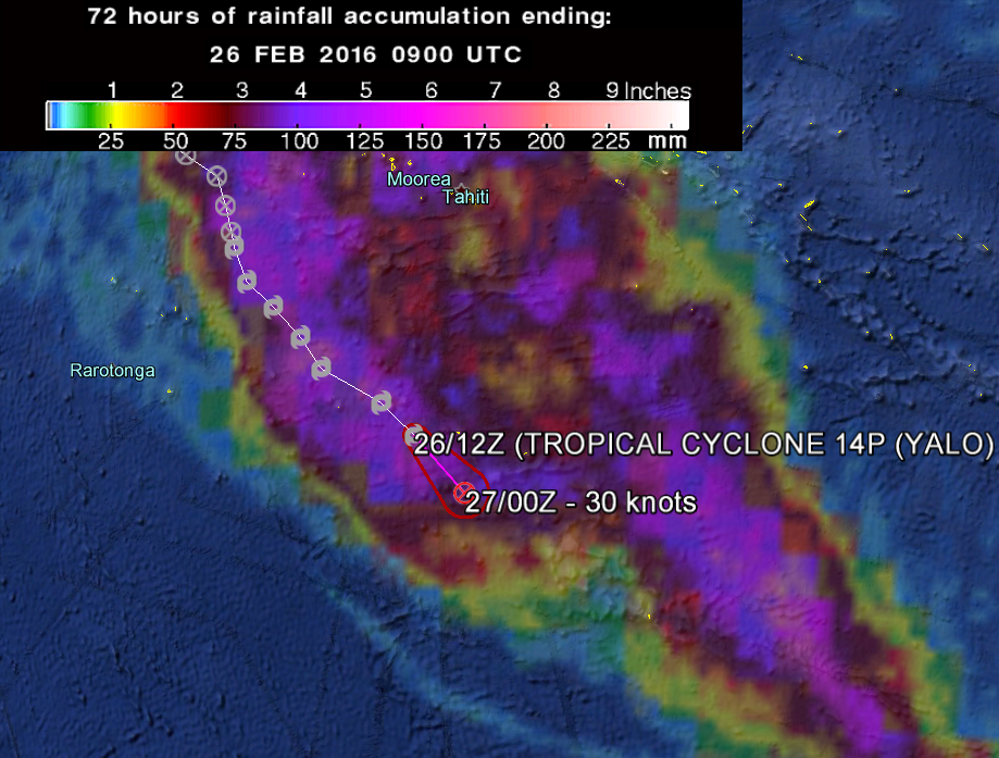
Tropical Cyclone "Yalo" moving track and 72-hour rainfall accumulation as observed by GPM. Image credit: Google/JTWC/NASA/JAXA GPM
Heavy rainfalls and strong winds have also affected the Austral Islands. The sustained winds between Rimatara and Tubuai reached 110 km/h (68.4 mph). Rainy passages are expected to fade throughout the afternoon of Friday 26.
Commenting rules and guidelines
We value the thoughts and opinions of our readers and welcome healthy discussions on our website. In order to maintain a respectful and positive community, we ask that all commenters follow these rules.