
Tropical Cyclones “11P” and “12P” (Winston and Tatiana) lurking in the waters of southern Pacific
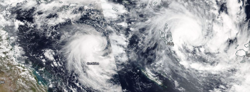
Featured image: Tropical Cyclones "11P" (Winston) and "12P" (Tatiana), February 11, 2016. Image credit: NASA/Suomi NPP/VIIRS
Two tropical cyclones are currently lurking over the warm waters of southern Pacific Ocean. Tropical Cyclone "11P" (Winston) is expected to affect Fiji islands with heavy rainfalls and strong winds while 12P, also known as Tatiana, will most likely remain far enough of the Australian shore throughout its short lifespan, and pose no threat to the mainland.
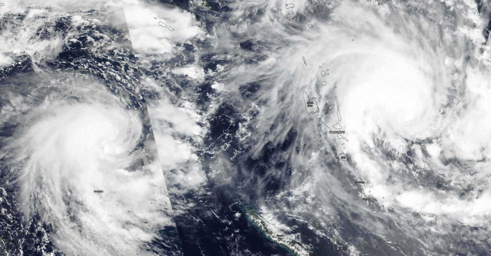
Tropical Cyclones "11P" (Winston) and "12P" (Tatiana), February 11, 2016. Image credit: NASA/Suomi NPP/VIIRS
Tropical Cyclone "11P" (Winston)
The tropical low pressure area previously named System 97P has developed into a category 1 Tropical Cyclone "11P", in Fiji known as Winston, on February 10 (UTC).
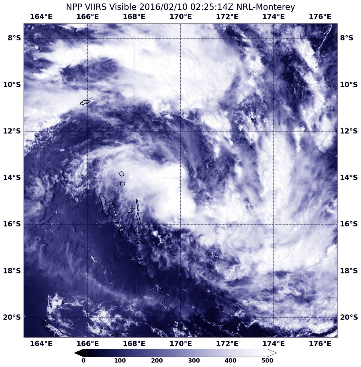
NASA-NOAA's Suomi NPP satellite provided this visible look at Tropical Storm "11P" on February 10, 2016, at 02:25 UTC (9:25 p.m. EST, February 9) just east of Vanuatu. Image credit: NASA/NOAA/Jeff Schmaltz
Tropical Cyclone "11P" was located approximately 820.4 km (509.8 miles) west-northwest of Suva, Fiji and traveling south-southeastward at 7.4 km/h (4.6 mph) on February 11, 2016, at 03:00 UTC, according to the Joint Typhoon Warning Center (JTWC).
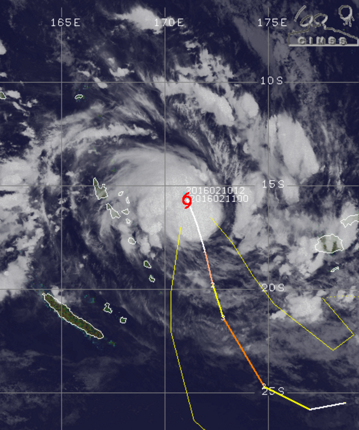
Tropical Cyclone "11P" (Winston), February 11, 2016, 10:30 UTC. Image credit: UW-CIMSS
The system was packing maximum sustained winds of 74 km/h (46 mph) with gusts reaching 92.6 km/h (57.5 mph).
11P is currently situated over warm water with sea surface temperatures of 31 °C (87.8 °F) and has very good radial outflow with vertical wind shear of 37 km/h (23 mph), supporting a significant development over the next few days. JTWC forecasts the cyclone will track poleward over the next 72 hours.
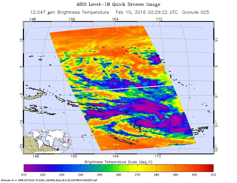
On February 10 at 0229 UTC, AIRS saw strongest storms with cloud top temperatures colder than -53 °C (-63 °F) north, east and south of the center. Image credit: NASA Goddard MODIS Rapid Response Team
Over the next 48 hours the cyclone is expected to strengthen into a category 3 system, with maximum sustained winds of 185.2 km/h (115 mph) and gust speeds climbing up to 231.5 km/h (143.8 mph). At its peak, the cyclone's strength will be equivalent to a category 3 hurricane on the Saffir-Simpson hurricane wind speed scale.
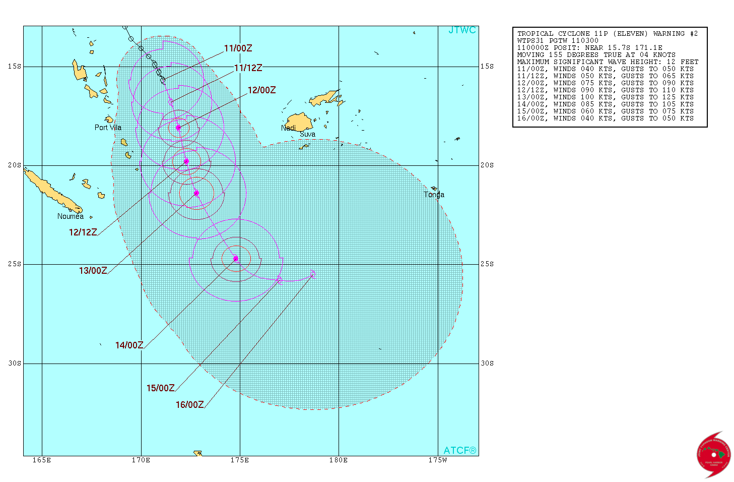
Tropical Cyclone "11P" (Winston) 6-day forecast track. Image credit: JTWC
Fiji Meteorological Service has issued a warning for heavy rainfall and strong winds. Periodically heavy rainfall and squally thunderstorms are expected over Viti Levu, Vanua Levu, Kadavu and the nearby smaller islands, and the Yasawa and Mamanuca group of islands. Localised heavy rain may lead to flash flooding of low lying areas.
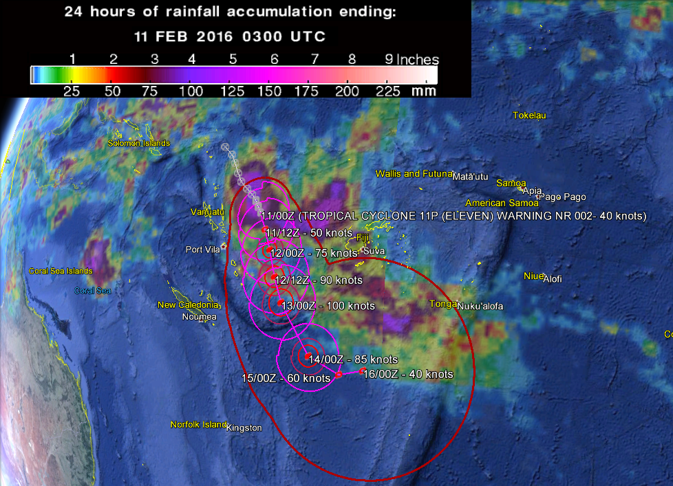
Tropical Cyclone "11P" (Winston) 5-day forecast track and 24-hr accumulated rainfall as observed by the GPM Core Observatory. Image credit: Google/JTWC/NASA/JAXA GPM
All the vessels within a 556 km (345.4 miles) radius of the cyclone's center are requested to send reports to RSMC Nadi-Tropical Cyclone Center every three hours.
Tropical Cyclone "12P" (Tatiana)
A category 1 Tropical Cyclone "12P", in Australia known as Tatiana, developed in the Coral Sea on February 11, 2016 (UTC).
Tropical Cyclone "12P" (Tatiana), February 11, 2016, 10:30 UTC. Image credit: UW-CIMSS
Tatiana was located 1 035.3 km (643.3 miles) west-northwest of Noumea, New Caledonia, and tracking eastward at 9.3 km/h (5.8 mph) on February 11, at 09:00 UTC, according to JTWC. The maximum sustained wind speed was estimated at 83.3 km/h (51.7 mph) with gusts reaching 101.9 km/h (63.3 mph).
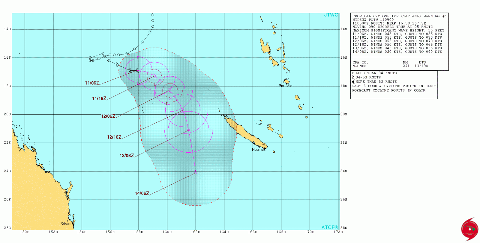
Tropical Cyclone "12P" (Tatiana) 4-day forecast track. Image credit: JTWC
Tropical Cyclone "Tatiana" remains in a region of high sea surface temperatures, combined with relatively low vertical wind shear, allowing for a short intensification over the next 12-24 hours. The system is expected to reach a category 2 status with a peak of 101.9 km/h (63.3 mph) in maximum sustained wind speed and gusts up to 129.6 km/h (80.5 mph).
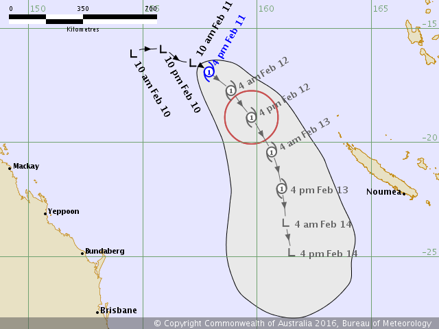
Tropical Cyclone "12P" (Tatiana) 4-day forecast track. Image credit: BOM
Following the short intensification period, the cyclone will begin to rapidly weaken before it becomes completely absorbed within the upper level trough over the next 72 hours.
Australian Bureau of Meteorology (BOM) expects Tatiana will remain far enough from the Queensland coast, and has, therefore, issued no watches or warnings.
Commenting rules and guidelines
We value the thoughts and opinions of our readers and welcome healthy discussions on our website. In order to maintain a respectful and positive community, we ask that all commenters follow these rules.