
Volcanic ash from Mount Raung continues disrupting flights, Indonesia
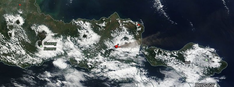
Featured image: Raung volcano on July 8, 2015. Image credit: NASA Terra/MODIS.
Indonesia's Raung volcano has been erupting continuously over the past week, and this has generated a significant ash cloud which will continue to disrupt flights around the islands of Bali and Lombok over the weekend (July 11 – 12, 2015).
Based on notices from the Ujung Padang MWO and PVMBG, satellite images, and pilot observations, the Darwin VAAC reported that during July 1 and 3 – 7 ash plumes from Raung rose to altitudes of 3.7 – 6.1 km a.s.l. (12 000 – 20 000 ft) and drifted 25 – 110 km (15 – 68 miles) E, ESE, and SE.
On July 5, BNPB reported that roaring was heard from continuous explosions and Strombolian activity at Raung. Dense white-and-gray plumes rose as high as 400 m (1 300 feet) and drifted SE.
Mount Raung erupting on July 7, 2015. Video credit: Aris Yanto.
On July 10, Volcano Discovery noted the eruption inside the summit caldera continues with intense Strombolian activity and the effusion of an intra-crater lava flow.
Ash emissions have been intense enough to produce a plume that rose to an altitude of 5 km (17 000 feet) and drifted more than 150 km (93 miles) to the SE.
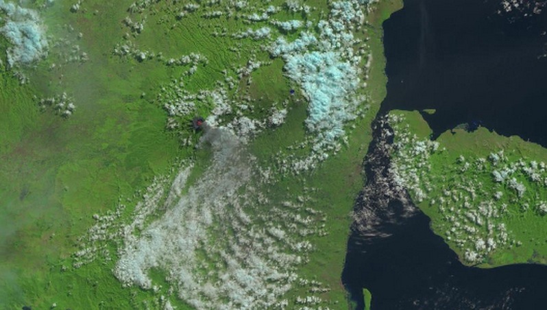
Raung as seen by NASA/USGS Landsat8-OLI on July 11, 2015.
The Alert Level remains at 3 (on a scale of 1-4), and the public is reminded not to approach the crater within a 3-km (1.9 miles) radius.
Geological background
Raung, one of Java's most active volcanoes, is a massive stratovolcano in easternmost Java that was constructed SW of the rim of Ijen caldera. The 3332-m-high, unvegetated summit of Gunung Raung is truncated by a dramatic steep-walled, 2-km-wide caldera that has been the site of frequent historical eruptions.
A prehistoric collapse of Gunung Gadung on the west flank produced a large debris avalanche that traveled 79 km from the volcano, reaching nearly to the Indian Ocean. Raung contains several centers constructed along a NE-SW line, with Gunung Suket and Gunung Gadung stratovolcanoes being located to the NE and west, respectively. (GVP)
I'm a dedicated researcher, journalist, and editor at The Watchers. With over 20 years of experience in the media industry, I specialize in hard science news, focusing on extreme weather, seismic and volcanic activity, space weather, and astronomy, including near-Earth objects and planetary defense strategies. You can reach me at teo /at/ watchers.news.
Commenting rules and guidelines
We value the thoughts and opinions of our readers and welcome healthy discussions on our website. In order to maintain a respectful and positive community, we ask that all commenters follow these rules.