
M4.1 quake hits Napa, California – the strongest since last year’s M6.0
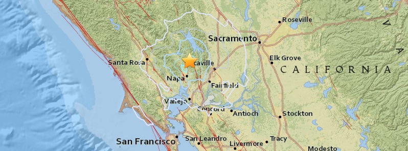
Image credit: USGS
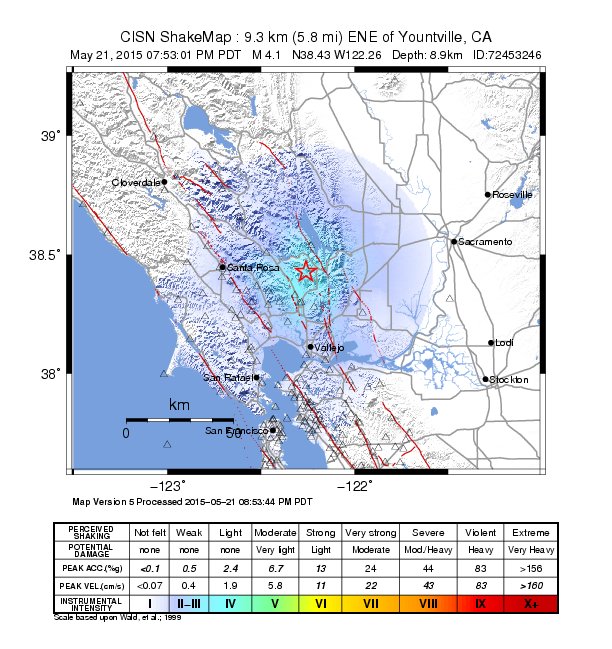
Magnitude 4.1 earthquake was registered by the USGS at a depth of 8.9 km (5.5 miles) in Napa County, California at 02:53 UTC on May 22, 2015. It is the strongest earthquake since August 23, 2014 when the region was hit by strong and shallow M6.0.
Going back a bit further, the M6.0 of 2014 was the strongest to impact the Bay Area since the 1989 M6.9 Loma Prieta earthquake.
The epicenter of today's earthquake was located 9 km (6 miles) ENE of Yountville, 14 km (9 miles) N of Napa, 23 km (14 miles) NE of Sonoma, 25 km (16 miles) WNW of Vacaville and 68 km (42 miles) WSW of Sacramento, California.
There are reports of broken glass but the quake caused no serious damage or injuries. Fire department urges residents to check their homes for gas leaks and other damage.
USGS geophysicist Brad Aagaard told KPIX 5 this quake was "larger than any of the aftershocks that struck Napa ater last summer's quake. The largest aftershock last August was a magnitude 3.0 earthquake."
"This location is not rare or unexpected because it lies along a region of seismicity," Aagaard added.
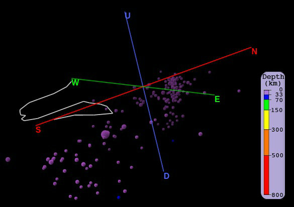
3d model showing last 200 strong earthquakes in this region. Image credit: IRIS.
Overall, the population in this region resides in structures that are highly resistant to earthquake shaking, though some vulnerable structures exist.
Historically, in this region shaking sufficient to seriously damage structures at Mare Island occurred during the M6.8 1868 Hayward Fault earthquake, the M7.8 1906 San Andreas Fault earthquake, and particularly during the M6.3 1898 Mare Island earthquake. The 1898 earthquake may have occurred about 20 km (12 miles) to the northwest on the southern Rodgers Creek Fault.
Even larger nearby events than the 1898 earthquake can be expected in the future.
In addition, the epicentral region of this earthquake is depicted on the USGS National Seismic Hazard Maps to have a high probability of strong shaking in the future.

Quaternary map of the San Francisco Bay Area fault systems. Credit: USGS/California Geological Survey.
2014 M6.0 South Napa earthquake
The M6.0 earthquake which struck in the summer of 2014 caused significant damage in south Napa County. Damage was localized in the region surrounding Napa due to the rupture directivity to the north-west. River valley sediments in Napa Valley likely contributed to the amplification of shaking around Napa.
.jpg)

Image credit: USGS.
GPS receivers operated by the USGS and others also measured a shift of the earth of a few inches caused by the earthquake.

I'm a dedicated researcher, journalist, and editor at The Watchers. With over 20 years of experience in the media industry, I specialize in hard science news, focusing on extreme weather, seismic and volcanic activity, space weather, and astronomy, including near-Earth objects and planetary defense strategies. You can reach me at teo /at/ watchers.news.
Commenting rules and guidelines
We value the thoughts and opinions of our readers and welcome healthy discussions on our website. In order to maintain a respectful and positive community, we ask that all commenters follow these rules.