
Earth from space 2014
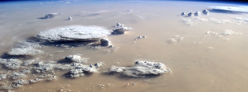
Image credit: TW
Every day of every year, NASA satellites provide useful data about our home planet, and along the way, some beautiful images as well. This video includes satellite images of Earth in 2014 from NASA and its partners as well as photos and a time lapse video from the International Space Station.
A range of data visualizations, model runs, and a conceptual animations that were produced in 2014 (but in some cases might have been utilizing data from earlier years) is also included.
Below is a full list of the images included:
- San Quintín Glacier, Chile. ISERV Pathfinder instrument on the ISS. http://earthobservatory.nasa.gov/IOTD…
- Bazman Volcano, Iran. Astronaut photograph ISS038-E-25895. http://earthobservatory.nasa.gov/IOTD…
- Kavir Desert, Iran. Astronaut photograph ISS038-E-47388. http://earthobservatory.nasa.gov/IOTD…
- Colorado River, Canyonlands National Park. Landsat 8. http://earthobservatory.nasa.gov/IOTD…
- Arrecife Alacranes, Mexico. Landsat 8. http://earthobservatory.nasa.gov/IOTD…
- Aral Sea, 2000 and 2014. Terra MODIS. http://earthobservatory.nasa.gov/IOTD…
- Mount Shasta, California, 2013 and 2014. Landsat 8. http://earthobservatory.nasa.gov/IOTD…
- Aleutian Islands, Alaska, 2013 and 2014. Landsat 8. http://earthobservatory.nasa.gov/IOTD…
- Bermuda. Landsat 8. http://earthobservatory.nasa.gov/IOTD…
- Amazon River. Landsat 5 and Landsat 8, 1985 and 2014. http://earthobservatory.nasa.gov/IOTD…
- Nepal. Aqua MODIS. http://earthobservatory.nasa.gov/IOTD…
- Colorado River. Landsat 8. http://earthobservatory.nasa.gov/IOTD…
- Eastern Mediterranean. Astronaut photograph ISS040-E-74022. http://earthobservatory.nasa.gov/IOTD…
- Upper Peninsula, Michigan. Landsat 8. http://earthobservatory.nasa.gov/IOTD…
- Sangeang Api volcano, Indonesia. http://earthobservatory.nasa.gov/Natu…
- Super Typhoon Vongfong. Terra MODIS. http://earthobservatory.nasa.gov/Natu…
- Namibia. Astronaut photograph ISS040-E-16513. http://earthobservatory.nasa.gov/IOTD…
- Copper River, Alaska. Aqua MODIS. http://earthobservatory.nasa.gov/IOTD…
- South Australia. Aqua MODIS. http://earthobservatory.nasa.gov/Natu…
- Lake Erie. Landsat 8. http://earthobservatory.nasa.gov/Natu…
- Saharan Desert. Astronaut photograph ISS040-E-90343. http://earthobservatory.nasa.gov/IOTD…
- NASA’s Earth Observing Fleet. http://svs.gsfc.nasa.gov/cgi-bin/deta…
- Landsat Orbit Swath. http://svs.gsfc.nasa.gov/cgi-bin/deta…
- Transport of Saharan Dust, conceptual and data visualization. http://svs.gsfc.nasa.gov/cgi-bin/deta…
- Shortwave Albedo. http://ceres.larc.nasa.gov/press_rele…
- Stratospheric Ozone Intrusion. http://svs.gsfc.nasa.gov/cgi-bin/deta…
- Global Precipitation Rates. http://svs.gsfc.nasa.gov/cgi-bin/deta…
- Simulated Atmospheric Carbon Concentrations. http://svs.gsfc.nasa.gov/cgi-bin/deta…
- Soil Moisture. http://svs.gsfc.nasa.gov/cgi-bin/deta…
- Volumetric Precipitation. http://svs.gsfc.nasa.gov/goto?4248
- Landsat 8 Onion Skin. http://svs.gsfc.nasa.gov/cgi-bin/deta…
- Ozone hole. http://svs.gsfc.nasa.gov/cgi-bin/deta…
- CCMP Winds. http://svs.gsfc.nasa.gov/cgi-bin/deta…
- Global Surface Temperature Anomalies. http://svs.gsfc.nasa.gov/cgi-bin/deta…
- Aurora and Moonglow over W. Europe. http://eol.jsc.nasa.gov/ForFun/CrewEa…
Video credit: NASA/Goddard
The Watchers team and our contributors bring the latest on extreme weather, earthquakes, volcanic eruptions, space weather, and all things science. We're all about making sense of the natural world and keeping you informed on what’s happening. Got a tip or a question? Hit us up using the form at newstips!
Commenting rules and guidelines
We value the thoughts and opinions of our readers and welcome healthy discussions on our website. In order to maintain a respectful and positive community, we ask that all commenters follow these rules.