
Typhoon “Maysak” impacts Chuuk, heading toward Yap and Philippines
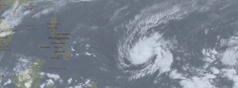
Featured image: Typhoon "Maysak" on March 29, 2015. Image credit: UW-CIMSS
A low-pressure area which formed on March 24, 2015 near the Marshal Islands in Pacific Ocean organized into a tropical storm by March 27 and was named Maysak. The system was tracking westward and rapidly intensified into a typhoon on March 28. This is now the fourth named storm of the very active 2015 Pacific typhoon season.
Typhoon "Maysak" impacted Chuuk State, Federated States of Micronesia on March 29 with wind gusts up to 114 km/h (70 mph) and dropped about 218 mm (8.6 inches) of rain over a 24-hour period.
The system is still intensifying and is heading west toward Yap which is expected to take the full impact of the storm early on March 31 (UTC). By that time, Maysak is expected to reach a Very Strong Typhoon strength (equivalent of Category 4 storm on Saffir-Simpson hurricane scale) with maximum sustained winds of about 222 km/h (138 mph) and gusts to 270 km/h (167 mph).
According to Intermediate Advisory Number 11A issued by NWS Guam at 19:00 UTC today, a Typhoon Warning is in effect for Ulul in Chuuk State and Faraulep in Yap State. Typhoon force winds of 119 km/h (74 mph) or more are expected in the next 24 hours.
A Tropical Storm Warning and a Typhoon Watch are in effect for Puluwat in Chuuk State as well as Satawal and Woleai in Yap State. Damaging winds of 62.7 km/h (39 mph) or more are expected this evening (ChST/March 30). Typhoon force winds of 119 km/h or more are possible if the eye of Maysak deviates southward.
A Typhoon Watch is in effect for Fais… Ulithi and Yap in Yap State. Typhoon force winds of 119 km/h or more are possible in the next 24 hours.
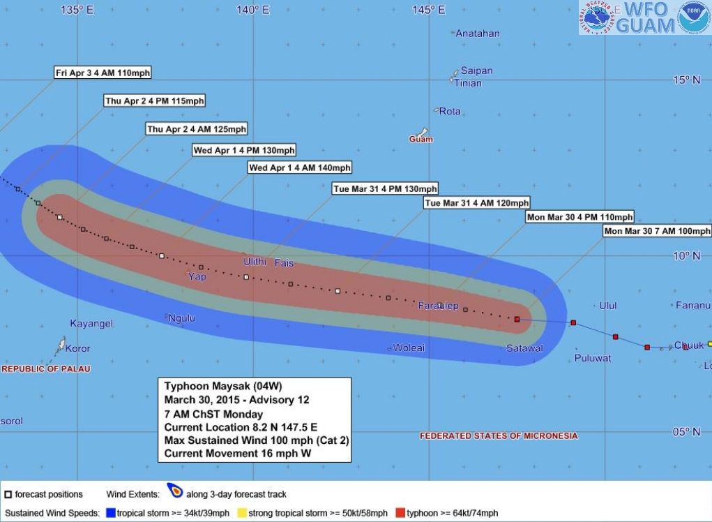
Typhoon "Maysak" – Forecast Track and Wind Distribution Graphic by NWS Guam issued 14:00 UTC on March 29, 2015.
According to JTWC's Tropical Cyclone Warning issued 21:00 UTC today, Maysak was located approximately 1 133 km (703 miles) east of Yap, and has tracked westward at 25.9 km/h (16.1 mph) over the past six hours. Maximum significant wave height at 18:00 UTC today was 9.1 meters (30 feet).
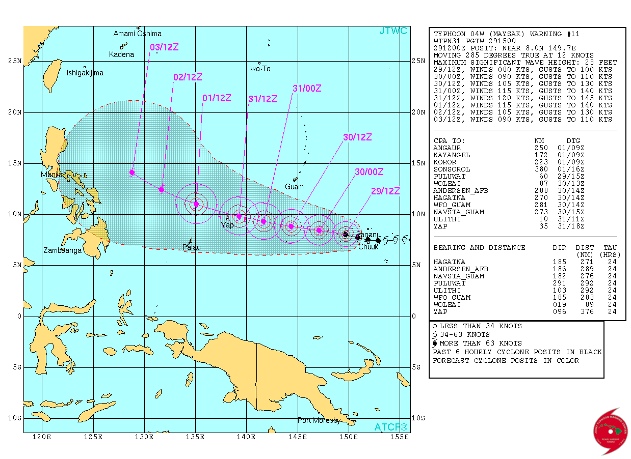
Typhoon "Maysak" forecast track by JTWC on March 29, 2015.
Long range forecasts, made by meteorologist Robert Speta of the WestPacWx, point this storm towards the East Philippine Sea early on Tuesday into Wednesday (March 31 – April 1).
"Having said that, all interests should be between Koror and the Eastern seaboards of the Philippines especially the Bicol region upwards to Eastern Luzon areas through the weekend, possibly into Black Saturday (April 4, 2015). That should be the worse case scenario for the Philippines, but take note things may change gradually as what the JTWC (Unofficial wx agency for the WestPac Basin) have indicated a slowdown in speeds and intensity going into Eastern Luzon. But as of the moment this is how far we can go. We cannot speculate at this point in time where exactly it might hit [Philippines] or how intense it would be felt so just be ready," Speta said.
Video courtesy of the WestPacWX
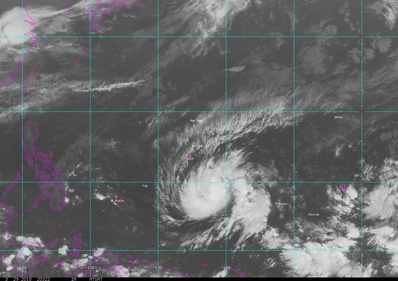
Satellite animations
- Storm-Centered Infrared (MTSAT2; NOAA/SSD)
- Storm-Centered Infrared (Aviation Color Enhancement) (MTSAT2; NOAA/SSD)
- Storm-Centered Water Vapor (MTSAT2; NOAA/SSD)
- Storm-Centered Visible (MTSAT2; NOAA/SSD)
- Storm-Centered Visible (Colorized) (MTSAT2; NOAA/SSD)
- Storm-Centered Infrared (MTSAT2; CIMSS)
- Storm-Centered Enhanced Infrared (MTSAT2; CIMSS)
- Storm-Centered Water Vapor (MTSAT2; CIMSS)
- Storm-Centered Visible (MTSAT2; CIMSS)
- Tropical West Pacific Infrared (MTSAT2; NOAA)
- Tropical West Pacific Enhanced Infrared (MTSAT2; NOAA)
- Tropical West Pacific Water Vapor (MTSAT2; NOAA)
- Tropical West Pacific Visible (MTSAT2; NOAA)
I'm a dedicated researcher, journalist, and editor at The Watchers. With over 20 years of experience in the media industry, I specialize in hard science news, focusing on extreme weather, seismic and volcanic activity, space weather, and astronomy, including near-Earth objects and planetary defense strategies. You can reach me at teo /at/ watchers.news.
everything that was happened we just thank to god for all what he had done and what all his plan, because now we’re all safe from the two super typhoons.