
Severe Tropical Cyclone “Pam” intensifies on its way to Vanuatu
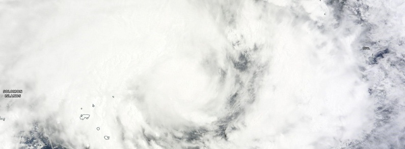
Featured image: Tropical Cyclone "Pam" on March 10, 2015. Image credit: NASA Terra/MODIS
Tropical Cyclone "Pam" formed in the Solomon Islands in the Southern Pacific Ocean early on March 9, 2015 prompting tropical cyclone watch for all of the Solomon Islands.
At 15:00 UTC on March 9, Pam's maximum sustained winds were near 83.3 km/h (51.7 mph). The system was moving to the southeast at 5.5 km/h (3.4 mph). It was centered about 1 408 km (874.6 miles) northwest of Nadi, Fiji.
Global Precipitation Mission's Core Observatory flew over Pam at 05:01 UTC on March 9, 2015. Rainfall from its Microwave Imager showed that Pam was dropping rain at a rate of 133.5 mm (5.26 inches) per hour.
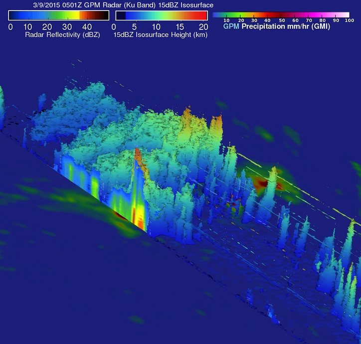
Image credit: NASA/JAXA/SSAI, Hal Pierce
On March 10 today, Pam strengthened to hurricane-force as it neared Vanuatu in the Southern Pacific Ocean.
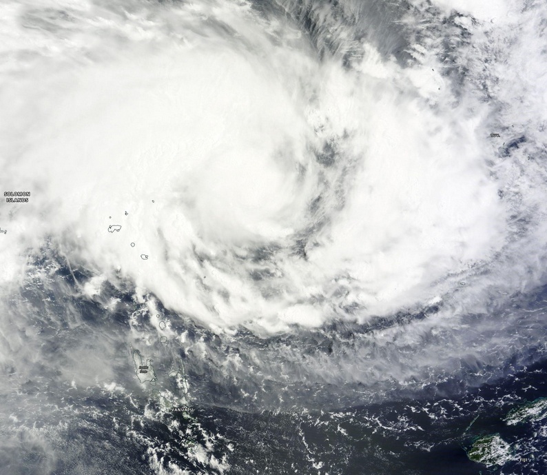
Tropical Cyclone "Pam" on March 10, 2015. Image credit: NASA Terra/MODIS
At 12:00 UTC (23:00 Vanuatu time (VUT)), the Vanuatu Meteorology and Geo-Hazards Department (VMGD) issued a Severe Weather Warning Bulletin for the Northern Islands of Vanuatu. The warning noted that Tropical Cyclone Pam was located northeast of the Torba province, and was slowly moving in a south southeasterly direction.
The VMGD forecast noted: Heavy rainfall is expected to affect Torba, Sanma and Penama. Flash floods and expansion of river banks are possible. People in these affected areas are advised to take extra precautions, especially those areas close to river banks and in low lying areas.
The Fiji Meteorological Service has forecast Cyclone Pam to intensify into a category 3 system in the next 24 to 36 hours.
Their authorities have begun making preparations for the impending cyclone and resulting rains and floods. Fiji Disaster Management Office said it expected most residents to be prepared after having been through the devastation caused by Cyclone Evan in December 2012.
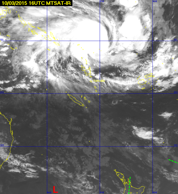
Tropical Cyclone "Pam" on March 10, 2015 at 16:00 UTC. Image credit: MTSAT
By 15:00 UTC on March 10, Pam's maximum sustained winds had increased to 148.2 km/h (80 knots). Pam was centered about 651 nautical miles 1 206 km (749.7 miles) northwest of Suva, Fiji. Pam has tracked south-southwestward at 7.4 km/h (4.6 mph).
Tropical Cyclone "Pam" forecast track. Image credit: RSMC Nadi, Fiji.
JTWC predicts that Pam will be increasingly powerful and become a dangerous category five tropical cyclone on the Saffir-Simpson wind scale. The agency expects Pam's winds to strengthen to about 259.3 km/h (161.1 mph) in the next couple of days as it continues in a southerly direction through the Southern Pacific Ocean.
Satellite animations
- Storm-Centered Infrared (Meteosat 7; NOAA/SSD)
- Storm-Centered Infrared (Aviation Color Enhancement) (Meteosat 7; NOAA/SSD)
- Storm-Centered Water Vapor (Meteosat 7; NOAA/SSD)
- Storm-Centered Visible (Meteosat 7; NOAA/SSD)
- Storm-Centered Visible (Colorized) (Meteosat 7; NOAA/SSD)
- Storm-Centered Infrared (Meteosat 7; CIMSS)
- Storm-Centered Enhanced Infrared (Meteosat 7; CIMSS)
- Storm-Centered Water Vapor (Meteosat 7; CIMSS)
- Storm-Centered Visible (Meteosat 7; CIMSS)
- Southwest Pacific Infrared (MTSAT; NOAA)
- Southwest Pacific Enhanced Infrared (MTSAT; NOAA)
- Southwest Pacific Water Vapor (MTSAT; NOAA)
I'm a dedicated researcher, journalist, and editor at The Watchers. With over 20 years of experience in the media industry, I specialize in hard science news, focusing on extreme weather, seismic and volcanic activity, space weather, and astronomy, including near-Earth objects and planetary defense strategies. You can reach me at teo /at/ watchers.news.
Really hope Pam does not hit Port Vila. Trust my wonderful family and mum-in-law Tousil stays safe. Pam looks to be a massive cyclone.