
Northern California awaits heavy rainfall after driest January on record
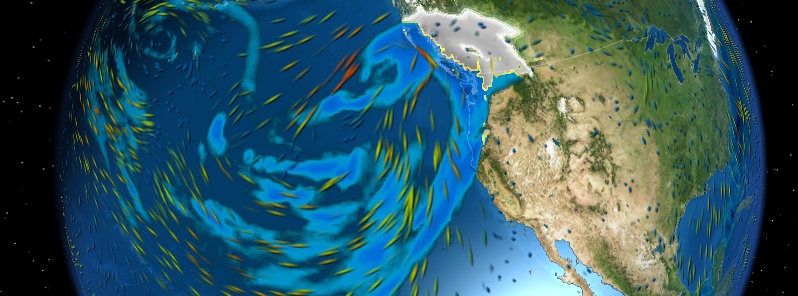
Image credit: MeteoEarth (Data for late Thursday, February 5, 2015)
Northern California is awating heavy rainfall late this week after one of the driest Januaries on record. San Francisco, for instance, received no measurable rain during last month for the first time in its recorded weather history that dates back to the 1850s.
Moderate to heavy rainfall in the Pacific Northwest is expected to begin today. The rain will spread into northern California on Thursday and is expected to continue through the weekend. Some areas could see in excess of 10 inches (254 mm) of rain through early Saturday, NWS said.
This animation of satellite imagery from NOAA's GOES-West satellite from February 1 to 4, 2015 captured the movement of a stream of clouds associated with moisture known as the "Pineapple Express". Meteorologists call this atmospheric river, which a term used to describe a long, narrow plume piping deep moisture from the tropics into the mid-latitudes. In the case of the Pineapple Express, the moisture is coming from the Hawaiian Islands to the US West Coast.
According to Quantitative Precipitation Forecast (QPF) Discussion issued 10:02 UTC today, coastal Pacific Northwest expects the beginning of a prolonged very heavy to excessive precipitation late Wednesday. This atmospheric river event will produce mostly light to moderate totals for the coastal Pacific Northwest during Wednesday, with much heavier totals expected on Thursday and Friday.
The heaviest precipitation on Thursday is expected over northern California, western Oregon and western Washington, particularly for the mountain ranges and The Cascades.
A well-developed surface low is expected to reach British Columbia Thursday afternoon, with a trailing cold front and convergence zone.
Another shortwave and frontal boundary arrives late Thursday, with a renewed surge of moisture and heavy rainfall. A small risk area for excessive rainfall was issued for northwest California.
A pattern for heavy to excessive rainfall continues to be depicted by model guidance for western parts of the Pacific Northwest into northern California during Friday, with models in very good agreement on the idea of several inches of rain over northern California and southwestern Oregon.
A small risk area was included for northern California on Friday given the forecast for 3 to 6 inches of rain over areas that are likely to receive significant rainfall on Thursday.

Landslides, debris flows, sharp rises on streams and rivers, urban flooding and periods of gusty winds are possible.
I'm a dedicated researcher, journalist, and editor at The Watchers. With over 20 years of experience in the media industry, I specialize in hard science news, focusing on extreme weather, seismic and volcanic activity, space weather, and astronomy, including near-Earth objects and planetary defense strategies. You can reach me at teo /at/ watchers.news.
Commenting rules and guidelines
We value the thoughts and opinions of our readers and welcome healthy discussions on our website. In order to maintain a respectful and positive community, we ask that all commenters follow these rules.