
“Nilofar” dissipated over northeast Arabian Sea
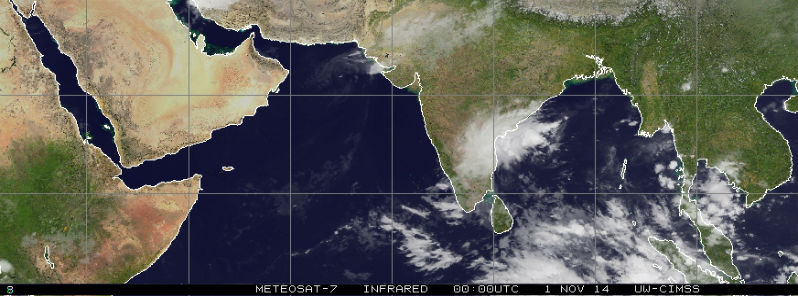
Featured image: METEOSAT-7 IR satellite image taken at 00:00 UTC on November 1, 2014. (Credit: NOAA/UW-CIMSS)
The depression over northeast Arabian Sea moved northeastwards and weakened into a well-marked low pressure area over northeast Arabian Sea early on October 31, 2014. Moderate rainfall, squally winds and moderate to rough sea surge along and off Gujarat coast are expected during next 24 hours. Fishermen along and off Gujarat coast are advised not to venture into the sea during next 24 hours.
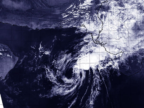
Aqua/MODIS satellite captured this image at 08:45 UTC on October 31, 2014 as the remnants of Cyclone Nilofar were ripped apart by wind shear in the Arabian Sea. (Credit: LANCE Rapid Response/MODIS)
Nilofar completely dissipated by November 1, 2014, before making landfall as organized system.
.jpg)
METEOSAT-7 IR satellite image taken at 00:00 UTC on November 1, 2014. (Credit: NOAA/UW-CIMSS)
.jpg)
Cyclone Nilofar became the third strongest tropical cyclone on record in the Arabian Sea. According to Joint Typhoon Warning Center, Nilofar shortly reached equivalent of a Category 4 hurricane with estimated maximum sustained wind speeds of 210 km/h (130 mph).
Commenting rules and guidelines
We value the thoughts and opinions of our readers and welcome healthy discussions on our website. In order to maintain a respectful and positive community, we ask that all commenters follow these rules.