
Tropical Storm “Iselle” hits Hawaii, brings heavy rain and strong winds
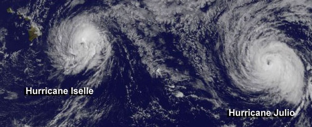
Image credit: NASA / NOAA GOES Project
Hurricane "Iselle" weakened to a tropical storm while approaching the island of Hawaii on Thursday August 7, 2014. As a tropical storm Iselle still contained some heavy rain showers and strong winds when it hit the big island early Friday, August 8. It downed trees, caused power outages and virtually shut down the state for a day.
There were several road and highway closures and reports of damage to homes and buildings from fallen trees and strong winds, according to the Hawaii County Civil Defense Agency. There are also numerous reports of downed power lines across the island and Hawaii Electric Light has asked residents to conserve power as much as possible until further notice, LATimes reports.
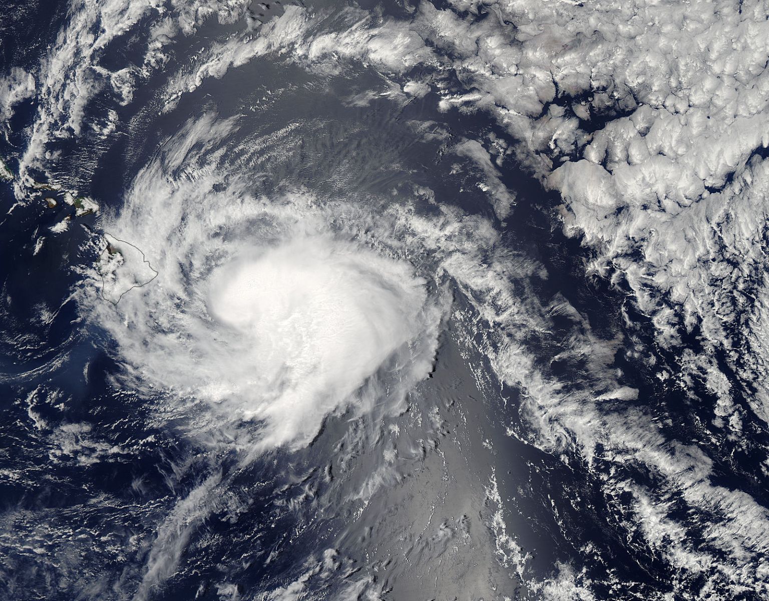
On August 8 at 23:15 UTC, the MODIS instrument aboard NASA's Aqua satellite took this visible image of Hurricane Iselle in the Eastern Pacific Ocean. Image Credit: NASA Goddard MODIS Rapid Response Team
The TRMM satellite had an excellent view of tropical storm Iselle as it neared the Hawaiian islands on August 8, 2014 at 01:52 UTC (August 7 at 3:52 PM HST). A rainfall analysis from TRMM's Microwave Imager (TMI) and Precipitation Radar (PR) instruments is shown overlaid on a 02:00 UTC GOES-WEST image.
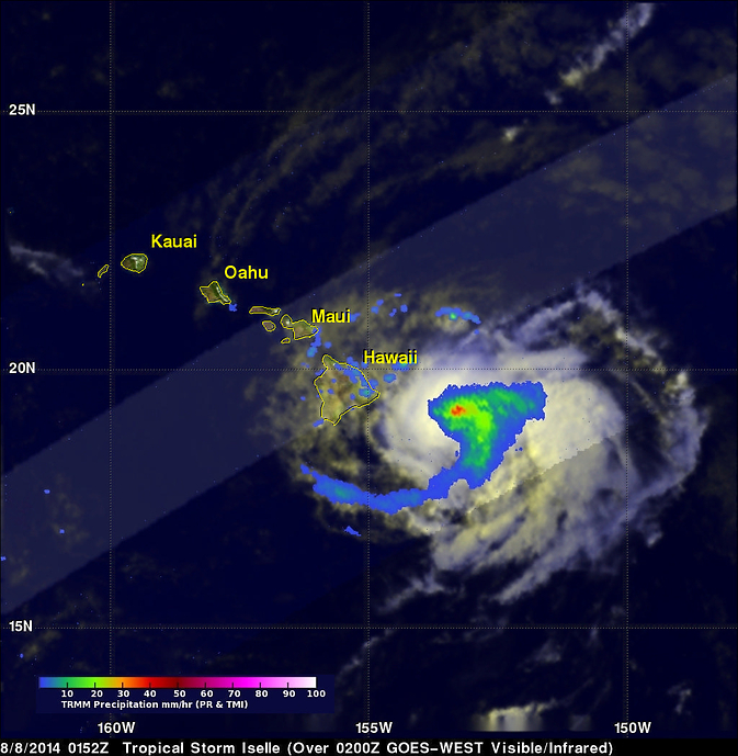
Image credit: SSAI/NASA, Hal Pierce. Acquired 01:52 UTC on August 8, 2014.
TRMM's TMI collected data showing that rain was falling at a rate of over 39 mm (1.5 inches) per hour near Iselle's center.
After crossing the island of Hawaii, Iselle is predicted to continue weakening as its center of circulation passes to the south of the other Hawaiian Islands.
Hurricane "Julio", following Iselle, also lost its strength and is expected to pass north of Hawaii on August 10, 2014, as Category 1 hurricane.
At 18:00 UTC today, Julio's maximum sustained winds were 90 knots (103 mph/166 km/h) – Category 2 hurricane, wind gusts were 110 knots (126 mph/2013 km/h).
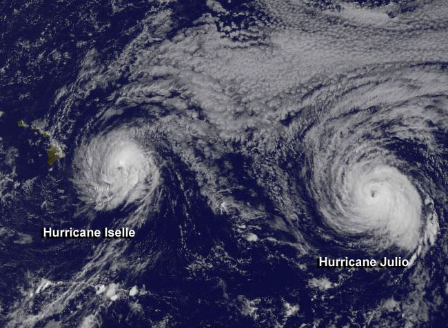
This GOES-West satellite image from August 7 at 1800 UTC (2 p.m. EDT) shows Hurricane Iselle approaching Hawaii and Hurricane Julio behind to the east. Image Credit: NASA/NOAA GOES Project
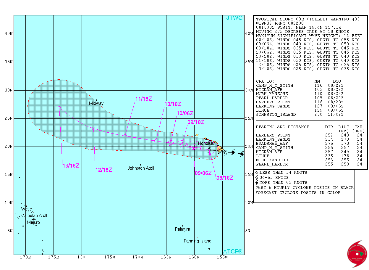
Tropical Storm "Iselle" forecast track on August 8, 2014. Image credit: JTWC
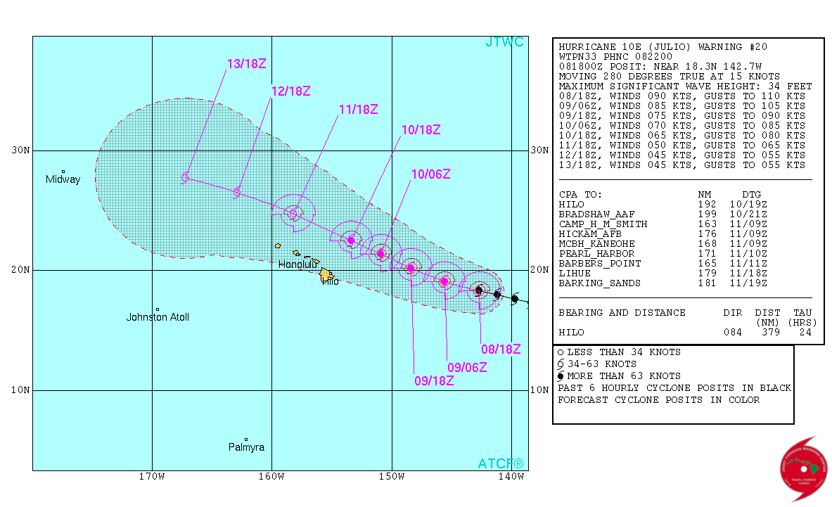
Tropical Storm "Julio" forecast track on August 8, 2014. Image credit: JTWC
I'm a dedicated researcher, journalist, and editor at The Watchers. With over 20 years of experience in the media industry, I specialize in hard science news, focusing on extreme weather, seismic and volcanic activity, space weather, and astronomy, including near-Earth objects and planetary defense strategies. You can reach me at teo /at/ watchers.news.
Commenting rules and guidelines
We value the thoughts and opinions of our readers and welcome healthy discussions on our website. In order to maintain a respectful and positive community, we ask that all commenters follow these rules.