
Seismic activity and ground deformation surge at Kīlauea’s summit, Hawaii
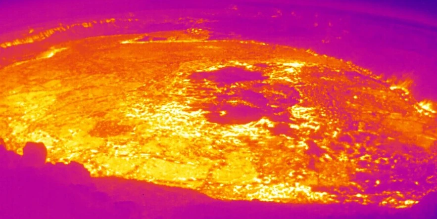
Featured image: Panorama of Halemaʻumaʻu - thermal image from the west rim of the summit caldera, looking east. Credit: USGS/HVO
Increased earthquake activity and signs of magma movement beneath Kīlauea’s summit, detected on January 31, 2024, have prompted the USGS Hawaiian Volcano Observatory to elevate the volcano’s alert level from ADVISORY/YELLOW to WATCH/ORANGE. With over 500 earthquakes recorded since midnight and ground deformation indicating pressurized magma chambers, the risk of an eruption remains high.
In the early morning hours (HST, GMT+10) of January 31, 2024, Kīlauea Volcano exhibited increased seismic activity and inflationary ground deformation, signaling the movement of magma in the subsurface. This prompted the USGS Hawaiian Volcano Observatory (HVO) to raise the volcano’s Alert Level and Aviation Color Code from ADVISORY/YELLOW to WATCH/ORANGE, indicating a heightened possibility of eruption.
The HVO’s latest update, published at 03:55 UTC on February 1, reports that activity beneath Kīlauea’s summit remains “heightened and dynamic.” The increase in seismicity and deformation, initially observed in the south caldera region, has fluctuated throughout the day but continues to signal a pressurized volcanic system. The seismic events, varying between 25 – 40 earthquakes per hour at depths of 1.5 – 3 km (approximately 1 – 2 miles), have formed clusters that migrated across the summit area, indicating shifting magma beneath the surface.
Since January 31, over 500 earthquakes have been located in this region, with magnitudes ranging up to 3.4, contributing to more than 1 400 earthquakes detected since January 27. Despite the increased seismicity, no events have caused damage, though several were felt by nearby communities and triggered rockfalls within the Halemaʻumaʻu crater.
Ground deformation measurements, particularly from tiltmeters at Sand Hill and Uēkahuna bluff, have shown variable directions and rates of tilt, typical of underground movements that could precede an eruption. Approximately 20 microradians of tilt change have been recorded, with step-wise changes often triggered by the seismic activity shaking the instruments.
Current patterns of deformation and seismicity suggest ongoing magma movement beneath the surface, extending from the region south of Halemaʻumaʻu to the area southwest of Kīlauea’s caldera. While activity remains concentrated in the summit region, with no unusual activity detected in the East Rift Zone or Southwest Rift Zone, the HVO warns that periods of increased earthquake activity and deformation rates are likely to continue.
Wind conditions, currently weak and from the south, could carry volcanic gases into areas of Hawaiʻi Volcanoes National Park and surrounding communities if an eruption occurs.
The HVO is closely monitoring the situation, including seismic activity, ground deformation, gas emissions, and webcam imagery, to detect any signs that might precede an eruption, such as accelerated seismic rates or changes in earthquake depths.
Officials at Hawaiʻi Volcanoes National Park are working in tandem with HVO staff to ensure public safety, staying vigilant for any signs of a new lava outbreak or dike propagation that could indicate an imminent eruption.
Kīlauea, located on the eastern flank of the massive Mauna Loa shield volcano on the island of Hawaii, has a rich history recorded in Polynesian legends and documented eruptions since 1820. These eruptions include frequent summit and flank lava flows, interspersed with periods of long-term lava lake activity at the Halemaumau crater within the summit caldera, up until 1924.
The caldera, which measures approximately 3 x 5 km (about 1.86 x 3.11 miles), was formed in several stages around 1 500 years ago and again during the 18th century. Eruptions have also originated from the extensive East and Southwest rift zones, which stretch to the ocean in both directions.
Around 90% of the volcano’s surface is comprised of lava flows that are less than approximately 1 100 years old, with 70% of its surface being younger than 600 years.
A prolonged eruption from the East rift zone, spanning from 1983 to 2018, produced lava flows that covered more than 100 km² (about 38.6 square miles), destroyed hundreds of homes, and contributed to the formation of new coastline. Kīlauea is located within the Hawaiian Islands, designated as a UNESCO World Heritage site.
References:
1 KILAUEA STATUS REPORT – HVO/USGS – 03:55 UTC on February 1, 2024
I'm a dedicated researcher, journalist, and editor at The Watchers. With over 20 years of experience in the media industry, I specialize in hard science news, focusing on extreme weather, seismic and volcanic activity, space weather, and astronomy, including near-Earth objects and planetary defense strategies. You can reach me at teo /at/ watchers.news.
Commenting rules and guidelines
We value the thoughts and opinions of our readers and welcome healthy discussions on our website. In order to maintain a respectful and positive community, we ask that all commenters follow these rules.