
Typhoon Neoguri expected to become super typhoon as it approaches southern Japan
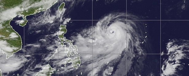
Featured image: Typhoon Neoguri on July 5, 2014 at 10:30 UTC. Image credit: MTSAT / UW CIMSS
Tropical Storm "Neoguri" which formed in the Northwestern Pacific Ocean on July 3, 2014, strengthened into Category 1 typhoon yesterday and has been rapidly intensifying over the last 24 hours.
By 06:00 UTC on July 5, 2014, Neoguri was Category 4 typhoon with maximum sustained winds of 115 knots (212 km/h, 132 mph), and wind gusts of 140 kt (259 km/h, 161 mph).
It is expected to develop into a super typhoon by the time it reaches Okinawa, Japan, throughout the weekend.
Derek Williams, a meteorologist for the National Weather Service Guam Office, says for the next 24 hours the tropical storm will not be affecting anyone or anything other than ships. However, by the time it reaches 130 degrees east longitude – around the southern islands of Japan – it will most likely have developed into a super typhoon.
“We’re kind of worried for Okinawa,” Williams said for Guampdn.
According to JTWC warning issued 06:00 UTC today, Typhoon Neoguri was located approximately 813 NM (1505 km, 935 miles) souteast of Kadena Air Base, and has tracked west-northwestward at 14 knots (25.9 hm/h, 16 mph) over the past six hours. Maximum significant wave height was 7.6 meters (25 feet).
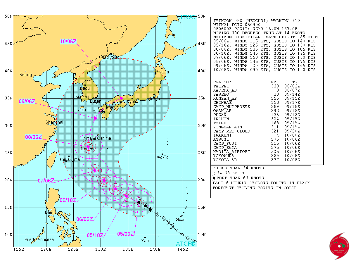
Typhoon Neoguri – forecast track by JTWC on July 5, 2014.
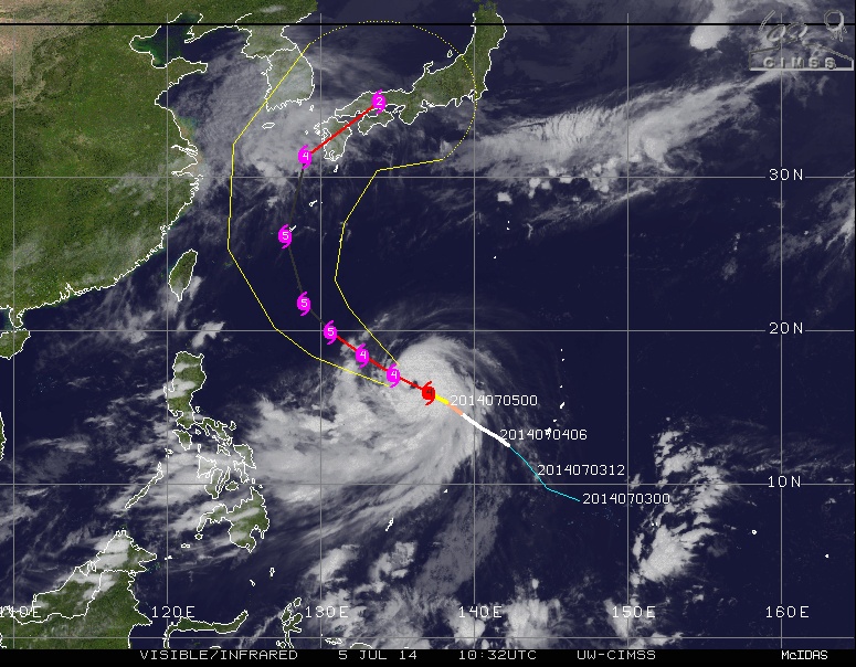
Typhoon Neoguri – forecast track by UW CIMSS (visible/infrared) on July 5, 2014.
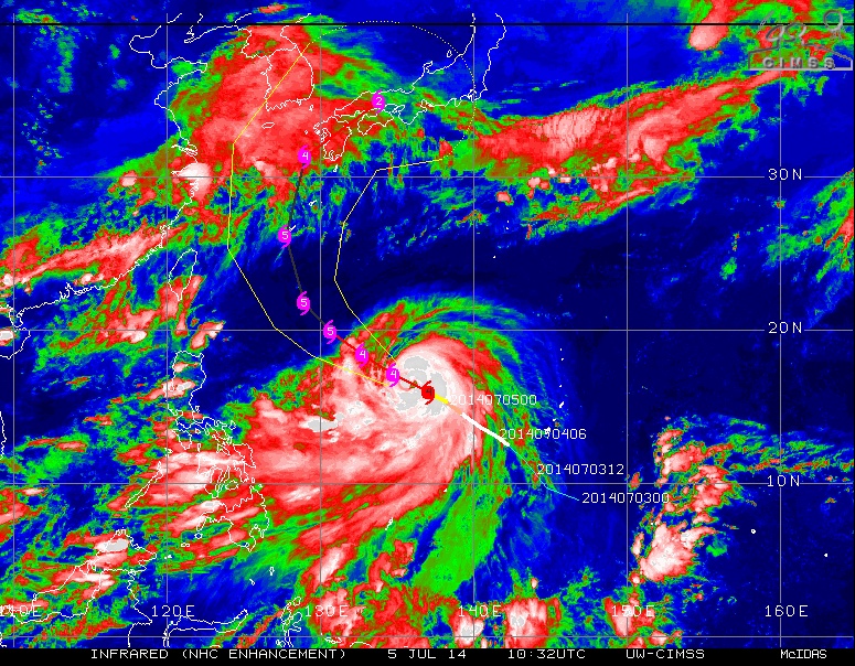
Typhoon Neoguri – forecast track by UW CIMSS (infrared, NHC enhancement) on July 5, 2014.
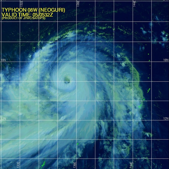
Typhoon Neoguri on July 5, 2014 by JTWC/SATOPS.
Satellite Animations
- Storm-Centered Infrared (MTSAT2; NOAA/SSD)
- Storm-Centered Infrared (Aviation Color Enhancement) (MTSAT2; NOAA/SSD)
- Storm-Centered Water Vapor (MTSAT2; NOAA/SSD)
- Storm-Centered Visible (MTSAT2; NOAA/SSD)
- Storm-Centered Visible (Colorized) (MTSAT2; NOAA/SSD)
- Storm-Centered Infrared (MTSAT2; CIMSS)
- Storm-Centered Enhanced Infrared (MTSAT2; CIMSS)
- Storm-Centered Water Vapor (MTSAT2; CIMSS)
- Storm-Centered Visible (MTSAT2; CIMSS)
- Tropical West Pacific Infrared (MTSAT2; NOAA)
- Tropical West Pacific Enhanced Infrared (MTSAT2; NOAA)
- Tropical West Pacific Water Vapor (MTSAT2; NOAA)
- Tropical West Pacific Visible (MTSAT2; NOAA)
I'm a dedicated researcher, journalist, and editor at The Watchers. With over 20 years of experience in the media industry, I specialize in hard science news, focusing on extreme weather, seismic and volcanic activity, space weather, and astronomy, including near-Earth objects and planetary defense strategies. You can reach me at teo /at/ watchers.news.
Commenting rules and guidelines
We value the thoughts and opinions of our readers and welcome healthy discussions on our website. In order to maintain a respectful and positive community, we ask that all commenters follow these rules.