
Tropical Cyclone Ian impacts Tonga
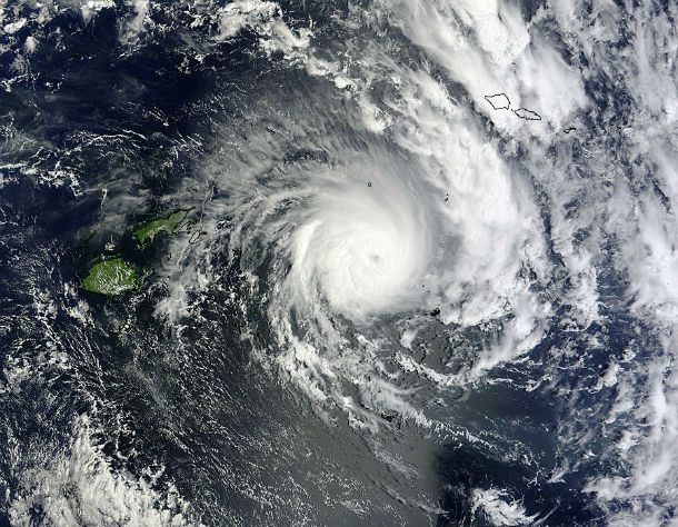
Featured image: Terra/MODIS satellite image taken at 22:10 UTC on January 9, 2013 (Credit: LANCE Rapid Response/MODIS)
Powerful and rare Category 5 tropical cyclone is starting to affect northern Tonga archipelago. Tropical Cyclone Ian is a first cyclone of the South Pacific season, which typically runs from November through April.
The Met Service's tropical warning centre says most of Tonga will feel the storm with a hurricane warning in place for Vava'u and Haapai. Tropical Cyclone Ian may bring damaging gale to destructive storm force winds up to hurricane force winds. Powerful intermittent gusts are forecast to reach 110 knots (203 km/h) with momentary gusts to 155 knots (287 km/h).
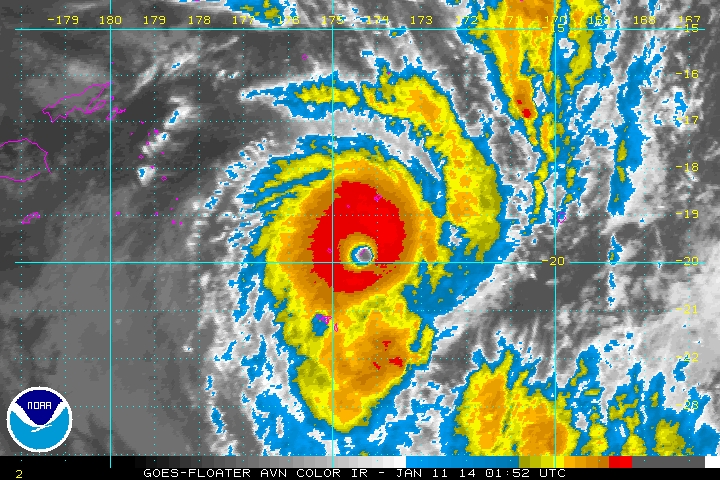
GOES-Floater AVN color IR satellite image of TC Ian at 01:52 UTC on January 11, 2014 (Credit: NOAA/GOES)
According to latest report by Joint Typhoon Warning Center (JTWC), the center of Tropical Cyclone Ian (07P) was located approximately 363 nm southwest of Pago Pago. The system is moving southward at 5 knots (9 km/h) over the past six hours.
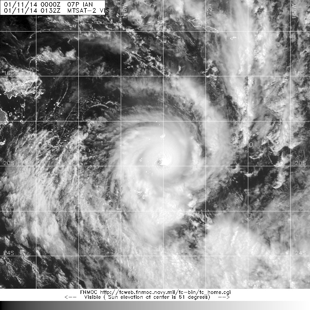
MTSAT-2 visible satellite image taken at 01:32 UTC on January 11, 2014. (Credit: MTSAT/FNMOC)
The favorable upper-level conditions and warm sea surface temperatures will further support an expected peak intensity of 125 knots (232 km/h) within the next 12 hours. A gradual weakening trend is expected thereafter. Tropical Cyclone Ian will begin encountering stronger vertical winds and cooler sea surface temperatures after the next 72 hours, beginning extra-tropical transition.
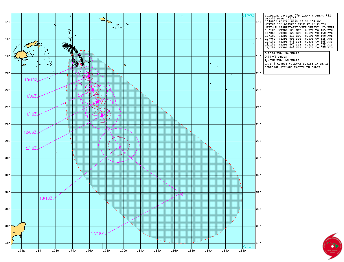
TC Ian forecast track (Credit: JTWC)
Tropical Cyclone Ian has been intensifying over the last several days near the Tonga Islands, in the South Pacific Ocean. By January 9 at 01:55 UTC it had reached hurricane-force when NASA's Aqua satellite flew overhead.
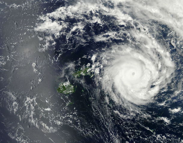
Moderate Resolution Imaging Spectroradiometer (MODIS) on NASA’s Aqua satellite acquired this image at 01:55 UTC on January 9, 2014. The storm had winds of 85 knots (157 kph or 98 mph), making it the equivalent of a category 2 hurricane. (NASA image courtesy Jeff Schmaltz, LANCE/EOSDIS MODIS Rapid Response Team at NASA GSFC. Caption by Holli Riebeek.)
Satellite Animations
- Storm-Centered Infrared (Meteosat 7; NOAA/SSD)
- Storm-Centered Infrared (Aviation Color Enhancement) (Meteosat 7; NOAA/SSD)
- Storm-Centered Water Vapor (Meteosat 7; NOAA/SSD)
- Storm-Centered Visible (Meteosat 7; NOAA/SSD)
- Storm-Centered Visible (Colorized) (Meteosat 7; NOAA/SSD)
- Southeast Pacific Infrared (GOES 11; NOAA)
- Southeast Pacific Enhanced Infrared (GOES 11; NOAA)
- Southeast Pacific Water Vapor (GOES 11; NOAA)
Commenting rules and guidelines
We value the thoughts and opinions of our readers and welcome healthy discussions on our website. In order to maintain a respectful and positive community, we ask that all commenters follow these rules.