
Category 3 Hurricane Raymond impacts western Mexico
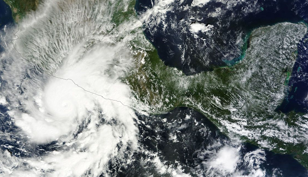
Featured image: Aqua MODIS satellite image of Hurricane Raymond taken at 21:05 UTC on October 21, 2013 (Credit: LANCE Rapid Response/MODIS)
Low pressure System 96E developed quickly over the weekend of October 19 and 20 and by October 21 had grown into Hurricane Raymond. Hurricane Raymond, now a major Category 3 storm, continues to intensify in Eastern Pacific waters, just off the southwest coast of Mexico. Huricane-force winds and storm surge accompanied by large and destructive waves is expected to produce significant coastal flooding. Raymond is expected to produce rainfall amounts of 4 to 8 inches with isolated amounts up to 12 inches over the Mexican states of Guerrero and Michoacan. These rains could produce life- threatening flash floods and mudslides.
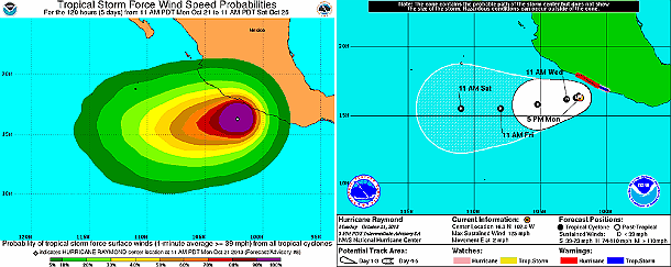
Tropical storm force wind speed probabilities and 5-day forecast track by NHC (Credit: NOAA/NHC)
According to latest public advisory issued by National Hurricane Center (NHC) at 00:00 UTC on October 22, 2013, the eye of Hurricane Raymond was located about 160 km (100 miles) SSW of Zihuatanejo, Mexico and about 235 km (145 miles) WSW of Acapulco, Mexico. Raymond has been moving eastward at 4 km/h (2 mph) during the past few hours. Maximum sustained winds are near 205 km/h (125 mph) with higher gusts. Hurricane force winds extend outward up to 35 km (25 miles) from the center and tropical storm force winds extend outward up to 130 km (80 miles).
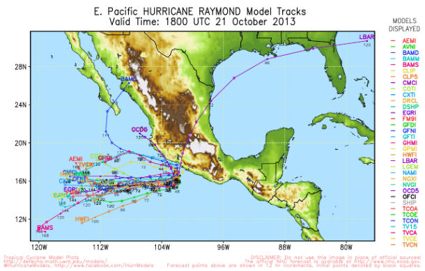
Hurricane Raymond forecast models (Credit: UWM/Spaghetti)
Raymond is not expected to make landfall, but it will bring heavy rain and hurricane-force winds to the Mexican coast near the cities of Manzanillo and Tecoman in the coming days.
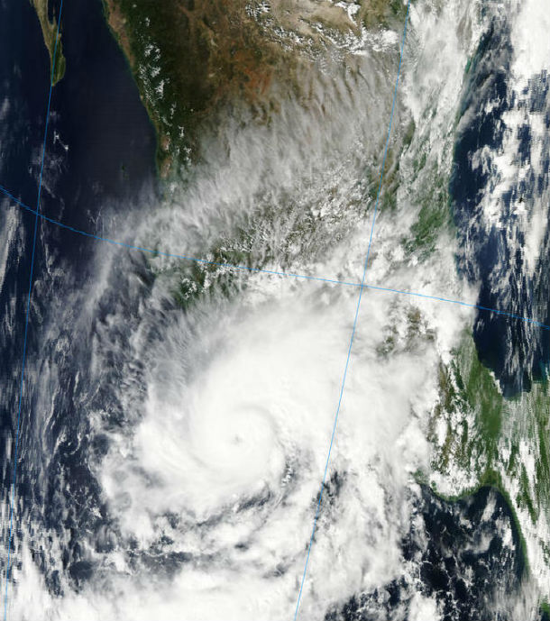
Aqua MODIS satellite image taken at 20:10 UTC on October 21, 2013 (Credit: LANCE Rapid Response/MODIS)
Satellite Animations
- Storm-Centered Infrared (GOES 13; NOAA/SSD)
- Storm-Centered Infrared (Aviation Color Enhancement) (GOES 13; NOAA/SSD)
- Storm-Centered Water Vapor (GOES 13; NOAA/SSD)
- Storm-Centered Visible (GOES 13; NOAA/SSD)
- Storm-Centered Visible (Colorized) (GOES 13; NOAA/SSD)
- Tropical East Pacific Hurricane Sector Infrared (GOES 15; NOAA)
- Tropical East Pacific Hurricane Sector Water Vapor (GOES 15; NOAA)
- Tropical East Pacific Hurricane Sector Visible (GOES 15; NOAA)
Commenting rules and guidelines
We value the thoughts and opinions of our readers and welcome healthy discussions on our website. In order to maintain a respectful and positive community, we ask that all commenters follow these rules.