
Typhoon Lekima aims northern Mariana Islands
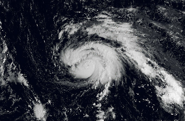
Image credit: NASA/Blue Marble base map
Typhoon Lekima is developing east of Guam and west of Wake Island as the 28th tropical disturbance and the easternmost named tropical system in the 2013 Western Pacific season. Lekima is expected to stay away from major landmasses as it tracks west and then north west. This system will bring heavy rainfall to the northern Mariana islands and the outlying islands of Japan, including Iwo To.
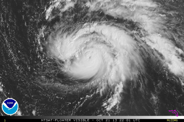
MTSAT visible satellite image of Typhoon Lekima taken at 22:01 UTC on October 21, 2013 (Credit: NOAA/MTSAT)
According to latest report by Joint Typhoon Warning Center (JTWC), the center of Typhoon Lekima is located approximately 827 nm east of Andersen AFB, Guam. The system is moving northwestward at speed of 11 knots (20 km/h, 12,5 mph). Maximum sustained winds are 80 knots (148 km/h, 92 mph) with gusts up to 100 knots (185 km/h, 115 mph).
.gif)
Typhoon Lekima forecast track (Credit: JTWC)
Relatively low vertical wind shear and good equatorward outflow, in addition to the perennially warm sea surface temperatures in the area will ensure gradual intensification. Lekima's maximum sustained winds are expected to peak near 115 knots (213 km/h,132.3 mph) by October 24 as it continues to move over open waters of the Northwestern Pacific. Lekima is forecast to approach Iwo To on October 24, and then turn to the northeast away from the island.
There is a chance that Lekima meets Typhoon Francisco north of Japan and two systems could merge into one large extra-tropical system.
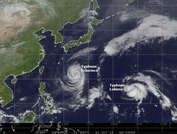
Francisco and Lekima on MTSAT Infrared satellite image taken at 21:30 UTC on October 21, 2013 (Credit: NOAA/UW-CIMSS)
Satellite Animations
- Storm-Centered Infrared (MTSAT2; NOAA/SSD)
- Storm-Centered Infrared (Aviation Color Enhancement) (MTSAT2; NOAA/SSD)
- Storm-Centered Water Vapor (MTSAT2; NOAA/SSD)
- Storm-Centered Visible (MTSAT2; NOAA/SSD)
- Storm-Centered Visible (Colorized) (MTSAT2; NOAA/SSD)
- Tropical West Pacific Infrared (MTSAT2; NOAA)
- Tropical West Pacific Enhanced Infrared (MTSAT2; NOAA)
- Tropical West Pacific Water Vapor (MTSAT2; NOAA)
- Tropical West Pacific Visible (MTSAT2; NOAA)
Commenting rules and guidelines
We value the thoughts and opinions of our readers and welcome healthy discussions on our website. In order to maintain a respectful and positive community, we ask that all commenters follow these rules.