
Mid-June East Coast low-end derecho satellite imagery by GOES-14
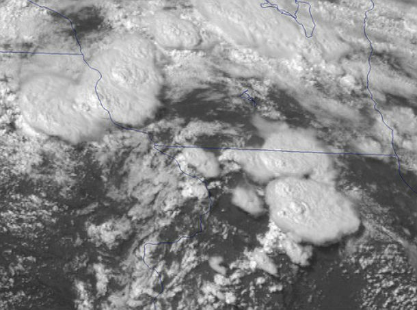
Featured image: GOES-14 0.63 µm visible channel image (Credit: NOAA/CIMSS)
For the past week, forecast models showed unstable conditions that could lead to significant severe weather events. NOAA put the GOES-14 satellite in Super Rapid Scan Operations mode on June 12 and 13, 2013 to monitor the ongoing severe bow echo/low-end derecho event that was moving across the eastern US. The satellite took images every minute in a truncated scan area, resulting in very detailed imagery of the storms developing out of the upper Midwestern U.S.
This movie bellow shows all of the available visible images from 09:20 UTC on June 13, 2013 through 01:29 UTC on June 14, 2013.
According to the SPC storm reports, these storms produced a wide swath of damaging winds (with gusts as high as 78 mph in Virginia), along with some large hail (up to 2.75 inches in diameter in Maryland).
Source: NOAA Visualisations
Commenting rules and guidelines
We value the thoughts and opinions of our readers and welcome healthy discussions on our website. In order to maintain a respectful and positive community, we ask that all commenters follow these rules.