
Active volcanoes in the world: March 13 – March 19, 2013
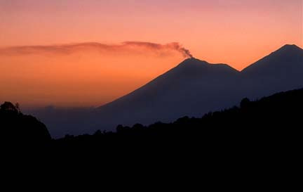
Image credit: Mike Baird - CC BY 2.0
This week, 8 volcanoes were noticed to have new activity, whereas ongoing activity was reported for 13 volcanoes. This report covers active volcanoes in the world recorded from March 13 – March 19, 2013 based on Smithsonian/USGS criteria.
New activity/unrest: | Etna, Sicily (Italy) | Fuego, Guatemala | Karkar, Northeast of New Guinea (SW Pacific) | Pacaya, Guatemala | Reventador, Ecuador | Sabancaya, Perú | Tangkubanparahu, Western Java (Indonesia) | Tungurahua, Ecuador
Ongoing activity: | Batu Tara, Komba Island (Indonesia) | Chirpoi, Kuril Islands (Russia) | Karymsky, Eastern Kamchatka (Russia) | Kilauea, Hawaii (USA) | Kizimen, Eastern Kamchatka (Russia) |Kliuchevskoi, Central Kamchatka (Russia) | Manam, Northeast of New Guinea (SW Pacific) | Paluweh, Lesser Sunda Islands (Indonesia) | Sakura-jima, Kyushu | Santa María, Guatemala | Shiveluch, Central Kamchatka (Russia) | Soufrière Hills, Montserrat | Tolbachik, Central Kamchatka (Russia)
The Weekly Volcanic Activity Report is a cooperative project between the Smithsonian’s Global Volcanism Program and the US Geological Survey’s Volcano Hazards Program. Updated by 2300 UTC every Wednesday, notices of volcanic activity posted on these pages are preliminary and subject to change as events are studied in more detail. This is not a comprehensive list of all of Earth’s volcanoes erupting during the week, but rather a summary of activity at volcanoes that meet criteria discussed in detail in the “Criteria and Disclaimers” section. Carefully reviewed, detailed reports on various volcanoes are published monthly in the Bulletin of the Global Volcanism Network.
New activity/unrest
ETNA, Sicily (Italy)
37.734°N, 15.004°E; summit elev. 3330 m
Sezione di Catania – Osservatorio Etneo reported that Strombolian activity continued at Etna’s Voragine Crater after the 5-6 March paroxysm at the New Southeast Crater (NSEC), but was rarely detected by 14 March. Sometime during the afternoon of 15 March, numerous explosion signals were detected, and the volcanic tremor amplitude increased through the evening. After nightfall, incandescence from the NSEC was visible, and nearby residents (on the SE flank) heard loud bangs coming from the crater. This activity continued during the night and through the following morning. At daybreak on 16 March, numerous gas rings formed by the more powerful explosions were recorded by the monitoring cameras and photographed by observers in the field.
During the early afternoon of 16 March, activity started to intensify more rapidly, and frequent jets of incandescentlava were launched up to150 m above the crater rim. At about 1800 lava started to flow through the deep breach in the SE rim of NSEC. Approximately 15 minutes later, explosions became progressively more energetic, ejecting incandescent bombs onto the outer flanks of the cone; contemporaneously, the quantity of pyroclastic material (ash and lapilli) in the eruptive plume increased. Ash plumes drifted SE.
Between 1830 and 1845, the eruptive activity changed from Strombolian explosions to lava fountaining, with the highest jets rising 600-800 m above the crater rim. The eruption column rose about 2 km above the summit of Etna before it was blown SE by the strong winds. Around 1900, several lightning flashes within the eruptive cloud were observed. Large, incandescent bombs and scoriae were deposited on the entire cone of the NSEC and the adjacent areas to the S and SE. Observations made after the end of the paroxysm revealed that a lava flow was emitted from the area of the saddle between the SEC cones. During the phase of most intense lava fountaining, numerous volcanic bombs fell onto the pyroclastic cones formed during the 2002-2003 eruption, up to 2 km from the NSEC. In this phase, the lava fountains were also spectacularly visible from the town of Randazzo, on the NNE flank, about 15 km from the NSEC.
Heavy tephra fall, mostly in the form of scoriaceous lapilli, affected the SE flank; on the W headwall of the Valle del Bove this material was still incandescent. Further downslope, in the towns of Zafferana Etnea, Santa Venerina, and a number of villages to the N of Acireale, the tephra fallout formed a continuous deposit of scoriaceous lapilli, which in the N portion of Zafferana Etnea locally was up to 10 cm thick. Many clasts in this area had diameters from 5 to 8 cm, and more rarely up to 10 cm. Numerous car windshields, skylights, and roof tiles were broken. Even on the Ionian coast, the deposit consisted largely of lapilli, with only a minor fraction of ash.
The activity started to decrease around 1904, and at 1910 the activity evolved into violent explosions that ejected broad fans of large, incandescent bombs, accompanied by loud bangs and detonations. These explosions ceased at 1920, but at 1927 two particularly powerful explosions ejected large incandescent rock fragments towards the SW at least 1.5 km from the crater. A few weaker Strombolian explosions occurred shortly after 1930. At 0449 on 17 March, a series of explosions started at Voragine, which continued for about 5 minutes, generating strong thermal anomalies that were recorded by the thermal surveillance camera, and probably produced small ash puffs. During the next few hours, weak glow coming from Voragine was recorded by a monitoring camera. There were also small collapses and slides of still hot material from unstable portions on the NSEC cone, which generated minor quantities of ash.
Geologic summary: Mount Etna, towering above Catania, Sicily’s second largest city, has one of the world’s longest documented records of historical volcanism, dating back to 1500 BC. Historical lava flows cover much of the surface of this massive basaltic stratovolcano, the highest and most voluminous in Italy. Two styles of eruptive activity typically occur at Etna. Persistent explosive eruptions, sometimes with minor lava emissions, take place from one or more of the three prominent summit craters, the Central Crater, NE Crater, and SE Crater. Flank eruptions, typically with higher effusion rates, occur less frequently and originate from fissures that open progressively downward from near the summit. A period of more intense intermittent explosive eruptions from Etna’s summit craters began in 1995. The active volcano is monitored by the Instituto Nazionale di Geofisica e Volcanologia (INGV) in Catania.
FUEGO, Guatemala
14.473°N, 90.880°W; summit elev. 3763 m
INSIVUMEH reported that during 13-18 March explosions from Fuego produced ash plumes that rose as high as 4.5 km above the crater, and drifted SW, W, NW, and NE, as far as 12 km. Explosions sometimes ejected incandescent material, generated rumbling noises, and produced shock waves. During 13-14 March ash fell in Panimache I and II (8 km SW) and shock waves vibrated structures. Ash again fell in the Panimache villages as well as in Morelia (9 km SW) during 14-15 March. Avalanches traveled SSW down the Ceniza drainage during 16-19 March.
Geologic summary: Volcán Fuego, one of Central America’s most active volcanoes, is one of three largestratovolcanoes overlooking Guatemala’s former capital, Antigua. The scarp of an older edifice, Meseta, lies between 3,763-m-high Fuego and its twin volcano to the N, Acatenango. Construction of Meseta volcano continued until the late Pleistocene or early Holocene, after which growth of the modern Fuego volcano continued the southward migration of volcanism that began at Acatenango. Frequent vigorous historical eruptions have been recorded at Fuego since the onset of the Spanish era in 1524, and have produced major ashfalls, along with occasional pyroclastic flows and lava flows. The last major explosive eruption from Fuego took place in 1974, producing spectacular pyroclastic flows visible from Antigua.
KARKAR, Northeast of New Guinea (SW Pacific)
4.649°S, 145.964°E; summit elev. 1839 m
Based on analyses of satellite imagery and wind data, the Darwin VAAC reported that on 26 February an ashplume from Karkar rose to an altitude of 8.5 km (28,000 ft) a.s.l. and drifted 75 km N and 130 km E.
Geologic summary: Karkar is a 19 x 25 km wide, forest-covered island that is truncated by two nested summit calderas. The 5.5-km-wide outer caldera was formed during one or more eruptions, the last of which occurred 9000 years ago. The eccentric 3.2-km-wide inner caldera was formed sometime between 1500 and 800 years ago. Parasitic cones are present on the northern and southern flanks of basaltic-to-andesitic Karkar volcano; a linear array of small cones extends from the northern rim of the outer caldera nearly to the coast. Most historical eruptions, which date back to 1643, have originated from Bagiai cone, a pyroclastic cone constructed within the steep-walled, 300-m-deep inner caldera. The floor of the caldera is covered by young, mostly unvegetated andesitic lava flows.
PACAYA, Guatemala
14.381°N, 90.601°W; summit elev. 2552 m
INSIVUMEH reported that during 13-14 and 16-18 March weak gas-and-ash plumes rose from Pacaya and drifted N, NW, and S. A diffuse white plume rose less than 500 m and drifted E on 19 March.
Geologic summary: Eruptions from Pacaya, one of Guatemala’s most active volcanoes, are frequently visible from Guatemala City, the nation’s capital. Pacaya is a complex volcano constructed on the southern rim of the 14 x 16 kmPleistocene Amatitlan caldera. A cluster of dacitic lava domes occupies the caldera floor. The Pacaya massif includes the Cerro Grande lava dome and a younger volcano to the SW. Collapse of Pacaya volcano about 1,100 years ago produced a debris-avalanche deposit that extends 25 km onto the Pacific coastal plain and left an arcuate somma rim inside which the modern Pacaya volcano (MacKenney cone) grew. During the past several decades, activity at Pacaya has consisted of frequent Strombolian eruptions with intermittent lava flow extrusion on the flanks of MacKenney cone, punctuated by occasional larger explosive eruptions.
REVENTADOR, Ecuador
0.077°S, 77.656°W; summit elev. 3562 m
IG reported that the seismic network at Reventador recorded multiple explosions during 12-17 March. Observers reported falling and rolling incandescent material on the S flank on 12 March. Explosions produced ash plumes that rose more than 1 km and drifted SW. The next day ash plumes rose as high as 3 km. On 15 and 17 March explosions were detected by the seismic network; cloud cover prevented visual observations. On 16 March an ash plume rose 1 km and drifted W.
Geologic summary: Reventador is the most frequently active of a chain of Ecuadorian volcanoes in the Cordillera Real, well E of the principal volcanic axis. It is a forested stratovolcano that rises above the remote jungles of the western Amazon basin. A 3-km-wide caldera breached to the E was formed by edifice collapse and is partially filled by a young, unvegetated stratovolcano that rises about 1,300 m above the caldera floor. Reventador has been the source of numerous lava flows as well as explosive eruptions that were visible from Quito in historical time. Frequent lahars in this region of heavy rainfall have constructed a debris plain on the eastern floor of the caldera.
SABANCAYA, Perú
15.78°S, 71.85°W; summit elev. 5967 m
INGEMMET reported that during 24 February-6 March fumarolic emissions from Sabancaya rose 400-1,000 m above the crater. On 27 February scientists who visited the volcano noted no ash deposits, and observed that the fumarolic emissions were comprised mostly of water vapor, carbon dioxide, and sulfur dioxide. During 28 February-5 March there were 400-500 earthquakes per day recorded, mostly volcano-tectonic events. The temperature of La Calera hot spring was unchanged from the previous year. The Alert Level remained at Yellow.
Geologic summary: Sabancaya, located on the saddle between 6288-m-high Ampato and 6025-m-high Hualca Hualca volcanoes, is the youngest of these volcanic centers and the only one to have erupted in historical time. The oldest of the three volcanoes, Nevado Hualca Hualca, is of probable late-Pliocene to early Pleistocene age. Both Nevado Ampato and Nevado Sabancaya are only slightly affected by glacial erosion and consist of a series of lava domes aligned along a NW-SW trend. The name of 5967-m-high Sabancaya (meaning “tongue of fire” in the Quechua Indian language) first appeared in records in 1595 AD, suggesting activity prior to that date. Holoceneactivity has consisted of plinian eruptions followed by emission of voluminous andesitic and dacitic lava flows, which form an extensive apron around the volcano on all sides but the south. Records of historical eruptions of Sabancaya date back to 1750.
TANGKUBANPARAHU, Western Java (Indonesia)
6.77°S, 107.60°E; summit elev. 2084 m
CVGHM reported that phreatic eruptions from Tangkubanparahu’s Ratu Crater occurred on 28 February and during 4-6 March, and generated ash plumes that rose up to 100 m above the crater. Sulfur dioxide emissions increased to a high level on 24 February and then decreased through 3 March. Sulfur dioxide emissions again increased during 5-9 March; CVGHM speculated that the increase was due to an enlargement of the eruptive vent, which had grown to a diameter of 20 m. Gas emissions decreased abruptly on 10 March and emission sounds stopped.
Seismicity had significantly increased on 22 February, marked by a growing number of daily events. A significant decrease was detected on 9 March. Deflation was detected from 24 February through early March, but was then stable during 7-14 March. On 18 March the Alert Level was lowered to 1 (on a scale of 1-4).
Geologic summary: Tangkubanparahu is a broad shield-like stratovolcano overlooking Indonesia’s former capital city of Bandung that was constructed within the 6 x 8 km Pleistocene Sunda caldera. The volcano’s low profile is the subject of legends referring to the mountain of the “upturned boat.” The rim of Sunda caldera forms a prominent ridge on the western side; elsewhere the caldera rim is largely buried by deposits of Tangkubanparahu volcano. The dominantly small phreatic historical eruptions recorded since the 19th century have originated from several nested craters within an elliptical 1 x 1.5 km summit depression. Tangkubanparahu last erupted in September 1983, whenash rose up to 150 m above the rim of Kawah Ratu.
TUNGURAHUA, Ecuador
1.467°S, 78.442°W; summit elev. 5023 m
IG reported that during 13-17 March seismicity at Tungurahua was high. On 13 March ash plumes rose 1-3 km above the crater, and generated ashfall in Choglontús (SW) and Puela (8 km SW). The next day nearly continuous emissions of gas and ash rose 500 m. Explosions produced ash plumes that rose 3 km; ash fell between the Mapayacu (SW) and Rea drainages, and in Choglontús, Cahuají (8 km SW), and El Manzano (8 km SW). Blocks rolled 500 m down the flanks. On 15 March ash plumes drifted SE and W. An explosion generated an ash plume that rose 4 km and drifted E. A pyroclastic flow occurred near the crater. Explosions on 16 March generated ash plumes; ashfall was reported in Puela, Pillate (8 km W), and Ambato (31 km NW). On 17 March explosions again produced ash plumes that rose 4 km. Lava fountains rose 200-300 m above the crater and incandescent material fell on the flanks. A pyroclastic flow descended the upper parts of the Mandur (NW) drainage. Ashfall was reported in El Manzano, Palictagua and Choglontús.
Geologic summary: The steep-sided Tungurahua stratovolcano towers more than 3 km above its northern base. It sits ~140 km S of Quito, Ecuador’s capital city, and is one of Ecuador’s most active volcanoes. Historical eruptions have all originated from the summit crater. They have been accompanied by strong explosions and sometimes bypyroclastic flows and lava flows that reached populated areas at the volcano’s base. The last major eruption took place from 1916 to 1918, although minor activity continued until 1925. The latest eruption began in October 1999 and prompted temporary evacuation of the town of Baños on the N side of the volcano.
Ongoing activity
BATU TARA, Komba Island (Indonesia)
7.792°S, 123.579°E; summit elev. 748 m
Based on analyses of satellite imagery and wind data, the Darwin Volcanic Ash Advisory Centre (VAAC) reported that on 17 March ash plumes from Batu Tara rose to an altitude of 3 km (10,000 ft) a.s.l. and drifted 55-95 km NW. During 18-19 March ash plumes drifted 55-110 km NW and WNW.
Geologic summary: The small isolated island of Batu Tara in the Flores Sea about 50 km north of Lembata (formerly Lomblen) Island contains a scarp on the eastern side similar to the Sciara del Fuoco of Italy’s Stromboli volcano. Vegetation covers the flanks of Batu Tara to within 50 m of the 748-m-high summit. Batu Tara lies north of the main volcanic arc and is noted for its potassic leucite-bearing basanitic and tephritic rocks. The first historicaleruption from Batu Tara, during 1847-52, produced explosions and a lava flow.
CHIRPOI, Kuril Islands (Russia)
46.525°N, 150.875°E; summit elev. 742 m
SVERT reported that a weak thermal anomaly over Snow, a volcano of Chirpoi, was detected in satellite images on 14 March; cloud cover prevented observations of the volcano on other days during 11-18 March.
Geologic summary: Chirpoi, a small island lying between the larger islands of Simushir and Urup, contains a half dozen volcanic edifices constructed within an 8-9 km wide, partially submerged caldera. The southern rim of thecaldera is exposed on nearby Brat Chirpoev Island. Two volcanoes on Chirpoi Island have been historically active. The symmetrical Cherny volcano, which forms the 691 m high point of the island, erupted twice during the 18th and 19th centuries. The youngest volcano, Snow, originated between 1770 and 1810. It is composed almost entirely oflava flows, many of which have reached the sea on the southern coast. No historical eruptions are known from 742-m-high Brat Chirpoev, but its youthful morphology suggests recent strombolian activity.
KARYMSKY, Eastern Kamchatka (Russia)
54.05°N, 159.45°E; summit elev. 1536 m
KVERT reported that weak-to-moderate seismic activity at Karymsky was detected during 8-15 March. Satellite data showed that the volcano was quiet. The Aviation Color Code remained at Orange.
Geologic summary: Karymsky, the most active volcano of Kamchatka’s eastern volcanic zone, is a symmetricalstratovolcano constructed within a 5-km-wide caldera that formed about 7,600-7,700 radiocarbon years ago. Construction of the Karymsky stratovolcano began about 2,000 years later. The latest eruptive period began about 500 years ago, following a 2,300-year quiescence. Much of the cone is mantled by lava flows less than 200 years old. Historical eruptions have been Vulcanian or Vulcanian-Strombolian with moderate explosive activity and occasional lava flows from the summit crater. Most seismicity preceding Karymsky eruptions has originated beneath Akademia Nauk caldera, which is located immediately S of Karymsky volcano and erupted simultaneously with Karymsky in 1996.
KILAUEA, Hawaii (USA)
19.421°N, 155.287°W; summit elev. 1222 m
During 13-19 March HVO reported that the circulating lava lake periodically rose and fell in the deep pit within Kilauea’s Halema’uma’u Crater. The plume from the vent continued to deposit variable amounts of ash, spatter, andPele’s hair onto nearby areas. The lake level was 31 m below the Halema’uma’u crater floor on 14 March.
At Pu’u ‘O’o Crater, glow emanated from four spatter cones on the crater floor. Multiple lava flows from the NE spatter cone, collectively and informally called the Kahauale’a flow, traveled across the NE flank of Pu’u ‘O’o cone to the cone’s base and advanced more than 4 km NE over older flows. A branch also traveled S, just S of Pu’u Kahauale’a. Lava flows were active above the pali (5 km SE of Pu’u ‘O’o), on the pali, and on the coastal plain. Web cameras recorded steam plumes from lava sporadically entering the ocean at multiple locations. A second lava-flow branch was active near the coast and a third branch was active near the base of the pali.
Geologic summary: Kilauea, one of five coalescing volcanoes that comprise the island of Hawaii, is one of the world’s most active volcanoes. Eruptions at Kilauea originate primarily from the summit caldera or along one of the lengthy E and SW rift zones that extend from the caldera to the sea. About 90% of the surface of Kilauea is formed of lava flows less than about 1,100 years old; 70% of the volcano’s surface is younger than 600 years. A long-term eruption from the East rift zone that began in 1983 has produced lava flows covering more than 100 sq km, destroying nearly 200 houses and adding new coastline to the island.
KIZIMEN, Eastern Kamchatka (Russia)
55.130°N, 160.32°E; summit elev. 2376 m
KVERT reported that during 8-15 March moderate seismic activity continued at Kizimen. Video data showed thatlava continued to extrude from the summit, producing summit incandescence, strong gas-and-steam activity, and hot avalanches on the W and E flanks. Satellite images detected a daily thermal anomaly over the volcano. TheAviation Color Code remained at Orange.
Geologic summary: Kizimen is an isolated, conical stratovolcano that is morphologically similar to Mount St. Helens prior to its 1980 eruption. The summit of Kizimen consists of overlapping lava domes, and blocky lava flows descend the flanks of the volcano, which is the westernmost of a volcanic chain north of Kronotsky volcano. The 2,376-m-high Kizimen was formed during four eruptive cycles beginning about 12,000 years ago and lasting 2,000-3,500 years. The largest eruptions took place about 10,000 and 8300-8400 years ago, and three periods of longterm lava-dome growth have occurred. The latest eruptive cycle began about 3,000 years ago with a large explosion and was followed by lava-dome growth lasting intermittently about 1,000 years. An explosive eruption about 1,100 years ago produced a lateral blast and created a 1.0 x 0.7 km wide crater breached to the NE, inside which a small lava dome (the fourth at Kizimen) has grown. A single explosive eruption, during 1927-28, has been recorded in historical time.
KLIUCHEVSKOI, Central Kamchatka (Russia)
56.057°N, 160.638°E; summit elev. 4835 m
KVERT reported that activity at Kliuchevskoi decreased in late 2012, around the same time the Tolbachik eruption started. In mid-January 2013 seismic activity decreased and Strombolian activity ceased. Starting in February incandescence at the summit and thermal anomalies were not observed. Weak seismic activity continued. On 18 March the Aviation Color Code was lowered to Green, the lowest level.
Geologic summary: Kliuchevskoi is Kamchatka’s highest and most active volcano. Since its origin about 7,000 years ago, the beautifully symmetrical, 4,835-m-high basaltic stratovolcano has produced frequent moderate-volume explosive and effusive eruptions without major periods of inactivity. More than 100 flank eruptions, mostly on the NE and SE flanks of the conical volcano between 500 m and 3,600 m elevation, have occurred during the past 3,000 years. The morphology of its 700-m-wide summit crater has been frequently modified by historical eruptions, which have been recorded since the late-17th century. Historical eruptions have originated primarily from the summit crater, but have also included major explosive and effusive events from flank craters.
MANAM, Northeast of New Guinea (SW Pacific)
4.080°S, 145.037°E; summit elev. 1807 m
Based on analysis of satellite imagery, pilot observations, and wind data analyses, the Darwin VAAC reported that on 14 March an ash plume from Manam rose to altitudes of 6.1-7.6 km (20,000-25,000 ft) a.s.l. and drifted 110-150 km ESE
Geologic summary: The 10-km-wide island of Manam, lying 13 km off the northern coast of mainland Papua New Guinea, is one of the country’s most active volcanoes. Four large radial valleys extend from the unvegetated summit of the conical 1807-m-high basaltic-andesitic stratovolcano to its lower flanks. These “avalanche valleys,” regularly spaced 90 degrees apart, channel lava flows and pyroclastic avalanches that have sometimes reached the coast. Two summit craters are present; both are active, although most historical eruptions have originated from the southern crater, concentrating eruptive products during much of the past century into the SE avalanche valley. Frequent historical eruptions, typically of mild-to-moderate scale, have been recorded at Manam since 1616. Occasional larger eruptions have produced pyroclastic flows and lava flows that reached flat-lying coastal areas and entered the sea, sometimes impacting populated areas.
PALUWEH, Lesser Sunda Islands (Indonesia)
8.32°S, 121.708°E; summit elev. 875 m
Based on analyses of satellite imagery and wind data, the Darwin VAAC reported that duirng 13 and 17-19 Marchash plumes from Paluweh rose to altitudes of 2.4 km (7,000-13,000 ft) a.s.l. and drifted 35-95 km E, W, and WNW.
Geologic summary: Paluweh volcano, also known as Rokatenda, forms the 8-km-wide island of Paluweh N of the volcanic arc that cuts across Flores Island. Although the volcano rises about 3,000 m above the sea floor, its summit reaches only 875 m above sea level. The broad irregular summit region contains overlapping craters up to 900 m wide and several lava domes. Several flank vents occur along a NW-trending fissure. The largest historical eruption of Paluweh occurred in 1928, when a strong explosive eruption was accompanied by landslide-induced tsunamis and lava-dome emplacement.
SAKURA-JIMA, Kyushu
31.585°N, 130.657°E; summit elev. 1117 m
JMA reported that 16 explosions from Sakura-jima’s Showa Crater were detected during 11-15 March, ejectingtephra that fell at most 1.8 km from the crater. Crater incandescence was detected at night.
Based on information from JMA, the Tokyo VAAC reported that explosions during 13 and 15-19 March generatedash plumes that rose to altitudes of 1.8-3 km (6,000-10,000 ft) a.s.l. and drifted SE, E, NE, and N. On 15 and 17 March pilots observed ash plumes that rose to altitudes of 1.5-2.4 km (5,000-8,000 ft) a.s.l.
Geologic summary: Sakura-jima, one of Japan’s most active volcanoes, is a post-caldera cone of the Aira calderaat the northern half of Kagoshima Bay. Eruption of the voluminous Ito pyroclastic flow was associated with the formation of the 17 x 23-km-wide Aira caldera about 22,000 years ago. The construction of Sakura-jima began about 13,000 years ago and built an island that was finally joined to the Osumi Peninsula during the major explosive and effusive eruption of 1914. Activity at the Kita-dake summit cone ended about 4,850 years ago, after which eruptions took place at Minami-dake. Frequent historical eruptions, recorded since the 8th century, have depositedash on Kagoshima, one of Kyushu’s largest cities, located across Kagoshima Bay only 8 km from the summit. The largest historical eruption took place during 1471-76.
SANTA MARIA, Guatemala
14.756°N, 91.552°W; summit elev. 3772 m
INSIVUMEH reported that during 13-19 March explosions from Santa María’s Santiaguito lava-dome complex produced ash plumes that rose as high as 4 km and drifted NE, E, S, SW, and W. Avalanches from lava-flow fronts traveled down the flanks, and incandescence in the crater was observed on some nights. Ashfall was reported in El Faro (SW flank) and La Florida (5 km S) during 13-14 March, in Quetzaltenango (18 km WNW) during 17-18 March, and in San Jose on 19 March.
Geologic summary: Symmetrical, forest-covered Santa María volcano is one of a chain of large stratovolcanoesthat rises dramatically above the Pacific coastal plain of Guatemala. The stratovolcano has a sharp-topped, conical profile that is cut on the SW flank by a large, 1-km-wide crater, which formed during a catastrophic eruption in 1902 and extends from just below the summit to the lower flank. The renowned Plinian eruption of 1902 followed a long repose period and devastated much of SW Guatemala. The large dacitic Santiaguito lava-dome complex has been growing at the base of the 1902 crater since 1922. Compound dome growth at Santiaguito has occurred episodically from four westward-younging vents, accompanied by almost continuous minor explosions and periodiclava extrusion, larger explosions, pyroclastic flows, and lahars.
SHIVELUCH, Central Kamchatka (Russia)
56.653°N, 161.360°E; summit elev. 3283 m
Based on visual observations and analyses of satellite data, KVERT reported that during 8-15 March a viscous lavaflow effused on the E flank of Shiveluch’s lava dome, accompanied by hot avalanches, incandescence, andfumarolic activity. Satellite imagery showed a daily thermal anomaly on the lava dome. The Aviation Color Coderemained at Orange.
Geologic summary: The high, isolated massif of Shiveluch volcano (also spelled Sheveluch) rises above the lowlands NNE of the Kliuchevskaya volcano group and forms one of Kamchatka’s largest and most active volcanoes. The currently active Molodoy Shiveluch lava-dome complex was constructed during the Holocene within a large breached caldera formed by collapse of the massive late-Pleistocene Strary Shiveluch volcano. At least 60 large eruptions of Shiveluch have occurred during the Holocene, making it the most vigorous andesitic volcano of the Kuril-Kamchatka arc. Frequent collapses of lava-dome complexes, most recently in 1964, have produced large debris avalanches whose deposits cover much of the floor of the breached caldera. Intermittent explosive eruptions began in the 1990s from a new lava dome that began growing in 1980. The largest historical eruptions from Shiveluch occurred in 1854 and 1964.
SOUFRIERE HILLS, Montserrat
16.72°N, 62.18°W; summit elev. 915 m
MVO reported that during 8-15 March activity at the Soufrière Hills lava dome was at a low level. During a helicopter overflight on 8 March, scientists observed a large fissure in the cliff on the E side of the lava dome, part of which had existed since 2007. This fissure was the result of slow cooling and erosion of the dome. It was parallel to the cliff face and estimated to be 2 m wide, suggesting that a large slab was slowing moving away from the dome. The Hazard Level remained at 2 (on a scale of 1-5).
Geologic summary: The complex dominantly andesitic Soufrière Hills volcano occupies the southern half of the island of Montserrat. The summit area consists primarily of a series of lava domes emplaced along an ESE-trending zone. English’s Crater, a 1-km-wide crater breached widely to the E, was formed during an eruption about 4,000 years ago in which the summit collapsed, producing a large submarine debris avalanche. Block-and-ash flow and surge deposits associated with dome growth predominate in flank deposits at Soufrière Hills. Non-eruptive seismic swarms occurred at 30-year intervals in the 20th century, but with the exception of a 17th-century eruption that produced the Castle Peak lava dome, no historical eruptions were recorded on Montserrat until 1995. Long-term small-to-moderate ash eruptions beginning in that year were later accompanied by lava-dome growth andpyroclastic flows that forced evacuation of the southern half of the island and ultimately destroyed the capital city of Plymouth, causing major social and economic disruption.
TOLBACHIK, Central Kamchatka (Russia)
55.830°N, 160.330°E; summit elev. 3682 m
KVERT reported that the S fissure along the W side of Tolbachinsky Dol, a lava plateau on the SW side of Tolbachik, continued to produce very fluid lava flows during 8-15 March that traveled to the W, S, and E sides of the plateau. Cinder cones continued to grow along the fissure. Gas-and-ash plumes rose to an altitude of 3.5 km (11,500 ft) a.s.l. and drifted in multiple directions. A very large thermal anomaly on the N part of Tolbachinsky Dol was visible daily in satellite imagery. The Aviation Color Code remained at Orange.
Geologic summary: The massive Tolbachik basaltic volcano is located at the southern end of the dominantlyandesitic Kliuchevskaya volcano group. The Tolbachik massif is composed of two overlapping, but morphologically dissimilar volcanoes. The flat-topped Plosky Tolbachik shield volcano with its nested Holocene Hawaiian-typecalderas up to 3 km in diameter is located east of the older and higher sharp-topped Ostry Tolbachik stratovolcano. The summit caldera at Plosky Tolbachik was formed in association with major lava effusion about 6500 years ago and simultaneously with a major southward-directed sector collapse of Ostry Tolbachik volcano. Lengthy rift zones extending NE and SSW of the volcano have erupted voluminous basaltic lava flows during the Holocene, with activity during the past two thousand years being confined to the narrow axial zone of the rifts. The 1975-76 eruption originating from the SSW-flank fissure system and the summit was the largest historical basaltic eruption in Kamchatka.
Source: Global Volcanism Program
Commenting rules and guidelines
We value the thoughts and opinions of our readers and welcome healthy discussions on our website. In order to maintain a respectful and positive community, we ask that all commenters follow these rules.