
Tropical Cyclone Haley about to dissipate in Southern Pacific Ocean
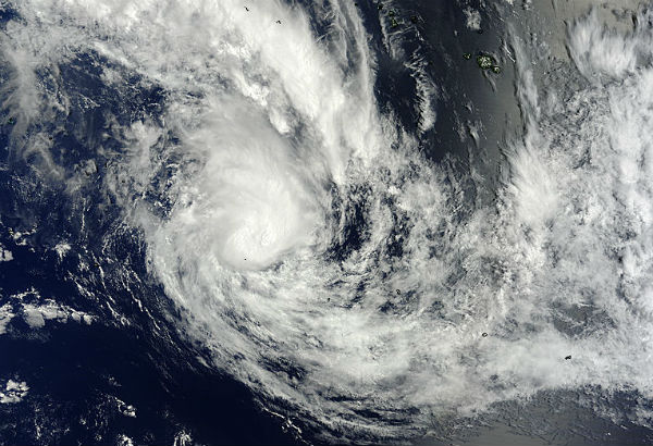
Image credit: TW
Storm system 93P (known in Fiji as 14F) developed in South Pacific Ocean on February 9, 2013. On February 10, 2013 the system developed into Tropical Cyclone Haley, about 325 nautical miles (374 miles/602 km) south-southwest of Bora Bora, Society Islands, French Polynesia, in the open waters of the South Pacific Ocean. Maximum sustained winds strengthened quickly to 45 knots (51.7 mph/83.3 kph).
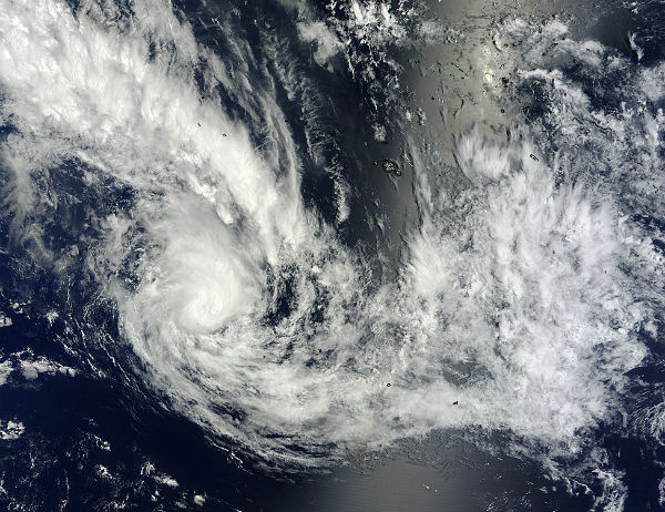 On February 9, 2013 at 20:20 UTC the MODIS instrument aboard NASA’s Terra satellite captured this visible image of Tropical Cyclone Haley (14P) in the South Pacific Ocean. (Credit: NASA Goddard MODIS Rapid Response Team)
Soon after Haley intensified, infrared satellite imagery indicated that convection (rising air that forms thunderstorms that make up the storm) were already weakening around the center and on February 11, 2013 maximum sustained winds had already dropped to 35 knots (40.2 mph/64.8 kph).
The forecasters at the Joint Typhoon Warning Center expect Haley to continue moving southeast as wind shear increases and sea surface temperatures become even cooler. Both of those factors are expected to dissipate Haley by the end of February 12, 2013.
Commenting rules and guidelines
We value the thoughts and opinions of our readers and welcome healthy discussions on our website. In order to maintain a respectful and positive community, we ask that all commenters follow these rules.