
Tropical Cyclone Emang picks up speed
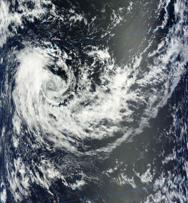
Image credit: TW
According to latest report by Joint Typhoon Warning Center (JTWC), Tropical Cyclone Emang was located approximately 500 nm east- southeast of Diego Garcia, and was moving at speed of 5 knots. Animated infrared (IR) satellite imagery depicts a partially exposed low-level circulation center (LLCC) with a recent flare of convection over the northwest quadrant of the LLCC.
 TC Emang forecast track (Credit: JTWC)
Upper level analysis reveals TC Emang is located within a marginal environment with poor outflow and moderate (10-20 knots) vertical wind shear. The system remains within a weak steering environment but has picked up speed over the last hours tracking westward under the influence of a building subtropical ridge to the south.
TC Emang captured on January 14, 2013 by MODIS/Terra satellite (Credit: LANCE/MODIS)
Emang is expected to move slowly southwestward along the northern periphery of this building subtropical ridge. Emang is expected to intensify slowly to a peak intensity of 65 knots by the next few days under the moderately favorable environmental conditions.
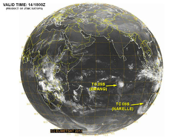 TC Emang and TC Narelle globe view (JTWC/SATOPS)
Satellite Animations
- Storm-Centered Infrared (Meteosat 7; CIMSS)
- Storm-Centered Enhanced Infrared (Meteosat 7; CIMSS)
- Storm-Centered Water Vapor (Meteosat 7; CIMSS)
- Storm-Centered Visible (Meteosat 7; CIMSS)
- Meteosat 7 Infrared (Meteosat 7; CIMSS)
- Meteosat 7 Infrared (Color Background) (Meteosat 7; CIMSS)
- Meteosat 7 Infrared (NHC Color Enhancement) (Meteosat 7; CIMSS)
- Meteosat 7 Water Vapor (Meteosat 7; CIMSS)
- Meteosat 7 Water Vapor (Color Background) (Meteosat 7; CIMSS)
Commenting rules and guidelines
We value the thoughts and opinions of our readers and welcome healthy discussions on our website. In order to maintain a respectful and positive community, we ask that all commenters follow these rules.