
Shelf clouds ahead of derecho in Chicago area
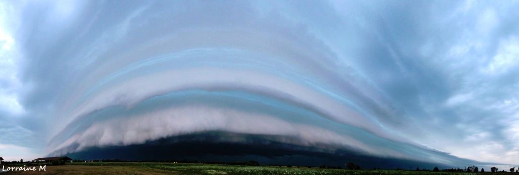
Featured image: A layered shelf cloud making its way into the Chicago area (Credit: Lorraine Mahoney #wntv pic.twitter.com/OpsVEM7N)
Severe storms, called a derecho by meteorologists, moved through Chicago this morning. Ahead of the storm, people sighted a shelf cloud in Illinois.
Shelf clouds often form at the leading edge of a gust front or outflow boundary from a thunderstorm, or strong winds flowing down and outward from a storm. The outer part of a shelf cloud is often smoother with a notable rising motion exhibited by a tiered look. Underneath, a turbulent, unsettled appearance is often the case.
A shelf cloud should be seen as a harbinger of strong winds, in this case it was harbinger of derecho storm. A derecho is a widespread and long-lived wind storm that accompanies rapidly moving showers or thunderstorms.
A sharp, strong gust front will cause the lowest part of the leading edge of a shelf cloud to be ragged and lined with rising fractus clouds. Sometimes vortices can be seen along the edge, with twisting masses of scud that may reach to the ground or be accompanied by rising dust.
Source: AccuWeather
Commenting rules and guidelines
We value the thoughts and opinions of our readers and welcome healthy discussions on our website. In order to maintain a respectful and positive community, we ask that all commenters follow these rules.