
Wallow North and Horseshoe2 fires, Arizona
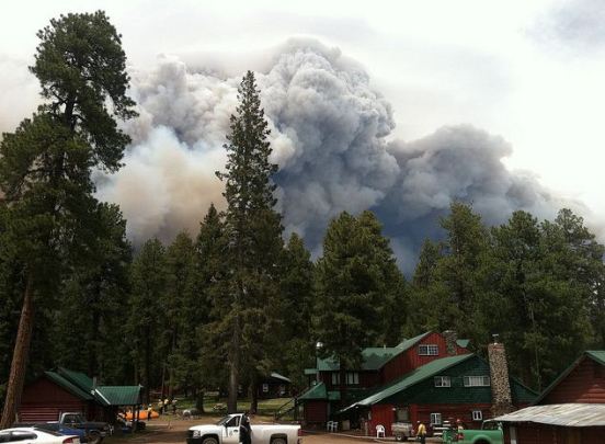
Image credit: TW
By the end of the day on June 9, 2011, Arizona’s massive Wallow Fire had reached 386,690 acres (609 square miles or 157,701 hectares) and had burned 29 and threatened 5,242 homes. Most of the homes destroyed were in Greer.
By the morning of June 12, the size of the fire had increased to about 443,989 acres, according to Wildfire Today. Over 4,300 people were working to contain the fire, which was reported to be only six percent contained at that time.

The Moderate Resolution Imaging Spectroradiometer (MODIS) on the Terra satellite acquired this image of the Wallow Fire on June 9 at 10:55 a.m. local time. Active fire areas are outlined in red. Smoke rises from the most intensely burning areas, but overall, the fire is producing less smoke than in previous days. (MODIS)


Commenting rules and guidelines
We value the thoughts and opinions of our readers and welcome healthy discussions on our website. In order to maintain a respectful and positive community, we ask that all commenters follow these rules.