
Flooding in Quebec and Northeastern U.S.
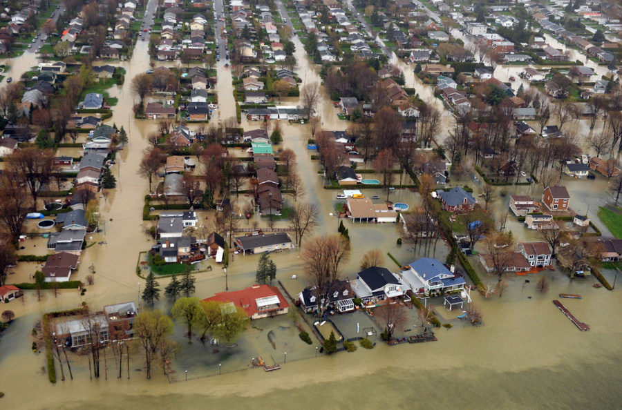
Image credit: TW
Flooding affected areas on either side of the United States-Canada border in late May 2011. Along the Vermont-New York border, Lake Champlain was at major flood stage, according to the Advanced Hydrological Prediction Service (AHPS) of the U.S. National Weather Service. Water levels were also unusually high in Lac St-Pierre, and the St. Lawrence and Richelieu Rivers in Quebec.


The Moderate Resolution Imaging Spectroradiometer (MODIS) on NASA’s Terra satellite acquired the right image on May 30, 2011. For comparison, the left image shows the same region a little over a year earlier, on May 26, 2010. Both images use a combination of infrared and visible light to increase the contrast between water and land. Water is navy blue. Vegetation is green. Bare ground is earth-toned. Clouds are pale blue-green and cast shadows.


Compared to one year earlier, water is visibly higher in Lac St-Pierre, and along parts of the St. Lawrence River to the southwest. The Richelieu River has also widened in 2011, and higher water is apparent in Lake Champlain. The AHPS reported that Lake Champlain reached its highest recorded level at Rouses Point, 103.2 feet (31.5 meters) on May 6, 2011. As of May 31, 2011, the water level was less than a foot down from its historic crest. (EarthObservatory)
Lake Champlain Flood Information (NOAA)

FLOOD STATEMENT

NATIONAL WEATHER SERVICE BURLINGTON VT

1138 AM EDT TUE MAY 31 2011


...THE FLOOD WARNING CONTINUES FOR LAKE CHAMPLAIN...

  AFFECTING THE LAKE CHAMPLAIN SHORELINE COUNTIES IN NEW YORK...

  CLINTON...ESSEX...WASHINGTON AND IN VERMONT...ADDISON...

  CHITTENDEN...FRANKLIN...GRAND ISLE...RUTLAND

PRECAUTIONARY/PREPAREDNESS ACTIONS...


PERSONS WITH INTERESTS IN FLOOD PRONE AREAS ALONG LAKE CHAMPLAIN

SHOULD TAKE ACTION TO PROTECT THEIR PROPERTY.  THE COMBINATION OF

WIND AND WAVE ACTION WILL ENHANCE FLOOD EFFECTS ON WINDWARD FACING

SHORES...AND MAY CAUSE ADDITIONAL DAMAGE TO SHORELINE ROADS AND LOW

LYING AREAS.
THE FLOOD WARNING CONTINUES FOR

  THE LAKE CHAMPLAIN AT ROUSES POINT.

* AT 11:00 AM TUESDAY THE STAGE WAS 102.7 FEET.

* FLOOD STAGE IS 100.0 FEET.

* MAJOR FLOODING IS OCCURRING AND MAJOR FLOODING IS FORECAST.

* FORECAST...LAKE CHAMPLAIN WILL CONTINUE RISING TO NEAR 102.8 FEET

  BY WEDNESDAY EVENING THEN BEGIN FALLING.

* IMPACT...AT 103.0 FEET...THERE WILL BE EXTENSIVE SEVERE SHORELINE

  FLOODING OF HOMES AND LOCAL ROADS. THE FOLLOWING HIGHWAYS IN

  VERMONT WILL FLOOD...ROUTES 2 AND 78 TO GRAND ISLE COUNTY...ROUTE

  129 FROM ALBURGH TO ISLE LAMOTTE...AND ROUTE 36 IN SAINT ALBANS. IN

  PLATTSBURGH NEW YORK...ROUTE 9 WILL FLOOD. WIND AND WAVE ACTION

  WILL CAUSE STRUCTURAL DAMAGE TO FLOODED HOMES AND CAMPS...AND ERODE

  ROADBEDS.

Commenting rules and guidelines
We value the thoughts and opinions of our readers and welcome healthy discussions on our website. In order to maintain a respectful and positive community, we ask that all commenters follow these rules.