
Strong and shallow M6.8 earthquake hits near the coast of Central Sulawesi, tsunami possible, Indonesia
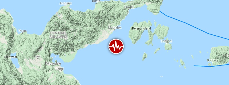
Image credit: Google, TW/SAM
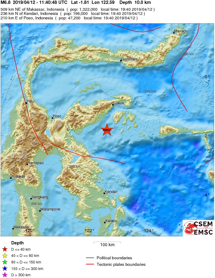
A strong and shallow earthquake registered by the USGS as M6.8 hit near the coast of Sulawesi, Indonesia at 11:40 UTC on April 12, 2019. The agency is reporting a depth of 17.5 km (10.9 miles). EMSC is reporting M6.8 at a depth of M6.8 at a depth of 10 km (6.2 miles).
The epicenter was located 100 km (62 miles) NE of Bungku, 103 km (64 miles) SSW of Luwuk and 207 km (129 miles) ESE of Poso, Central Sulawesi, Indonesia.
There are about 310 000 people living within 100 km (62 miles).
A tsunami is possible, authorities said. Parts of the region have been evacuated.
Gempa 6,9 SR berpusat di 85 km barat daya Banggai Sulteng. BMKG melaporkan gemppa berpotensi di Kab Morowali dengan status Waspada.
Guncangan gempa dirasakan kuat di Kota Palu, Kab Luwu, Morowali dan Banggai. Sebagian warga evakuasi. pic.twitter.com/ByzNqhlOGY
— Sutopo Purwo Nugroho (@Sutopo_PN) April 12, 2019
BMKG telah menyatakan peringatan dini tsunami yang disebabkan oleh gempa magnitudo 6.9 SR pada 12/4/2019 pukul 18:40:49 WIB, telah berakhir. Sebagian warga masih evakuasi ke tempat lebih tinggi. pic.twitter.com/POYtx4H9Zq
— Sutopo Purwo Nugroho (@Sutopo_PN) April 12, 2019
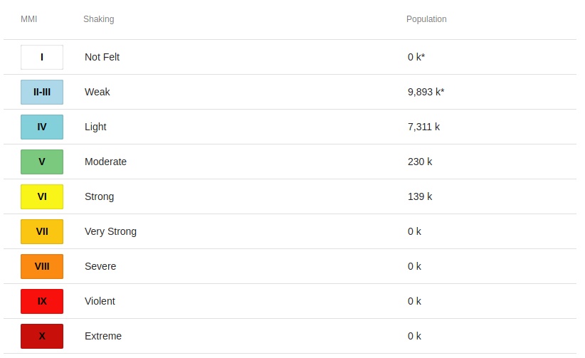
139 000 people are estimated to have felt strong shaking, 230 000 moderate, 7 311 000 light and 9 893 000 weak.
Estimated population exposure to earthquake shaking
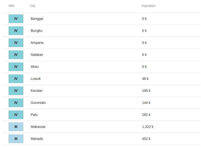
Selected cities exposed
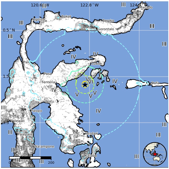
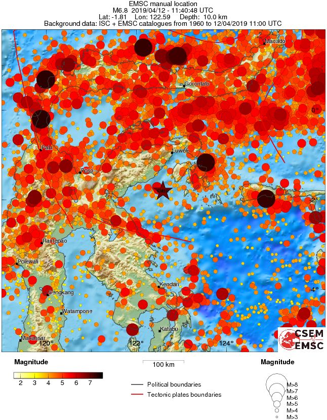
Regional seismicity
The Watchers team and our contributors bring the latest on extreme weather, earthquakes, volcanic eruptions, space weather, and all things science. We're all about making sense of the natural world and keeping you informed on what’s happening. Got a tip or a question? Hit us up using the form at newstips!
Commenting rules and guidelines
We value the thoughts and opinions of our readers and welcome healthy discussions on our website. In order to maintain a respectful and positive community, we ask that all commenters follow these rules.