
Yellowstone lake sediments reveal 15 000 years of hydrothermal and wildfire change
A 15 000-year environmental reconstruction from five lakes in Yellowstone National Park’s Lower Geyser Basin found that hydrothermal input was generally greatest during wetter periods and lowest during dry intervals with reduced snowpack. The sediment record also shows increased wildfire activity during warmer, drier periods, according to a study published in PNAS and summarized by the U.S. Geological Survey’s Yellowstone Volcano Observatory on September 21, 2026.
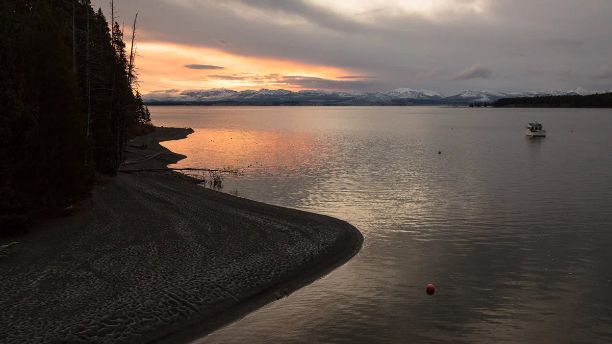
Yellowstone Lake at sunrise. Credit: NPS/Jacob W. Frank
The research, published in the Proceedings of the National Academy of Sciences (PNAS) on August 17, 2026, reconstructs environmental conditions in Yellowstone’s largest thermal area since the end of the last glaciation. Whitlock et al. (2026) examined sediment records from five lakes and compared the findings with independently developed regional paleoclimate simulations to investigate hydrothermal input, wildfire activity, vegetation, and lake conditions.
Arsenic concentrations in the lake sediments provide evidence of changing hydrothermal input after the lakes formed. Hydrothermal contributions were generally greatest during wetter intervals and lowest during dry periods when reduced snowpack supplied less water to the hydrothermal circulation system. The timing and intensity of the reconstructed input varied among individual lake sites.
Water from precipitation and melting snow enters the ground and circulates through Yellowstone’s heated subsurface. Changes in the availability of this water can alter the supply of fluid to hydrothermal features, making moisture availability an important factor in their activity.
Between approximately 12 000 and 6 000 years ago, summer insolation was about 8% greater than pre-industrial conditions. Regional paleoclimate simulations reconstructed July–September temperatures 2.6–2.7°C (4.7–4.9°F) warmer, while effective moisture, defined as precipitation minus evaporation, was 36–54% lower.
July–September vapor-pressure deficit was 29–56% greater than the pre-industrial reference. Vapor-pressure deficit measures the difference between the amount of water vapor present in the air and the amount it can hold at saturation; higher values correspond to greater atmospheric moisture demand. The reconstructed conditions were associated with increased wildfire activity preserved in the lake-sediment charcoal record.
The PNAS study identifies the interval between approximately 12 000 and 4 000 years ago as having the highest wildfire activity in the reconstructed Lower Geyser Basin record. Charcoal particles deposited in lake sediments provide evidence of past fires, allowing researchers to examine variations in fire activity over thousands of years. The interval of highest wildfire activity extended beyond the approximately 12 000–6 000-year period used for the detailed temperature and moisture reconstruction.
The study lakes were shallower and had lower nutrient levels during the warm, dry interval, according to evidence preserved in their sediments. Diatoms, microscopic algae whose remains accumulate on lake floors, provide information about historical water conditions and nutrient availability.
The research combined pollen, charcoal, diatoms and sedimentary arsenic and cesium to reconstruct vegetation, wildfire, aquatic conditions and hydrothermal input. A separate research group independently developed high-resolution regional paleoclimate simulations. The two evidence streams allowed the researchers to compare changes preserved in the lakes with independently reconstructed temperature and moisture conditions.
The simulations and sediment records identify deglaciation as an important influence on the basin’s early environmental history, followed by long-term variations in seasonal solar radiation associated with cyclical changes in Earth’s orbit. The variations contributed to changing summer temperatures, moisture availability and conditions associated with wildfire and hydrothermal input.
Two of the five study lakes probably formed following hydrothermal explosions near the end of the last glaciation, when glaciers were melting across the Yellowstone region. Their subsequent sediment records preserve evidence of changes in the surrounding hydrothermal and terrestrial environments.
Hydrothermal explosions can occur when pressure increases in a confined underground reservoir containing heated water and steam until the surrounding rocks fracture. The expansion ejects material and can create or enlarge a crater. The USGS identifies Pocket Basin in Lower Geyser Basin as an ancient hydrothermal-explosion crater; it is a separate geological example and is not identified here as one of the five study lakes.
The five-lake study does not establish a recurrence interval or provide a forecast of future hydrothermal explosions. Its reconstruction of reduced hydrothermal input during dry intervals must not be interpreted as evidence of reduced magmatic hazard.
The vegetation record shows comparatively little change in the composition and cover of lodgepole pine forests after their establishment between approximately 12 800 and 11 000 years ago, despite the variations recorded in hydrothermal input, wildfire activity and lake conditions.
Pollen evidence indicates that the forests persisted through periods of substantially warmer and drier conditions and varying wildfire activity. The researchers attribute their relative stability partly to the area’s nutrient-poor rhyolitic soils, which constrain vegetation composition.
Vegetation records from other parts of Yellowstone show more substantial changes in forest composition on different underlying rock types, where nutrient and moisture availability is greater.
References:
1 Whitlock, C., Schiller, C. M., Hostetler, S. W., Hurwitz, S., Alt, M., Brown, S. R., Harrison, L. N., Alder, J. R., Busch, K., Shelly, J., & McWethy, D. B. (2026). Postglacial ecosystem development of a hydrothermal landscape in Yellowstone National Park. Proceedings of the National Academy of Sciences, 123(35), e2613422123. https://doi.org/10.1073/pnas.2613422123
2 15,000 years of change in Yellowstone’s Lower Geyser Basin – U.S. Geological Survey – September 21, 2026

I’m a science journalist and researcher at The Watchers, contributing to the Epicenter edition, where I cover peer-reviewed scientific research and emerging discoveries across Earth and space sciences. With a background in astronomy and a passion for environmental science, I’ve worked in shark and coral conservation in Fiji, conducting reef and shark-behavior research, contributing to mangrove restoration, and earning PADI Open Water and Coral Reef Certifications. I bring a blend of scientific rigor and storytelling to illuminate the discoveries shaping our planet and beyond.

North America is rotating CCW and the Yellowstone plume has arrived at the continental divide. There is where the water is reaching the edge of the plume. The plume during pangea was located west of Washington. The plume is primarily under Mt. Borah
See TruPangea
After cooling down for 100 million
Years our earth has for only
13 thousand years started the next
100 million year warming cycle.
We are only beginning to warm.