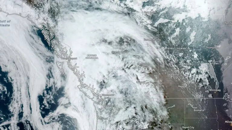
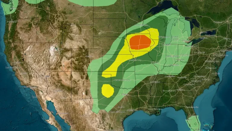
• Major late-season winter storm forecast to bring up to 50 cm (20 inches) of snow and freezing rain to northern Manitoba, Canada

    A major late-season winter storm is forecast to impact northern Manitoba, Canada, beginning Wednesday evening, April 22, 2026, bringing 30–50 cm (12–20 inches) of snow, freezing rain, and strong winds. The system will produce rain or freezing rain across central regions before transitioning to heavy snow through Saturday, creating hazardous travel conditions and increasing the risk of power outages.

  • Record rainfall triggers flooding and evacuations in Wellington, New Zealand, one person missing

    Severe flooding and landslides struck Wellington, New Zealand, between April 20 and 21, 2026, after 77 mm (3 inches) of rain fell in less than 1 hour, prompting evacuations across multiple suburbs and leaving one person missing. A state of emergency remains in place as saturated ground and additional rainfall maintain the risk of further flooding and landslides.

  • Heavy mountain snow and strong winds forecast across Sierra Nevada, California

    Heavy snow and strong winds are forecast to impact the Sierra Nevada, California, from April 21 to April 22, 2026, as a Pacific storm system moves inland, bringing significant snowfall to elevations above 2 100 m (7 000 feet). Authorities warn that travel through major mountain passes could become very difficult to impossible due to snow-covered roads and reduced visibility.

  • State of emergency declared as Red Heavy Rain Warnings take effect in Wellington and Wairarapa, New Zealand

    Red Heavy Rain Warnings were issued for Wellington and Wairarapa on Monday, April 20, 2026, as flooding, swollen rivers, and landslides cut through infrastructure across the region, prompting the declaration of a state of emergency. Further heavy rain is forecast through Tuesday, April 21, with accumulations of up to 150 mm (5.9 inches) expected in the hardest-hit areas.

  • Tornadoes damage homes and infrastructure across multiple Midwest states on April 17

    A severe weather outbreak produced multiple tornadoes across the Midwestern United States on April 17, 2026, resulting in structural damage to residential buildings and infrastructure in several states. Preliminary National Weather Service data indicates more than 20 tornado reports, with impacts concentrated in Wisconsin, Illinois, and Minnesota and extending into Missouri, and at least one reported injury.

  • Tornado Watch issued for parts of Iowa, Illinois, Minnesota, Missouri and Wisconsin

    The Storm Prediction Center issued a Tornado Watch for a multi-state region of the Upper Midwest at 17:40 UTC (12:40 CDT) on April 17, 2026, citing a highly unstable environment ahead of an advancing cold front. Severe storms are expected to develop through the afternoon and evening, with tornadoes, large hail, and strong wind gusts as primary hazards.

  • Strong tornadoes, large hail and damaging winds expected from Plains to Great Lakes on April 17

    A multi-phase severe weather event is expected to impact the central United States on April 17, 2026, from northern Oklahoma to Wisconsin, with an Enhanced Risk of severe storms in place. Initial supercells may produce strong tornadoes and large hail before transitioning into an organized system capable of widespread damaging winds and localized flash flooding.

  • Severe hailstorm damages hundreds of homes in Bắc Hà, Lào Cai Province, Vietnam

    A severe hailstorm struck Bắc Hà Commune, Lào Cai Province, Vietnam, in the early hours of April 16, 2026, damaging 338 homes, injuring four people, and affecting 485.5 ha (1 200 acres) of crops. The storm, which lasted about 20–30 minutes, produced large hail and strong winds that caused structural damage and economic losses exceeding VND 30 billion (USD 1.1–1.2 million).

  • At least 12 killed as floods cut off communities in northwestern Haiti

    Heavy rainfall caused floods, river overflows, and landslides across northwestern Haiti from April 11 to 13, 2026, killing at least 12 people and flooding hundreds of homes. The hardest-hit municipalities were Saint-Louis-du-Nord, Port-de-Paix, and Anse-à-Foleur, where damaged roads and bridges left several communities cut off.