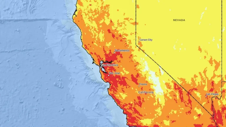
• Bay Area heat wave brings temperatures up to 11°C (20°F) above normal, unhealthy air quality, and Major HeatRisk, California

    A heat wave across the San Francisco Bay Area and Central Coast brought temperatures well above normal on September 9, 2026, with daytime highs and overnight lows forecast 6–11°C (10–20°F) above normal and widespread Moderate to Major HeatRisk across the region. The National Weather Service (NWS) said the heat would persist through September 10, with inland highs reaching approximately 32–41°C (90–105°F), while the Bay Area Air District issued a Spare the Air Alert as ground-level ozone was forecast to reach unhealthy levels in parts of the Bay Area.

  • Driveway collapses into sinkhole at Nicolas Cage’s Malibu home, prompting evacuations, California

    Malibu ordered evacuations along Sea Level Drive after an expanding sinkhole collapsed the driveway of a beachfront home reportedly owned by actor Nicolas Cage and severely constrained emergency access. Seven residences had been red-tagged because of hazardous conditions, while another 24 were to be red-tagged because safe vehicular access had been lost.

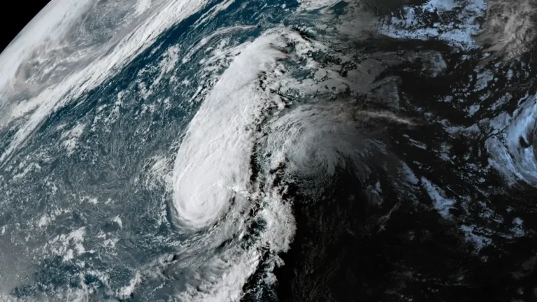
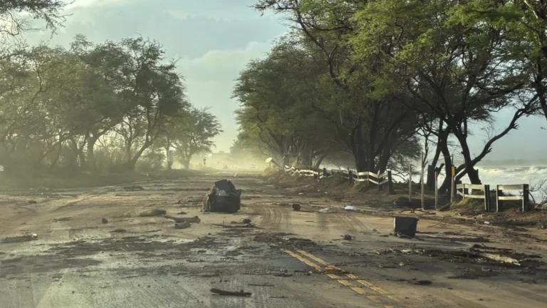
  • 1 dead as Hurricane Lowell passes west of Niʻihau, knocks out power to 90% of Kauaʻi, Hawaii

    One person died on Oʻahu as Hurricane Lowell passed the Hawaiian Islands late on September 7, 2026 (local time), while the storm’s core passed near Niʻihau with maximum sustained winds of 175 km/h (110 mph). Approximately 90% of Kauaʻi Island Utility Cooperative customers were without power the following morning, while numerous roads and Port Allen Small-Boat Harbor sustained severe damage. Preliminary National Weather Service (NWS) observations included a gust of approximately 150 km/h (92 mph) at Puʻu Lua and a 72-hour rainfall total of 536.2 mm (21.11 inches) at Kilohana.

  • Record rainfall floods roads and disrupts rail services in Nagoya, Japan

    Nagoya recorded 104.5 mm (4.1 inches) of rain in one hour on September 8, 2026, setting an all-time station record as flooding disrupted roads and rail services. Nagoya City issued Level 5 Emergency Safety Measures for communities along the Kanare, Yada and Ueda rivers, while the Japan Meteorological Agency and the Ministry of Land, Infrastructure, Transport and Tourism issued a Level 5 flood special warning for the Shonai River system at 18:20 LT (09:20 UTC). The municipal Level 5 measures were downgraded at 22:25 LT (13:25 UTC), while local media reported four injuries across Aichi Prefecture.

  • Five dead as Bihar floods affect more than 3.4 million, Ganga exceeds previous highest levels

    Five people have drowned in flood-affected parts of Patna district as widespread flooding continues across Bihar, where more than 3.4 million people in 13 districts are affected as of September 8, 2026. The Ganga exceeded previous highest flood levels at Gandhi Ghat and Pandarak during the weekend, while the official flood-monitoring system showed the river still above its previous HFL at Sultanganj on September 8.**

  • Extreme Heat Warnings and Heat Advisories issued from the Central Plains to the Southwest U.S.

    Extreme Heat Warnings and Heat Advisories were issued across parts of the central and southern United States, the Southwest and California on September 8, 2026. The National Weather Service (NWS) forecast heat index values up to 44°C (112°F) in parts of Arkansas and Oklahoma and temperatures up to 47°C (116°F) in Death Valley and the Colorado River Valley, with several western alerts continuing through September 11.

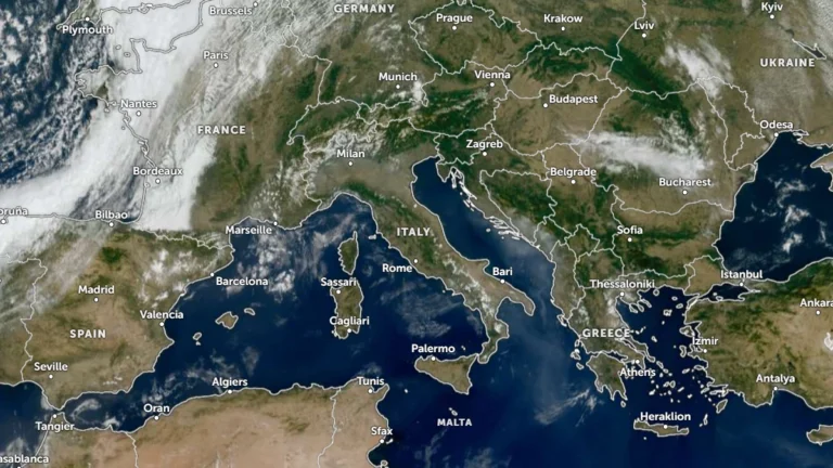
  • Thunderstorms, heavy rainfall and flash flood risk forecast across northern Italy, Slovenia and Croatia, ending late-summer heat

    Widespread thunderstorms and locally heavy rainfall are forecast across northern Italy, Slovenia and Croatia on September 9, 2026, with intense rainfall posing a risk of rapid rises in torrential watercourses and localized flash flooding. A marked temperature drop is also forecast behind the system, bringing substantially cooler conditions to northern Italy and parts of the Alpine and northern Adriatic region after the recent late-summer heat.

  • First-ever Tornado Watch reported for Hawaii as Hurricane Lowell passes west of Niʻihau

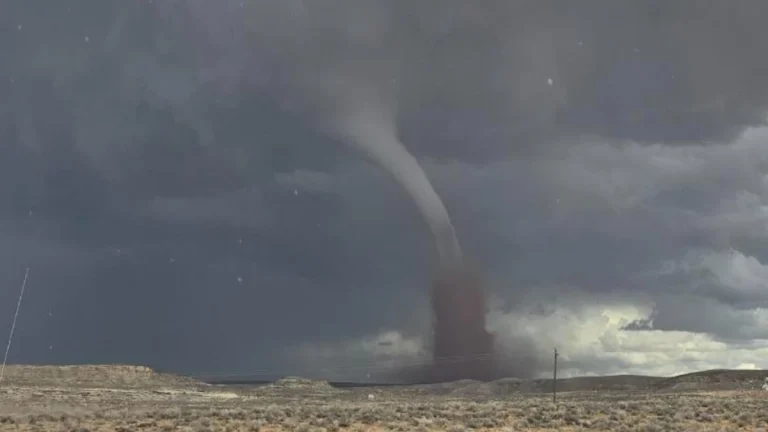
    The National Weather Service (NWS) issued a Tornado Watch 1 for Kauaʻi County, including Kauaʻi and Niʻihau, and adjacent coastal waters at 16:13 HST on September 7, 2026 (02:13 UTC on September 8), as Hurricane Lowell approached the western Hawaiian Islands. The watch, an exceptionally rare issuance for Hawaiʻi, remains in effect until 04:00 HST (14:00 UTC) on September 8, with several tornadoes possible near Kauaʻi and Niʻihau and a few possible elsewhere across the state.

  • Hurricane Lowell approaches Kauaʻi County with destructive winds, flooding, storm surge and tornado threat, Hawaii

    Flooding and transportation disruptions were already affecting Kauaʻi late September 7, 2026, as Hurricane Lowell moved toward the island with maximum sustained winds of 175 km/h (110 mph). The hurricane was about 215 km (135 miles) southwest of Līhuʻe at 20:00 HST (06:00 UTC on September 8), with its core forecast to pass near or just west of Niʻihau overnight.

  • Level 5 Emergency Warnings for landslides issued for Niijima, record rain lashes Oshima and Toshima, Japan

    The Japan Meteorological Agency (JMA) issued Level 5 Emergency Warnings for landslides in Niijima Village, Oshima Town and Toshima Village in Tokyo’s Izu Islands on September 7, 2026, after 24-hour rainfall totals broke records at multiple stations. Niijima recorded 485 mm (19.1 inches), while the main Oshima station received 581.5 mm (22.9 inches), its highest September total on record. Separately, Iwaki City in Fukushima Prefecture issued a citywide Level 4 Evacuation Instruction and listed one death in its final disaster report, according to the Fire and Disaster Management Agency (FDMA).