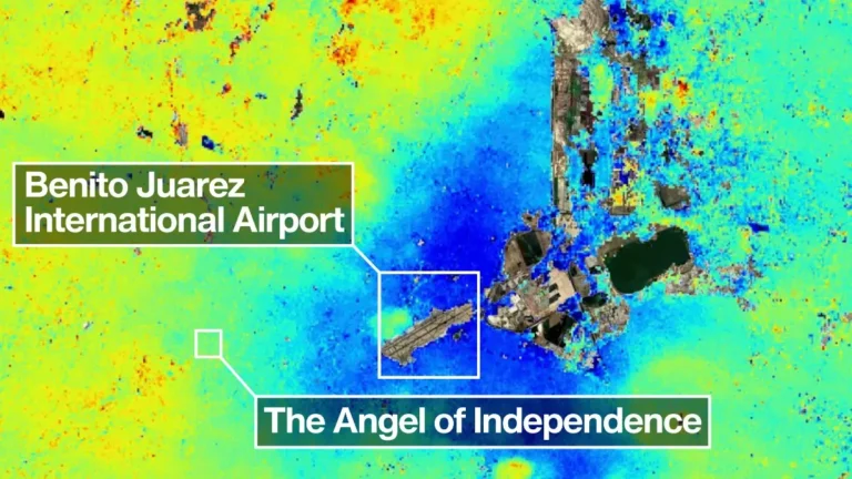
Extreme subsidence in Mexico City exceeds 2 cm (0.8 inches) per month
Preliminary measurements from the NASA-ISRO Synthetic Aperture Radar (NISAR) satellite mapped parts of Mexico City and surrounding areas subsiding by more than 2 cm (0.8 inches) per month between October 25, 2025, and January 17, 2026, NASA’s Jet Propulsion Laboratory (JPL) reported. JPL attributed the deformation in large part to groundwater pumping and long-term compaction of the ancient lakebed beneath the metropolitan area.