
Dust storm causes chain-reaction crashes on U.S. 91 near Cove, Utah
At least seven people were hospitalized after blowing dust reduced visibility and triggered multiple vehicle crashes along U.S. 91 near Cove, Utah, close to the Idaho border, at around 16:00 MDT (22:00 UTC) on May 13, 2026.
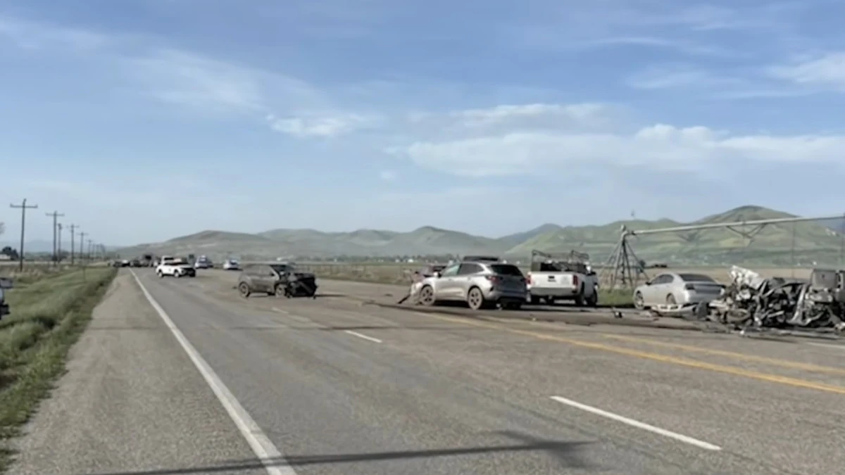
Chain-reaction crash on U.S. 91 near Cove, Utah on May 13, 2026. Credit: Utah Highway Patrol
The largest crash occurred in the northbound lanes near milepost 44 and involved eight vehicles, while a second collision about one block farther north in the southbound lanes involved six vehicles. Utah Highway Patrol Sgt. Jason Kendrick, quoted by local media, said one person suffered critical injuries and six others sustained serious but non-life-threatening injuries.
Authorities closed U.S. 91 in both directions as emergency crews responded to the crashes and cleared damaged vehicles from the roadway. Traffic was rerouted through SR-23 via Cornish during response operations. The highway remained closed for more than four hours before reopening shortly before 20:30 MDT.
The crashes occurred during a regional high-wind event affecting parts of northern Utah and southern Idaho.
The National Weather Service (NWS) office in Salt Lake City said a High Wind Warning would remain in effect through 03:00 MDT on May 14, with gusts exceeding 95 km/h (60 mph) possible in exposed areas, including Park Valley and Curlew Junction.
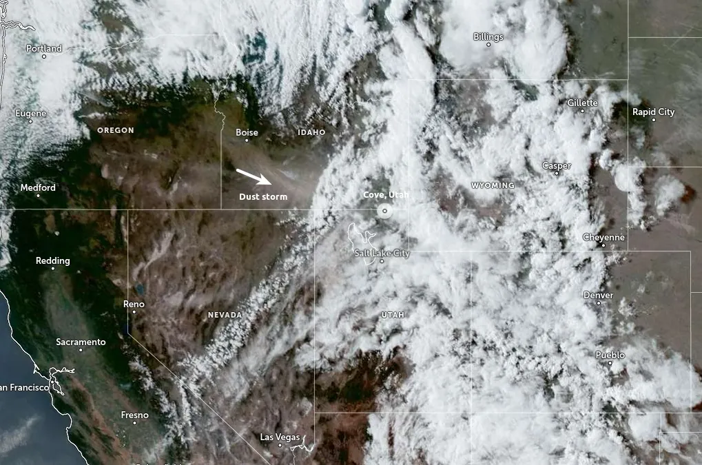
NWS office in Pocatello also warned of severe thunderstorm outflow winds moving through parts of southeastern Idaho during the afternoon. A warning issued at 15:47 MDT said wind gusts up to 115 km/h (70 mph) are possible as storms moved northeast at approximately 95 km/h (60 mph).
Strong winds frequently reduce visibility across exposed transport corridors in northern Utah and southern Idaho during late spring, particularly in agricultural and dry-soil areas affected by frontal systems or thunderstorm outflow boundaries.

References:
1 Major crash along US-91 near Cove shuts down highway – KVNU – May 13, 2026
2 Dust storm creates low visibility, results in eight-vehicle pileup near Utah/Idaho border – 2KUTV – May 13, 2026

Teo Blašković founded The Watchers in 2011 and edited it until 2026, covering seismic and volcanic activity, extreme weather, space weather and near-Earth objects. Articles on this page are his archive.
Published in the last 24 hours
- High Risk of excessive rainfall covers Florida’s Space Coast as St. Johns River near Cocoa reaches 5.67 m
- Four small asteroids will pass close to Earth from November 21 to 23
- Cyclone Akvan weakens after landfall near Gopalpur; more than 300 000 evacuated in Odisha, India
- A broad low over southeastern Florida and the northwestern Bahamas has a 30 percent chance of subtropical or tropical development within 48 hours and a 50 percent chance within 7 days, the National Hurricane Center says
