
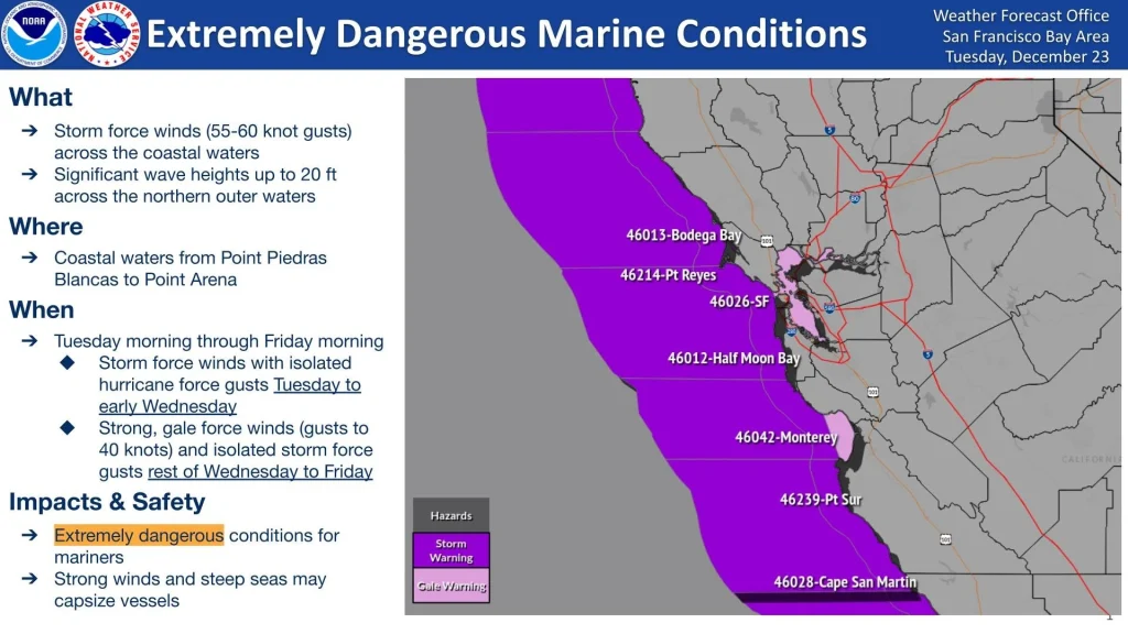
Extremely dangerous marine conditions across coastal California waters this week
Extremely dangerous marine conditions are developing across Northern and Central California waters this week, the National Weather Service (NWS) San Francisco Bay Area warned on Tuesday, December 23, 2025. Storm Force winds are forecast across the coastal waters with Gale Force winds extending into San Francisco and Monterey bays beginning Tuesday morning. Seas are expected to build to near 6 m (20 feet) under the strongest winds, posing life-threatening conditions for mariners.
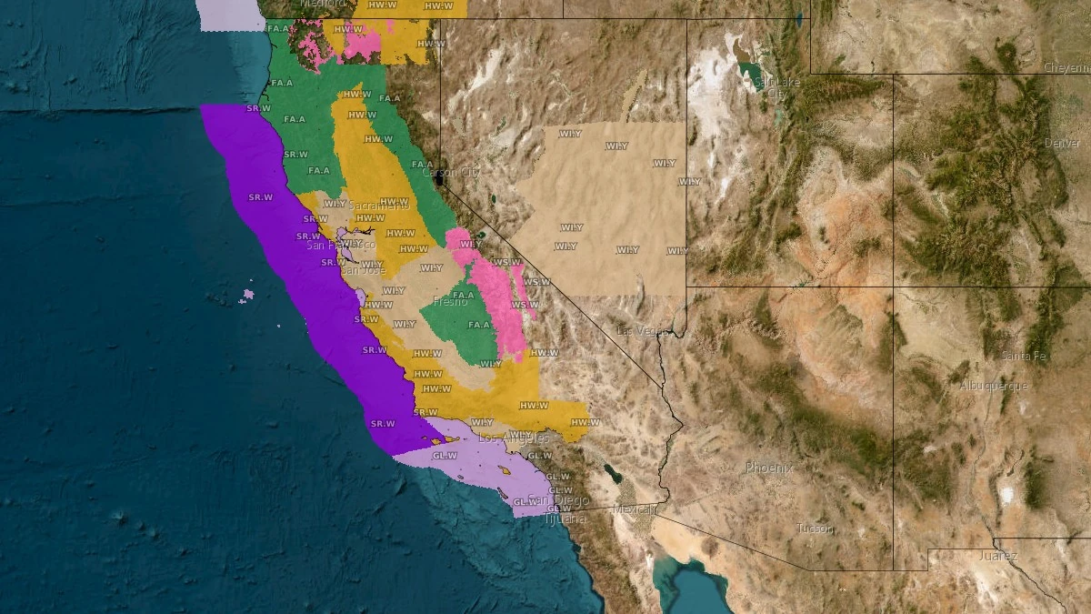
Hazards issued for California, valid December 24, 2025. Credit: NWS
A powerful Pacific storm is forecast to bring extremely hazardous conditions to mariners and coastal regions of Northern and Central California this week.
The National Weather Service (NWS) San Francisco Bay Area reported that Storm Force winds will develop across open coastal waters on Tuesday morning, December 23, with Gale Force winds spreading into the San Francisco Bay and Monterey Bay. Winds are expected to ease gradually by late Wednesday, but hazardous seas will persist into Friday.
The NWS Coastal Waters Forecast indicates sustained winds exceeding 90 km/h (55 mph) with gusts near 110 km/h (70 mph) offshore, accompanied by steep waves reaching 5–6 m (16–20 feet).
Such conditions pose serious danger to vessels, particularly small craft and recreational boats, and can make navigation extremely difficult even for larger vessels. Mariners are strongly advised to remain in port or seek immediate shelter until conditions improve.
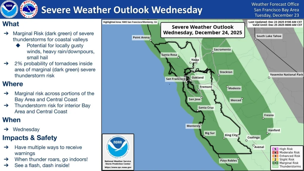
The NWS Storm Prediction Center (SPC) has issued a marginal risk (dark green on the map below) of severe thunderstorms and a 2% probability of tornadoes for coastal portions of the Bay Area and Central Coast on Wednesday, December 24. Meteorologists at the NWS Bay Area office are urging residents to have multiple ways to receive warnings and stay weather aware tomorrow.
According to the Short Range Forecast Discussion issued by the NWS Weather Prediction Center (WPC) at 02:54 EST (07:54 UTC) on December 23, this event is associated with a deep Pacific low-pressure system and a broad plume of moisture extending across the West Coast.
The system is expected to move onshore over California by Wednesday, producing widespread rainfall, heavy mountain snow, and severe marine winds.
A High Risk (level 4/4) of excessive rainfall has been issued for Southern California on Wednesday into Thursday morning, where severe and widespread flash flooding is expected.
In addition, heavy snow will continue across the Sierra Nevada, while the same atmospheric river driving inland precipitation is responsible for the strong onshore winds and hazardous sea state along the coast.
Marine conditions will remain dangerous through the end of the week as residual swell and elevated winds persist even after the frontal passage.
References:
1 Extremely dangerous marine conditions expected this week – NWS/San Francisco Bay Area – December 23, 2025
2 Short Range Forecast Discussion – NWS/WPC – December 23, 2025
3 Coastal Waters Forecast for Northern and Central California – NWS/San Francisco Bay Area – December 23, 2025
I'm a dedicated researcher, journalist, and editor at The Watchers. With over 20 years of experience in the media industry, I specialize in hard science news, focusing on extreme weather, seismic and volcanic activity, space weather, and astronomy, including near-Earth objects and planetary defense strategies. You can reach me at teo /at/ watchers.news.
Commenting rules and guidelines
We value the thoughts and opinions of our readers and welcome healthy discussions on our website. In order to maintain a respectful and positive community, we ask that all commenters follow these rules.